
Departments 23 Demonym(s) salteño/a | Municipalities 58 Time zone ART (UTC−3) | |
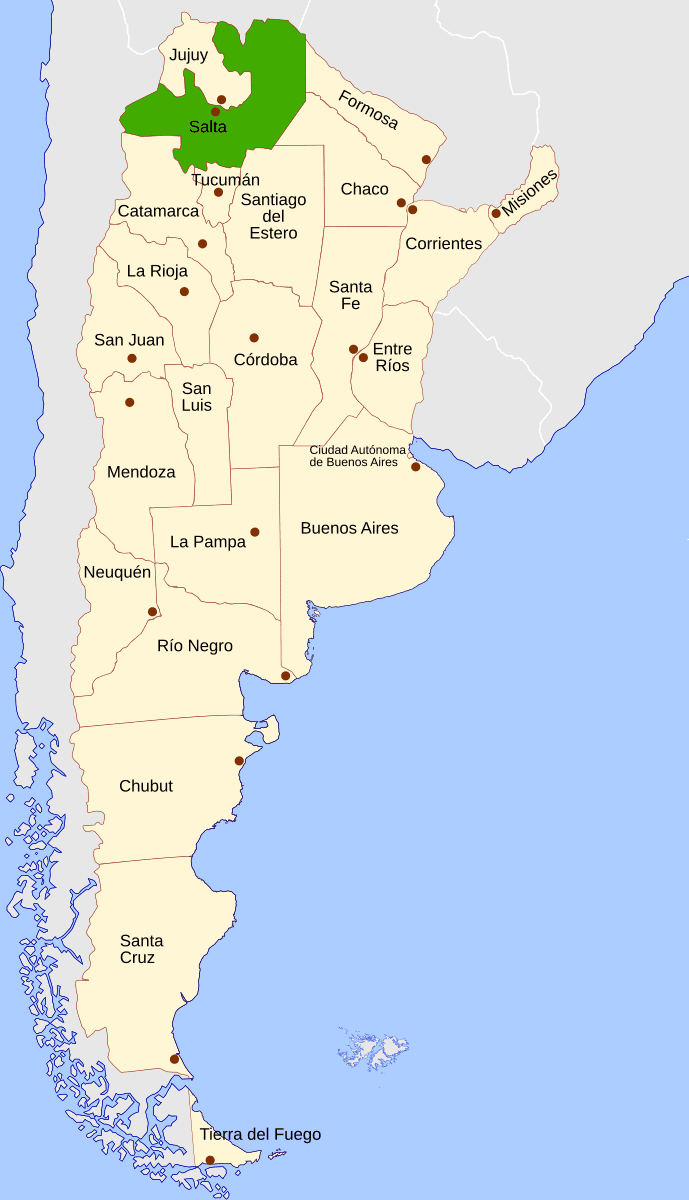 | ||
Salta ([ˈsalta]) is a province of Argentina, located in the northwest of the country. Neighboring provinces are from the east clockwise Formosa, Chaco, Santiago del Estero, Tucumán and Catamarca. It also surrounds Jujuy. To the north it borders Bolivia and Paraguay and to the west lies Chile.
Contents
- Map of Salta Province Argentina
- History
- Geography and climate
- Economy
- Tourism
- Demographics
- Political division
- References
Map of Salta Province, Argentina
History
Before the Spanish conquest, numerous native peoples (now called Diaguitas and Calchaquíes) lived in the valleys of what is now Salta Province; they formed many different tribes, the Quilmes and Humahuacas among them, which all shared the Cacán language. The Atacamas lived in the Puna, and the Wichís (Matacos), in the Chaco region.
The first conquistador to venture into the area was Diego de Almagro in 1535; he was followed by Diego de Rojas. Hernando de Lerma founded San Felipe de Lerma in 1582, following orders of the viceroy Francisco de Toledo, Count of Oropesa; the name of the city was soon changed to "San Felipe de Salta". By 1650, the city had around five hundred inhabitants.
An intendency of "Salta del Tucumán" was created within the Viceroyalty of the Río de la Plata. In 1774, San Ramón de La Nueva Orán was founded between Salta and Tarija (Tarija was added to the intendency later, in 1807). In 1783, in recognition of the growing importance of the city, the capital of the intendency of Salta del Tucumán was moved from San Miguel de Tucumán to Salta.
The battle of Salta in 1813 freed the territory from Spain, but occasional attacks were mounted from the Viceroyalty of Peru as late as 1826. Gervasio de Posadas created the Province of Salta in 1814, containing the current provinces of Salta, Jujuy, and parts of southern Bolivia and northern Chile.
Exploiting internal Argentine conflicts that arose after the Argentine Declaration of Independence, Bolivia annexed Tarija in 1826. In 1834, Jujuy withdrew from Salta and became a separate province. The borders of Salta were further reduced in 1900, with the loss of Yacuiba to Bolivia.
The National Government of Los Andes, constituted from the province in 1902 with a capital at San Antonio de los Cobres, was returned to Salta Province in 1943 as the Department of Los Andes.
Antonio Alice's painting, La muerte de Güemes, which received a Gold Medal at the Centenary Exposition, is on display at the offices of the Salta Provincial Government.
Geography and climate
The province is located in the tropical zone and has a warm climate in general, though it has marked variation in climate types owing to the variation in altitudes. The orientation of the Andes influences the distribution of precipitation within the province.
The easternmost parts of the province have a semi-arid climate with a dry winter season. The mean annual temperature and precipitation are 20 °C (68.0 °F) and 500 millimetres (19.7 in). Temperatures can reach up to 47 °C (116.6 °F) during summers, while they can fall down to −5 °C (23.0 °F) during winters.
The first slopes of the Andes force the moist, easterly winds to rise, provoking very high condensation leading to the formation of clouds that generate copious amounts of rain. The eastern slopes of the mountains receive between 1,000 to 1,500 mm (39 to 59 in) of precipitation a year, although some places receive up to 2,500 mm (98 in) of precipitation annually owing to orographic precipitation. Most of the precipitation is concentrated in the summer, with winters being dry. The high rainfall on these first slopes creates a thick jungle that extends in a narrow strip along these ranges, creating an area of great species diversity. At higher altitudes on these slopes, the climate is cooler and more humid, with the vegetation consisting of deciduous and pine trees.
Between the high altitudes to the east and the low plains to the west lie the valleys. The climate of these valleys is temperate, allowing for human settlement and agricultural activities. Mean annual precipitation is around 1,000 mm (39 in), most of it during summer. Mean temperatures exceed 20 °C (68.0 °F) during the summer, while during winter, they are below 14 °C (57.2 °F).
Further west, the Altiplano is a plateau at 3,000 m to 4,000 m above sea level. The climate is arid and cold: high temperatures vary little (since the warmer season is cloudy, and the coolest is sunny), ranging from 14 °C to 21 °C (57F to 70F); night temperatures go from 6 °C (43F) in midsummer, to -8 °C (18F) in midwinter, and extremes under -15 °C (5F) might be recorded. All rain falls exclusively in the summer, with values between 200 mm and 400 mm in total. Several salt flats exist in this area.
At the highest altitudes found in the western parts of the province, the climate is arid and cold, with large diurnal ranges (temperature range between day and night).
The main rivers of the province are the Pilcomayo, Bermejo, and the Juramento, which later becomes the Salado River. Salta Province is located at a geologically active region, and suffers from occasional earthquakes. There have been four earthquakes of note in the province:
The 1692 earthquake was the inspiration for Salta's annual citywide festival, held on 16 September, in honor of El Señor y la Virgen del Milagro.
Economy
Salta's economy is relatively underdeveloped, yet diverse. Its economy in 2006 was estimated at US$5.141 billion or, US$4,764 per capita, 45% below the national average. In 2012, its economy was estimated at $30.613 billon Pesos (about US$6.743 billion) or, 23,971 pesos (about US$5,280) per capita.
Agriculture and its derived industries are still an important activity in the province, adding over 10% to output. Tobacco, sugar cane and viticulture are the most important and produce most of the exports from the area. Other crops mostly for local consumption are maize, beans, citrus, bananas, and tomatoes. The sugar cane is processed in plants in Salta before it is sent to the rest of Argentina and other countries. The plant in San Martín de Tabacal is the most important of them. The famous wines of the Valles Calchaquíes region near Cafayate are produced in numerous vineyards of diverse sizes (mainly Torrontés, Malbec and Cabernet Sauvignon).
Gas and petroleum from the Tartagal, Aguas Blancas, Madrejones and Campo Durán centres is transported to Buenos Aires and Rosario by pipes. Campo Durán also has an oil refinery located in the province. In all, manufacturing plays a significant role in Salta, adding 20% to the economy. Mining includes uranium at Iruya, La Poma and San Carlos.
American breeds of cattle are raised only on the humid subtropical east, along with some sheep and goats.
Tourism
The Salta Province is home to a number of natural, social and historic attractions.
The city of Salta "La Linda" ("The beautiful") is both an important tourist destination, and the centre point for visiting the rest of the province. The city holds different attractions; among them are her colonial houses and cathedral, and the Museo de Arqueología de Alta Montaña de Salta that holds the 3 frozen Inca mummies found at the 6,700 meters of the Llullaillaco volcano.
Also from Salta, the Tren a las Nubes crosses canyons and cliffs before arriving to the 3,775 metres (12,500 feet) of San Antonio de los Cobres. The red-rock formations of the Valles Calchaquíes and the wine-town of Cafayate are the second most visited place in the province. Many visit the Cachi mountains and the villages (such as Payogasta) around it.
There are three national parks in Salta: El Rey National Park in the Yungas jungle, Baritú National Park and Los Cardones National Park.
Demographics
According to the results from the 2010 census [INDEC], the province has a population of 1,214,441. It constitutes 3.0% of the total population in Argentina. This represented a 12.5% increase in the population compared to 2001 census [INDEC] which had 1,079,051 inhabitants. 6.5% of the population or 79,204 persons declared themselves as having Indigenous background, making it one of the provinces that has a high percentage of indigenous people, being ranked 5th behind Chubut, Neuquén, Jujuy and Río Negro. The most populous indigenous groups in the province are the Wichí, which make up 24.9% of the total indigenous population followed by the Kolla (21.6%), and the Guaraní (13.7%). As well, 4,189 persons declared themselves to be Afro-Argentine.
Political division
The province is divided in 23 departments (Spanish: departamentos). Department (Capital)
- Anta (Joaquín Víctor González)
- Cachi (Cachi)
- Cafayate (Cafayate)
- Capital (Salta)
- Cerrillos (Cerrillos)
- Chicoana (Chicoana)
- General Güemes (General Güemes)
- General San Martín (Tartagal)
- Guachipas (Guachipas)
- Iruya (Iruya)
- La Poma (La Poma)
- La Caldera (La Caldera)
- La Candelaria (La Candelaria)
- La Viña (La Viña)
- Los Andes (San Antonio de los Cobres)
- Metán (San José de Metán)
- Molinos (Molinos)
- Orán (San Ramón de la Nueva Orán)
- Rivadavia (Rivadavia)
- Rosario de la Frontera (Rosario de la Frontera)
- Rosario de Lerma (Rosario de Lerma)
- San Carlos (San Carlos)
- Santa Victoria (Santa Victoria)