
Country Capital Santa Rosa Population 318,951 | Area 143,440 km2 Governor Oscar Jorge | |
 | ||
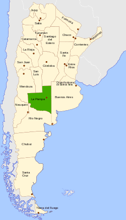
Map of La Pampa Province
La Pampa ([la ˈpampa]) is a sparsely populated province of Argentina, located in the Pampas in the center of the country. Neighboring provinces are from the north clockwise San Luis, Córdoba, Buenos Aires, Río Negro, Neuquén and Mendoza.
Contents
- Map of La Pampa Province
- History
- Geography
- Climate
- Temperature
- Precipitation
- Economy
- Political division
- References
History
In 1604 Hernandarias was the first European explorer to reach the area; it was later explored by Jerónimo Luis de Cabrera in 1662. But it was not until the 18th century that Spanish colonists established permanent settlements here.
Resistance of the local indigenous people prevented much expansion until the government of Juan Manuel de Rosas. It did not cease until Julio Roca's conquest of the desert in the 19th century. The territory was divided between the officers, and they erected the first Spanish settlements.
The Territorio Nacional de La Pampa Central was erected in 1884, containing the Río Negro Province and parts of other surrounding provinces. It had around 25,000 inhabitants. By 1915 there were 110,000 residents, a reflection of movement to that area. In 1945 the territory was divided and La Pampa became a province.
In 1952 its constitution was indited and the province was renamed after Eva Peron. In 1955 after the government changed and the Peróns went into exile, both La Pampa and Chaco, which had been named for Juan Perón, were reverted to their original names.
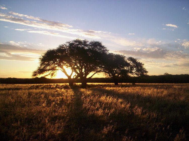
Geography
There are only two major rivers in the province: the Colorado ("Red River") on the border with the Province of Río Negro, and the Salado ("Salty River") crossing it. The Salado's level has been dropping, as its tributaries in the Province of Mendoza are diverted for irrigation.
Climate
Being located in the Pampas, the province has a cool temperate climate. In general, the province is dominated by two different types of climates: a temperate one in the east and a semi-arid one in the west. Precipitation generally decreases from east to west and from north to south. Being characterized by large thermal amplitudes, the climate of the province has continental characteristics, particularly in the west where thermal amplitudes are much larger. The general atmospheric circulation is one of the most important factors that influence the climate on a regional scale. During summer, the South Atlantic High is displaced to the southeast, which brings hot and humid air masses from the north and northeast. The South Pacific High in summer is responsible for bringing cooler air masses from the southwest which when these two contrasting air masses meet lead to precipitation occurring. In contrast, winters are dry due the northward displacement of the South Atlantic high and the topographic barrier of the Andes north of 40oS which prevents frontal systems that bring precipitation from reaching the province. Any winds from the southwest during winter bring in cold and dry weather since most of the precipitation and humidity are released in the Andes. As such, most of the precipitation occurs during summer.
Temperature
Mean annual temperatures in the province range between 14 to 16 °C (57.2 to 60.8 °F) although the thermal amplitude (difference between temperatures in the warmest and coldest months) is large. In summer, mean temperatures in the warmest month (January) range from 24 °C (75.2 °F) in the north and northeastern parts to 22 °C (71.6 °F) in the west and southwestern parts of the province. Temperatures tend to be cooler in the west owing to the higher altitudes. In winter, mean temperatures in the coldest month (July) range from 8 °C (46.4 °F) in the north to 6 °C (42.8 °F) in the west and southwest. The northern parts are the warmest parts of the province; absolute maximum temperatures can reach up to 40 to 45 °C (104.0 to 113.0 °F). The lowest temperatures ever recorded range from −10 °C (14.0 °F) in the northeast to −17 °C (1.4 °F) in the southwest.
Precipitation
One characteristic of the precipitation in the province is that most of the precipitation occurs from October to March with little precipitation during winter. Mean annual precipitation ranges from a low of 260 mm (10 in) in the southwest to 820 mm (32 in) in the northeast. Precipitation generally decreases from northeast to southwest. Most of the precipitation is caused by frontal systems. Precipitation is highly variable from year to year.
Economy
La Pampa, long Argentina's most economically agricultural province, produced an estimated US$3.144 billion in output in 2006, or, US$10,504 per capita (almost 20% above the national average). Now, the GDP per capita of the province is of US$ 14.000.
Agriculture contributes a fourth to La Pampa's economy, the most important activity being cattle ranching, with 3,632,684 (2002) head, which takes place all over the province. Other livestock include 202,428 sheep, 140,498 goats and 64,118 pigs.
The Northeast, on the more fertile lands, has also an important activity with wheat (10% of the national production), sunflower (13% of NP), maize, alfalfa, barley, and other cereals.
There's also a dairy industry of 300 centres of extraction and 25 cheese factories, honey production, and salt extraction from salt basins.
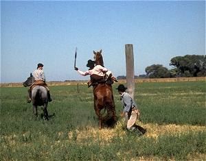
La Pampa is home to very little industry, construction or mining and, so, its services sector accounts for over two-thirds of the economy, a fairly high proportion. Tourism is an underdeveloped activity, however. Visitors start at Santa Rosa and reach Lihué Calel National Park, Parque Luro Provincial Reserve or visit one of the many estancias, some of which are dedicated to agritourism.
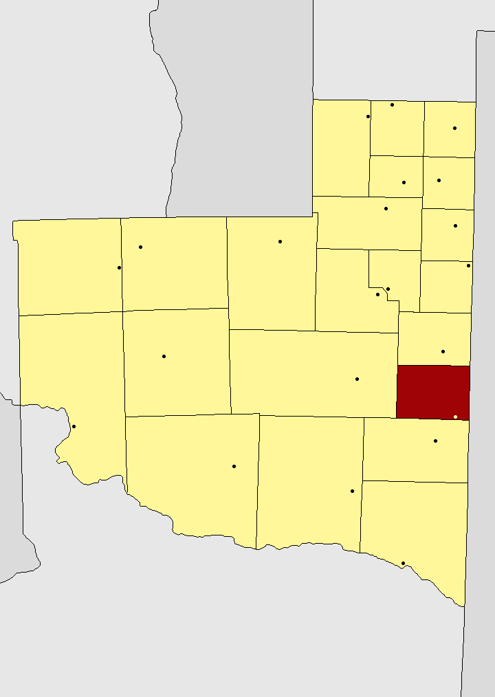
Political division
The province is divided in 22 departments (Spanish: departamentos).
Department (Capital)
- Atreuco Department (Macachín)
- Caleu Caleu Department (La Adela)
- Capital (Santa Rosa)
- Catriló Department (Catriló)
- Chalileo Department (Santa Isabel)
- Chapaleufú Department (Intendente Alvear)
- Chical Có Department (Algarrobo del Aguila)
- Conhelo Department (Eduardo Castex)
- Curacó Department (Puelches)
- Guatraché Department (Guatraché)
- Huncal Department (Bernasconi)
- Lihué Calel Department (Cuchillo-Co)
- Limay Mahuida Department (Limay Mahuida)
- Loventué Department (Victorica)
- Maracó Department (General Pico)
- Puelén Department (Veinticinco de Mayo)
- Quemú Quemú Department (Quemú Quemú)
- Rancul Department (Parera)
- Realicó Department (Realicó)
- Toay Department (Toay)
- Trenel Department (Trenel)
- Utracán Department (General Acha)