
Length 529.3 km | ||
 | ||
Existed: 1945 renumbering (definition) – present South end: Bertha Street in Key West Similar | ||
State Road A1A (SR A1A) is a north-south Florida State Road that runs along the Atlantic Ocean, from Key West at the southern tip of Florida, to Fernandina Beach, just south of Georgia on Amelia Island. It is the main road through most oceanfront towns. Part of SR A1A is designated the A1A Scenic and Historic Coastal Byway, a National Scenic Byway. A portion of A1A that passes through Volusia County is designated the Ormond Scenic Loop and Trail, a Florida Scenic Highway. It is also called the Indian River Lagoon Scenic Highway from State Road 510 at Wabasso Beach to U.S. Route 1 in Cocoa. A1A is famous worldwide as the center of beach culture in the United States, a scenic coastal route through most Atlantic coastal cities and beach towns, including the unique tropical coral islands of the Florida Keys. A1A also serves as a major thoroughfare through Miami Beach and other south Florida coastal cities.
Contents
- Map of Florida A1A Florida USA
- Route description
- Pre 1945 alignment
- Initial alignment
- Alignment modifications
- Jungle Trail
- County Road A1A
- Martin County
- Volusia County
- St Johns County
- References
Map of Florida A1A, Florida, USA
Other than SR A1A Alternate (now SR 811, CR 707, SR 732, and an extension of SR 842), only two other Florida state roads have begun with a letter: SR A19A (now a loop of SR 693-SR 699-SR 682 near St. Petersburg), and SR G1A (now SR 300).
The road was assigned the number 1 in the 1945 renumbering, mostly replacing the former State Road 140 designation. The number reflected its location in the new grid as the easternmost major north–south road. About a year and a half later, in November 1946, the State Road Board resolved to renumber the route due to confusion with the parallel U.S. Highway 1. The new designation, A1A, was chosen to keep the number 1 in its place in the grid.
The East Coast Greenway, a system of trails that connects Maine to Florida, travels along sections of State Road A1A.
Route description
SR A1A is heavily associated with Florida beach culture and is known for its lush tropical and subtropical scenery and ocean vistas. In many places, the highway runs directly along the waterfront of the Atlantic Ocean, but in other places, it runs one to five blocks inland from the beachfront. For most of its length, A1A runs along Florida's East Coast Barrier Islands, separated from the mainland of the state by the Intracoastal Waterway. Because of the proximity of the highway to the ocean and its susceptibility to storm surges, sections of A1A are often closed or damaged by hurricanes and tropical storms.
A1A also has been a backbone of Florida's Spring Break serving as "the strip" in both Fort Lauderdale – a popular spring break destination during the 1960s, 1970s, and 1980s – and Daytona Beach, which became a popular destination for college spring breaks during the 1970s. Today, A1A serves as more a main coastal highway that connects beach towns for more than 375 miles along Florida's East Coast.
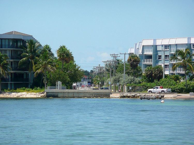
The southern terminus of SR A1A is at the southern end of Bertha Street, where SR A1A begins as a two-lane, then a four-lane highway along the Straits of Florida in Key West, known locally as South Roosevelt Boulevard. The road heads east past East Martello Tower and Key West International Airport, before curving north with an intersection with CR 5A (Flagler Avenue), followed by the northern terminus of the Key West section of SR A1A, U.S. Route 1 and State Road 5 (the Overseas Highway). Running along the south shore of Key West, SR A1A is the southmost numbered highway in the lower 48 states.
SR A1A reappears at Interstate 395 and US 1 in Miami, beginning at MacArthur Causeway before becoming Collins Avenue at Fifth Street in Miami Beach (or, in small segments, Harding Avenue, Abbott Avenue, or Indian Creek Drive), serving as one of Miami Beach's main north — south thoroughfares. Just north in the town of Surfside, the northbound is Collins Avenue, and the southbound is Harding Avenue. In Bal Harbour it is called Bal Harbour Boulevard. In Golden Beach it is called Ocean Boulevard.
It serves Hallendale Beach, Hollywood Beach, and Dania Beach. It joins with US 1 for 3.4 miles, and passes the Ft. Lauderdale/Hollywood International Airport. It then divides and serves Ft. Lauderdale Beach, Pompano Beach, and continuing north.
It serves as the main road throughout much of the exclusive Palm Beach, further to the north.
In the area of Vero Beach, A1A is called the Robert C. Spillman Memorial Highway, and it spans Sebastian Inlet at the Sebastian Inlet Bridge.
A1A next passes just to the west of Cape Canaveral and the John F. Kennedy Space Center.
Two miles of A1A were used as part of the well-known Daytona Beach Road Course.
A1A also passes through St. Augustine, the oldest continuously-inhabited city on the mainland of the United States.
A1A is called 3rd Street in Jacksonville Beach and Neptune Beach.
Just south of Atlantic Beach, A1A turns inland for several blocks, following Atlantic blvd, before resuming a northward course along Mayport Road that ends at the St. Johns River. A ferry takes traffic to the northern section of A1A that continues along the coast to just south of Fort Clinch State Park on the estuary of the Saint Mary's River. At that point A1A hooks back south to Fernandina Beach and then turns west, going inland 20 miles through Yulee and crossing I-95 and U.S. Highway 17. It ends at U.S. Highway 1, U.S. Highway 23, and U.S. Highway 301 in Callahan, Florida. This section west of Fernandina Beach, is also marked as SR 200, but SR A1A signs are displayed at every cluster of signs, though a designated direction is only above the SR 200 signs.
Pre-1945 alignment
Prior to the 1945 renumbering, the route that became SR 1 had the following numbers:
Initial alignment
SR 1 was defined in the 1945 renumbering as:
Alignment modifications
Since then, the following changes have been made:
Jungle Trail
The Jungle Trail (pre-1945 State Road 252) was part of A1A in northeastern Indian River County, Florida. The narrow, seven-and-a-half mile long road is located between Old Winter Beach Road and the current A1A, along the western side of Orchid Island, and is unpaved. It is part of the Indian River Lagoon Scenic Highway system, and the southernmost road in the highway system.
The road started as a means to quickly transport citrus to packinghouses on the mainland, then in the 1930s and 1940s became more used by tourists. On August 1, 2003, it was added to the U.S. National Register of Historic Places.
County Road A1A
County Road A1A is a county road in four counties in the U.S. state of Florida. The route is discontinuous and functions as a spur of State Road A1A.
Martin County
The longest of the four county spurs, County Road A1A is 15.88-mile (25.56 km) that runs along the Florida East Coast Railroad main line from Jonathan Dickinson State Park in Hobe Sound to Stuart, where it suddenly changes course and runs east along the south coast of the St. Lucie River. After the terminus of SR 714, it approaches a bridge between Stuart and Sewall's Point and becomes SR A1A.
Volusia County
County Road A1A is a 7-mile (11 km) spur route of State Road A1A at Volusia County, Florida, United States. The route begins at U.S. Route 1 and State Road A1A at Downtown New Smyrna Beach as Lytel Avenue. Next, the route crosses the Intracoastal Waterway and Callalisa Creek before heading southbound. After the 2 bridges, the road becomes 3rd Avenue, the northern terminus of Saxon Drive as the first right after Callalisa Creek. East of Indian River Village Shopping Center, the road turns southward and becomes Atlantic Avenue. At the intersection of 27th Avenue, the road becomes 2 lanes wide. Less than a mile south of New Smyrna Beach, Saxon Drive ends. At Bethune Beach, the road slightly turns away from the Atlantic Ocean. The road became Turtle Mound Road at that point. After Bethune Beach, the road is midway between the Intracoastal Waterway and the Atlantic Ocean. At this point, a gate brings access to Canaveral National Seashore. It passes through the ghost town of Eldora. The road ends as a dead end at a beach.
St. Johns County
County Road A1A is a 3.40-mile (5.47 km) spur route of SR A1A in St. Augustine Beach that runs closer to the Atlantic Ocean than SR A1A. It runs northeast from SR A1A, but begins to straighten out between John Drive and a private driveway south of F Street. The closest thing resembling a major intersection is 16th Street. After passing by the St Johns County Ocean Pier, the road intersects Pope Road and leaves the city limits, where it enters Anastasia State Park, and makes a sharp curve to the west. Once the road leaves the park, it features an exceptionlly long west-to-north turning ramp towards SR A1A, but ends at the intersection of SRs A1A and 312.