
 | ||
Twenty one pilots lane boy official video
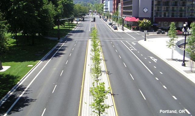
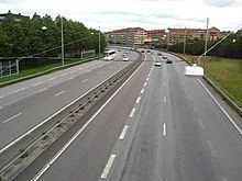
In the context of traffic control, a lane is part of a roadway (carriageway) that is designated for use by a single line of vehicles, to control and guide drivers and reduce traffic conflicts. Most public roads (highways) have at least two lanes, one for traffic in each direction, separated by lane markings. On multilane roadways and busier two-lane roads, lanes are designated with road surface markings. Major highways often have two multi-lane roadways separated by a median.
Contents
- Twenty one pilots lane boy official video
- Tyga switch lanes feat the game official music video in hd
- Capacity
- Types
- Lane width
- Lane markings
- Numbering of freeway lanes in California
- History
- References

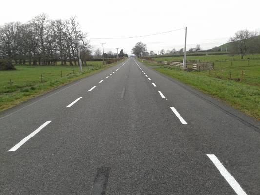
Some roads and bridges that carry very low volumes of traffic are less than 15 feet (4.6 m) wide, and are only a single lane wide. Vehicles travelling in opposite directions must slow or stop to pass each other. In rural areas, these are often called country lanes. In urban areas, alleys are often only one lane wide. Urban and suburban one lane roads are often designated for one-way traffic.
Tyga switch lanes feat the game official music video in hd
Capacity
Lane capacity varies widely due to conditions such as neighboring lanes, lane width, elements next to the road, number of driveways, presence of parking, speed limits, number of heavy vehicles and so on – the range can be as low as 1000 passenger cars / hour to as high as 4800 passenger cars /hour but mostly falls between 1500 and 2400 passenger cars / hour.
Types
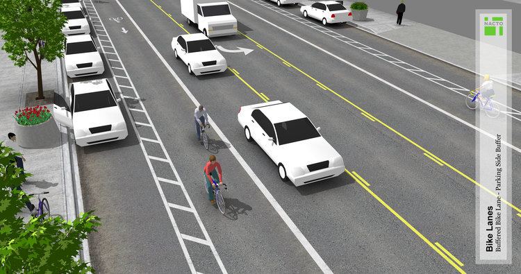
Lane width
While in general, wider lanes are associated with a reduction in crashes, in urban settings both narrow (less than 2.8 m) and wide (over 3.1~3.2 m) lanes increase crash risks in urban settings. Wider lanes (over 3.3~3.4m) are associated with 33% higher impact speeds, as well as higher crash rates. Carrying capacity is also maximal at a width of 3 to 3.1 metres (9.8 to 10.2 ft), both for motor traffic and for bicycles. Pedestrian volume declines as lanes widen, and intersections with narrower lanes provide the highest capacity for bicycles. As lane width decreases, traffic speed diminishes.
The widths of vehicle lanes typically vary from 9 to 15 feet (2.7 to 4.6 m). Lane widths are commonly narrower on low volume roads and wider on higher volume roads. The lane width depends on the assumed maximum vehicle width with an additional space to allow for lateral motion of the vehicle.
The maximum truck width had been 96 inches (2.438 m) in the Code of Federal Regulations of 1956 which matches with the width of eight-foot for shipping containers. This had been increased to 102 inches (2.591 m) in 1976 which explicitly states to be read as the slightly larger metric 2.6 metres (102.36 in) width respecting international harmonization. The same applies to standards in Europe which had increased the allowable size of road vehicles with a current maximum of 2.55 metres (100.39 in) for most trucks and allowing 2.6 metres (102.36 in) for refrigerator trucks. The minimum extra space had been 0.20 metres (7.87 in) and it is currently assumed to be at least 0.25 metres (9.84 in) on each side. For roads with a lower amount of traffic it is allowed to build the second or third lane in the same direction to an assumed lower width for cars like 1.75 metres (68.90 in), however this is not recommended as a design principle for new roads as changes in the amount of traffic could make for unnecessarily increased risks in the future.
The Interstate Highway standards for the U.S. Interstate Highway System uses a 12-foot (3.7 m) standard for lane width, while narrower lanes are used on lower classification roads. In Europe, as laws and road width vary by country, the minimum widths of lanes is generally between 2.5 to 3.25 metres (8.2 to 10.7 ft). The federal Bundesstraße interurban network in Germany defines a minimum of 3.5 metres (11 ft 6 in) for each lane for the smallest two lane roads with an additional 0.25 metres (9.84 in) on the outer sides and shoulders being at least 1.5 metres (59.06 in) on each side. A modern Autobahn divided highway will have two lanes per direction which are 3.75 metres (12 ft 4 in) wide with an additional clearance of 0.50 metres (19.69 in) on each side, while three lanes per direction are set at 3.75 metres (12 ft 4 in) for the rightmost lane and 3.5 metres (11 ft 6 in) for the other lanes. Urban access roads and roads in low-density areas may have lanes as small as 2.75 metres (9 ft 0 in) in width per lane with shoulders being at least 1 metre (3 ft 3 in) wide.
Lane markings
Painted lane markings vary widely from country to country. In the United States, Canada, Mexico, Honduras, Puerto Rico, Virgin Islands and Norway, yellow lines separate traffic going opposite directions and white separates lanes of traffic traveling the same direction, but such is not the case in many European countries.
Lane markings are mostly lines painted on the road by a road marking machine, which can adjust the marking widths according to the lane type.
Numbering of freeway lanes in California
Traffic reports in California often refer to accidents being "in the number X lane." The California Department of Transportation (Caltrans) assigns the numbers from left to right. The far left passing lane is the number 1 lane. The number of the slow lane (closest to freeway onramps/offramps) depends on the total number of lanes, and could be anywhere from 2 to 6.
History
For much of human history, roads did not need lane markings because most people walked or rode horses at relatively slow speeds. Another reason for not using lane markings is that they are expensive to maintain.
When automobiles, trucks, and buses came into widespread use during the first two decades of the 20th century, head-on collisions became more common.
Without the guidance provided by lane markings, drivers in the early days often erred in favor of keeping closer to the middle of the road, rather than risk going off-road into ditches or trees. This practice often left inadequate room for opposing traffic.
The history of lane markings is connected to the mass automobile construction in Detroit. It resulted in the formation of the first Road Commission of Wayne County, Michigan in 1906 which was trying to make roads safer (Henry Ford served on the board in the first year). The commission would order the construction of the first concrete road in 1909 (the Woodard Avenue in Detroit) and it conceived the centerline for highways in 1911. Hence the chairmen of the Road Commission, Edward N. Hines is widely credited as the inventor of line markings.
The introduction as a common standard is connected to June McCarroll, a physician in Indio, California who started experimenting with painting lines on roads in 1917 after she was run off a highway by a truck driver. In November 1924, after years of lobbying by Dr. McCarroll and her allies, California officially adopted a policy of painting lines on its highways. A portion of Interstate 10 near Indio has been named the Dr. June McCarroll Memorial Freeway in her honor.
The first lane markings in Europe were painted at an accident hotspot in the small town of Sutton Coldfield near Birmingham, England in 1921. The success of this experiment made its way to other hotspots and later standardization of white paint for line markings in Great Britain.
The first lane markings in Germany were used in Berlin in 1925 using white paint for line markings and road edge markings. When the standard for the new autobahn network was conceived in the 1930s it mandated the usage of black paint for the center line for each carriageway as black was better visible on the bright surface of the concrete roads.
By 1939, lane markings had become so popular that they were officially standardized throughout the United States. The concept of line markings spread throughout the world becoming standard for most roads. Originally the lines were drawn manually with normal paint which would bleach out quickly. After the war, the first machines for line markings were invented and a plastic strip was becoming standard in the 1950s which led to gradually find line markings on all roads.