
 | ||
Bridges Roosevelt Bridge, Old Roosevelt Bridge | ||
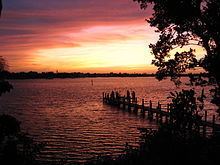
The St. Lucie River is a 7-mile-long (11 km) estuary linked to a coastal river system in St. Lucie and Martin counties in the U.S. state of Florida.
Contents
- Map of Saint Lucie River Sewalls Point FL USA
- Location
- Discharges
- Environmental Concerns
- St Lucie River Watershed Protection Plan
- List of crossings
- References
Map of Saint Lucie River, Sewall's Point, FL, USA
The St. Lucie River and St. Lucie Estuary are an "ecological jewel" of the Treasure Coast, central to the health and well-being of the surrounding communities.
Location
The North Fork of the St. Lucie River flows south from St Lucie County into Martin County where it joins the north-flowing South Fork, which was once called the Halpatiokee River, just south of the old Roosevelt Bridge (Old Dixie Highway) in Stuart to form the main St. Lucie River. It then passes under the Florida East Coast Railway drawbridge and the new high-level Roosevelt Bridge (U.S. Route 1) and flows east with Rio on the north side and Stuart on the south until it reaches the northern end of the Sewall's Point peninsula, where it runs south under the Evans Crary Bridge to the end of Sewall's Point, where it flows into the Indian River Lagoon directly west of the St. Lucie Inlet which goes into the Atlantic Ocean. The entire river is accessible to Lake Okeechobee by the Okeechobee Waterway.
The main river passes through Sewall's Point, Port Salerno, Stuart, and Jensen Beach. The South Fork passes through Palm City. Although brackish for most of its length, the salt content of the South Fork diminishes considerably south of the Kanner Highway bridge. The headwaters of the South Fork are located in ranchland and scrub forest, primarily to the east of I-95 and northwest of Hobe Sound. The North Fork passes through Port Saint Lucie and White City. A Club Med resort lies on the eastern shore of the North Fork of the river at Greenridge Point. The North Fork is brackish along most of its length, but takes on the character of a fresh-water creek from White City northward. The headwaters of the North Fork are in the farmlands of St. Lucie County near Interstate 95 at an elevation of 20 feet (6 m) above sea level.
Discharges
In 2016, 237 billion gallons of water was discharged into the St. Lucie River from Lake Okeechobee by the U.S. Army Corps of Engineers between January and November. In 2013, the U.S. Army Corps of Engineers dumped 137 billion gallons of water into the St. Lucie River from Lake Okeechobee. The USACE noted they "do share the concern about the quality of the water being released" but also noted that poor water quality was the state's fault in a release called "setting the record straight."
Environmental Concerns
Historic modifications to St. Lucie River, most notably digging of the Okeechobee Waterway (C-44 Navigational Canal), connections with the C-24 and C-23 drainage canals, and the associated water control structures, have had impacted water quality throughout the river basin. Intermittent freshwater discharges from Lake Okeechobee have negatively affected the river itself and the connected Indian River Lagoon. The impact takes several forms. First, this water tends to be rich in nutrients as a result of agricultural runoff, and thus has a tendency to cause algae blooms and other imbalances. Second, it contains pollutants found in street runoff and other urban sources, which are carried south by the Kissimmee River from the southern Orlando suburbs into Lake Okeechobee. Third, it is a source of turbidity and particulates that settle along the river bottom as a layer of muck. Finally, the discharges radically reduce salinity levels, making the river temporarily uninhabitable by fauna and flora that are intolerant to fresh water.
In 2013, heavy rains in southern Florida resulted in high runoff into the lake; rising lake levels forced the U.S. Army Corps of Engineers to release large volumes of polluted water from the lake through the St. Lucie River estuary to the east and the Caloosahatchee River estuary to the west. Thus the normal mix of fresh and salt water in those estuaries was replaced by a flood of polluted fresh water resulting in ecological damage.
St. Lucie River Watershed Protection Plan
According to the South Florida Water Management District, this plan will address pollutant load reductions based on adopted total maximum daily loads (TMDLs). It will also include a goal for salinity levels and freshwater inflow targets for the St. Lucie Estuary.
List of crossings
This is the list of bridges crossing the river, starting with the North Fork, then going down the main river, and then jumping back to where the South Fork joins the North Fork to form the main river and going south up the South Fork.