
Time zone UTC +6 Local time Sunday 6:48 PM | Elevation 3,005 m | |
 | ||
Weather -12°C, Wind NE at 6 km/h, 50% Humidity | ||
Erkeshtam, also Irkeshtam or Erkesh-tam (Chinese: 伊尔克什坦), is a border crossing between Kyrgyzstan and Xinjiang, China, named after a village on the Kyrgyz side of the border in southern Osh Region. The border crossing is also called Simuhana (斯姆哈纳), after the first settlement on the Chinese side of the border, but Irkeshtam is now the more common name used in both countries.
Contents
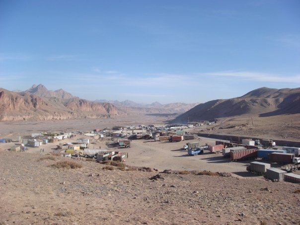
Map of Irkeshtam, Kyrgyzstan
Erkeshtam is the western most border crossing in China. It is one of two border crossings between Kyrgyzstan and China, the other being Torugart, some 165 km (103 mi) to the northeast. The overland travel distance from Erekshtam to Osh is 210 km (130 mi), about 800 km (500 mi) shorter than via the Torugart Border Crossing.
Location
Erkeshtam Border Crossing strategically located about 230 kilometres (140 mi) west of Kashgar, 250 kilometres (160 mi) southeast of Osh and 550 kilometres (340 mi) east of Dushanbe, Tajikistan. The crossing staddles the Irkeshtam Pass, a deep gorge where the southern flank of the Tian Shan meets the Pamir Mountains. The elevation of the gorge is approximately 2,950 metres (9,680 ft) above sea level. The village of Erkeshtam is situated about 2 kilometres (1.2 mi) from the Kyrgyz-Chinese border. Both Irkeshtam and the village of Simuhana, about 3.5 kilometres (2.2 mi) on the Chinese side of the border, are situated along the Kizilesu River. Simuhana belongs to Ulugqat County, under the Kizilsu Kirghiz Autonomous Prefecture of Xinjiang.
The Erkeshtam Border Crossing controls the main trade routes between the Tarim Basin to the east, and the Alay and Ferghana Valleys to the west and north.
From the Kyrgyz side of the border, the A372 road goes west over a pass into the Alay Valley. At Sary-Tash, the A372 meets the M41 highway, which leads north through the Taldyk Pass (elevation 3,615 metres (11,860 ft) to Osh and the Ferghana Valley.
Both the A372 and M41 south runs west to Dushanbe, Tajikistan.
From the Chinese side of the border, the G3013 Kashgar–Irkeshtam Expressway, runs east to Kashgar and the Tarim Basin via Ulugqat. A372 and M41 are part of Asian Highway AH65.
The European route E60, originating in Brest, France, has its eastern terminus in Irkeshtam. At a length of 8,200 kilometres, it is the second longest European route.
There is now a bus that travels every Monday and Tuesday from Kashgar to Osh through Irkeshtam, and obviously travels in the other direction too. It is also possible to make more informal arrangements.
Travel can be difficult due to poor infrastructure, snowfall, broken down trucks, closed customs posts and border formalities.
Other settlements near the village of Irkeshtam include Nura 6.4 kilometres (4.0 mi) and Ikazak 13 kilometres (8.1 mi).
History
Irkeshtam, being located at the natural dividing line between major geographic and cultural regions, has been an important border control point for several millennia. It was known during the Han Dynasty and the Three Kingdoms era (2nd third of the 3rd century CE) as Juandu (Chinese: 捐毒; Wade–Giles: chüan-tu; literally: "Tax Control"). According to the Book of Han, Juandu contained "380 households, 1,100 individuals and 500 persons able to bear arms" and the inhabitants were originally of the Sai race, who wore the clothing of the Wusun and followed "the water and pastures" and kept close to the "Ts'ung-ling" (Pamir Mountains).
Irkeshtam is thought to be the Hormeterium (merchants' station) by some historians which Ptolemy writes about in his treatise Geography; while other researchers have suggested it is one of multiple possible locations which he refers to as the Stone Tower (6.13.2), that was under the control of Sai or Sakai people;
In the territory of the Sakai there rises the already mentioned mountain region of the Komedai – the ascent to the mountain region of Sogdiana lies at 125° / 43°, the position of its terminal point near the ravine of the Komedai [(the Alai Valley)] is at 130° / 39°; the so-called Stone Tower lies at 135° / [43°].
After Tsarist Russia took control of Central Asia, the horse path from Osh to Irkestam was developed in 1893.
In 1934, Khoja Niyaz, the titular leader of the First East Turkestan Republic (ETR) was driven out Kashgar by the Hui warlord Ma Zhongying and retreated Irkeshtam, where he signed an agreement that dissolved the ETR and pledged support for Sheng Shicai's Soviet-backed government in Xinjiang. Ma Zhongying also left Xinjiang for the Soviet Union via Irkeshtam.
Modern border crossing
During Soviet times, the border post was named in honor of Andrei Bescennov, a frontier guard, who was killed in a clash with the Basmachi rebels in 1931. For decades, the Irkeshtam Border Crossing was closed due to poor relations between the Soviet Union and China. On July 21, 1997, the border crossing was open on a temporary basis. On January 26, 1998, the border crossing was officially open. Russian troops were stationed at the post until 1999.
In 2002, the border post processed 8,071 travelers, 7,066 vehicles and 76,000 tons of cargo. In 2008, Irkeshtam processed 58,900 travelers and 520,000 tons of cargo. In December 2011, the customs office on the Chinese side of the border was relocated to a larger facility about 100 km to the east, outside the town of Ulugqat, which is about 1,000 m lower in elevation. In the first eleven months of 2013, 39,045 travelers, 32,554 vehicles and 464,00 tons of goods passed through the Irkeshtam Border Crossing, which ranked fourth among border crossings in Xinjiang by the tonnage of goods processed.