
Country United States Elevation 768 ft (234 m) Area code 330, 234 Zip code 43920 Population 11,010 (2013) | Time zone Eastern (EST) (UTC−5) FIPS code 39-23730 Local time Friday 2:11 AM | |
 | ||
Weather 0°C, Wind N at 2 km/h, 97% Humidity Colleges and Universities | ||
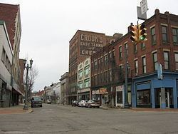
East Liverpool is a city in Columbiana County, Ohio, United States. The population was 11,195 at the time of the 2010 census. It is located along the Ohio River and borders the states of Pennsylvania and West Virginia. East Liverpool is a major city in the Salem, OH Micropolitan Statistical Area, approximately 40 miles from downtown Pittsburgh.
Contents
- Map of East Liverpool OH 43920 USA
- Woman struck by car killed in east liverpool ohio
- History
- Areas and neighborhoods
- Satellite communities
- Neighboring communities
- Primary and secondary
- Postsecondary
- Highways
- Airports
- Bridges
- Golf course
- Parks
- Athletics
- Media
- Geography
- 2010 census
- 2000 census
- Notable people
- References
Map of East Liverpool, OH 43920, USA
Historically, it was referred to as the "Pottery Capital of the World" due to the large number of potteries in the city; due to changes in the industry, only three remain in the area. The city is also known as the hometown of former University of Notre Dame and University of South Carolina football coach Lou Holtz. It was the destination for the body of bank robber Pretty Boy Floyd, brought here for embalming. The Beginning Point of the U.S. Public Land Survey is just east of the city center, on the Ohio–Pennsylvania border.
Woman struck by car killed in east liverpool ohio
History
East Liverpool traces its European-American settlement to 1798 when Thomas Fawcett purchased 1,100 acres of land along the Ohio River in what was then Jefferson County. In 1802 he platted the town of St. Clair, named for Arthur St. Clair, who at that time was Governor of the Northwest Territory. It was called Fawcettstown for a time by the residents. In 1816, they changed the name to Liverpool. It was incorporated as East Liverpool in 1834 when Liverpool Township in Medina County objected to possible confusion.
James Bennett, an English potter, established the pottery industry in East Liverpool, and it became the community's leading employer. East Liverpool became known as "The Crockery City." From 1870 through 1890, the US Census showed that the city more than doubled in population each decade, as it attracted new industrial workers with the growth of the pottery industry. By 1910, it had more than 20,000 people. East Liverpool once produced more than half of the United States's annual ceramics output. Throughout East Liverpool's ceramics history, there were more than 300 potteries.
Of these potteries, three continue to operate in this area: The Hall China Company, the Homer Laughlin China Company (located across the Ohio River in Newell, West Virginia), and Pioneer Pottery. In the mid-19th century, East Liverpool also produced most of the yellowware pottery used in the United States. Among the most famous of East Liverpool's ceramics was the porcelain known as Lotus Ware. Produced by Knowles, Taylor & Knowles in the 1890s, this Moorish- and Persian-influenced artware swept the competition at the 1893 World's Fair in Chicago. It is generally considered to be the finest porcelain ever produced in the US. The Museum of Ceramics in downtown East Liverpool has the world's largest public display of Lotus Ware.
As of 1914, East Liverpool was served by the Cleveland and Pittsburgh Railroad.
The city reached its peak population of more than 26,000 in 1970, but East Liverpool's pottery industry had already begun its decline by the mid-1960s or so. As with other industries, production moved to developing countries where labor costs were cheaper. This cost many jobs and, ultimately, population in the Ohio/West Virginia area, as people moved away in search of work.
In the mid-1990s, the city renovated its downtown district. To improve its urban design, it installed Great Depression-era lightposts, developed a new center called Devon's Diamond, and reconstructed the old high school's clocktower. This building is now the home of the East Liverpool High School Alumni Association.
Areas and neighborhoods
Satellite communities
Though not located within the city limits, there are a few communities that share East Liverpool's 43920 ZIP code and have an East Liverpool mailing address. They are the census-designated places of Calcutta, Glenmoor and La Croft and the unincorporated community of Fredericktown.
Neighboring communities
In the bordering states of West Virginia and Pennsylvania, the communities of Chester and Newell, West Virginia and Glasgow, Pennsylvania developed and grew in relation to the growth of the pottery industry and expansion of East Liverpool in the late nineteenth and early twentieth centuries.
Primary and secondary
Children in East Liverpool (and immediate surrounding areas in Liverpool Township) are served by the East Liverpool City School District. The current schools in the district are:
The American Spirit Academy (K-12) also serve area students, as well as an online school, Buckeye Online School for Success. St. Aloysius School (K-8) formerly operated for 130 years as a Roman Catholic School in the Diocese of Youngstown, before closing on June 6, 2015.
Many local children use Ohio's open enrollment option to join the Beaver Local School District that primarily serves the satellite communities of Calcutta and Glenmoor. All students enrolled in this district attend the Beaver Local K-12 Campus, built in 2015, that houses a high school, middle school, and elementary under one roof.
Postsecondary
Kent State University has been operating a satellite campus, Kent State University at East Liverpool, since 1965. It is clustered around 4th Street in Downtown. The Ohio Valley College of Technology in nearby Calcutta also focuses on job training.
Highways
Airports
The Columbiana County Airport is located four miles northwest of the city.
Bridges
Since the 1890s, East Liverpool and the West Virginia communities of Chester and Newell have been connected by three different bridges spanning the Ohio River.
Golf course
The East Liverpool Country Club has a 9-hole golf course that was designed by Willie Park, Jr. and opened on July 14, 1921. Calcutta also features the 18-hole Turkana Golf Course.
Parks
There are two public parks located within East Liverpool city limits.
Additionally, Beaver Creek State Park is located outside the city limits but partially within the 43920 ZIP code area.
Athletics
Because of its size, East Liverpool has never had a major professional sports team. However, during the city's heyday, many semipro and company teams, and city and area leagues were thriving. Baseball, basketball and American football were all popular among residents, and games attracted many patrons. The semipro East Liverpool Potters basketball team of the Central Basketball League played in the city from 1906 to 1909. No semipro or company teams exist in the city today.
East Liverpool High School athletics have been consistently popular among students and residents in the past 100-plus years. All of the teams are known as the Potters. The school fields American football, baseball, basketball, bowling, cross country running, golf, soccer, softball, swimming, tennis, track and field, volleyball and wrestling teams. Most of these teams have had team and/or individual successes in their existences. Athletic facilities include:
Media
Geography
East Liverpool is located at 40°37′43″N 80°34′9″W (40.628510, -80.569063). It lies within the ecoregion of the Western Allegheny Plateau.
According to the United States Census Bureau, the city has a total area of 4.76 square miles (12.33 km2), of which 4.56 square miles (11.81 km2) is land and 0.20 square miles (0.52 km2) is water.
2010 census
As of the census of 2010, there were 11,195 people, 4,601 households, and 2,892 families residing in the city. The population density was 2,455.0 inhabitants per square mile (947.9/km2). There were 5,316 housing units at an average density of 1,165.8 per square mile (450.1/km2). The racial makeup of the city was 91.7% White, 4.6% African American, 0.2% Native American, 0.2% Asian, 0.3% from other races, and 3.0% from two or more races. Hispanic or Latino of any race were 1.1% of the population.
There were 4,601 households of which 33.4% had children under the age of 18 living with them, 36.0% were married couples living together, 20.1% had a female householder with no husband present, 6.7% had a male householder with no wife present, and 37.1% were non-families. 31.9% of all households were made up of individuals and 11.9% had someone living alone who was 65 years of age or older. The average household size was 2.39 and the average family size was 2.97.
The median age in the city was 37.6 years. 25.4% of residents were under the age of 18; 9.5% were between the ages of 18 and 24; 24% were from 25 to 44; 26.5% were from 45 to 64; and 14.6% were 65 years of age or older. The gender makeup of the city was 47.6% male and 52.4% female.
2000 census
As of the census of 2000, there were 13,089 people, 5,261 households, and 3,424 families residing in the city. The population density was 3,010.3 people per square mile (1,161.8/km²). There were 5,743 housing units at an average density of 1,320.8 per square mile (509.7/km²). The racial makeup of the city was 92.85% White, 4.81% African American, 0.24% Native American, 0.08% Asian, 0.05% Pacific Islander, 0.21% from other races, and 1.76% from two or more races. Hispanic or Latino of any race were 0.72% of the population.
There were 5,261 households out of which 32.9% had children under the age of 18 living with them, 43.5% were married couples living together, 16.6% had a female householder with no husband present, and 34.9% were non-families. 30.3% of all households were made up of individuals and 13.5% had someone living alone who was 65 years of age or older. The average household size was 2.44 and the average family size was 3.01.
In the city the population was spread out with 27.1% under the age of 18, 8.8% from 18 to 24, 27.3% from 25 to 44, 20.8% from 45 to 64, and 16.0% who were 65 years of age or older. The median age was 36 years. For every 100 females there were 86.5 males. For every 100 females age 18 and over, there were 81.8 males.
The median income for a household in the city was $23,138, and the median income for a family was $27,500. Males had a median income of $27,346 versus $18,990 for females. The per capita income for the city was $12,656. About 21.5% of families and 25.2% of the population were below the poverty line, including 35.2% of those under age 18 and 13.0% of those age 65 or over.