
NRHP Reference # 66000606 Opened 1786 Added to NRHP 15 October 1966 | Built 1786 Designated NHL June 23, 1965 Area 3,642 m² | |
 | ||
Similar Richard L Cawood Residence, Elks Club, Potters National Bank, Godwin‑Knowles House, John Street House | ||
Youtube beginning point of the u s public land survey
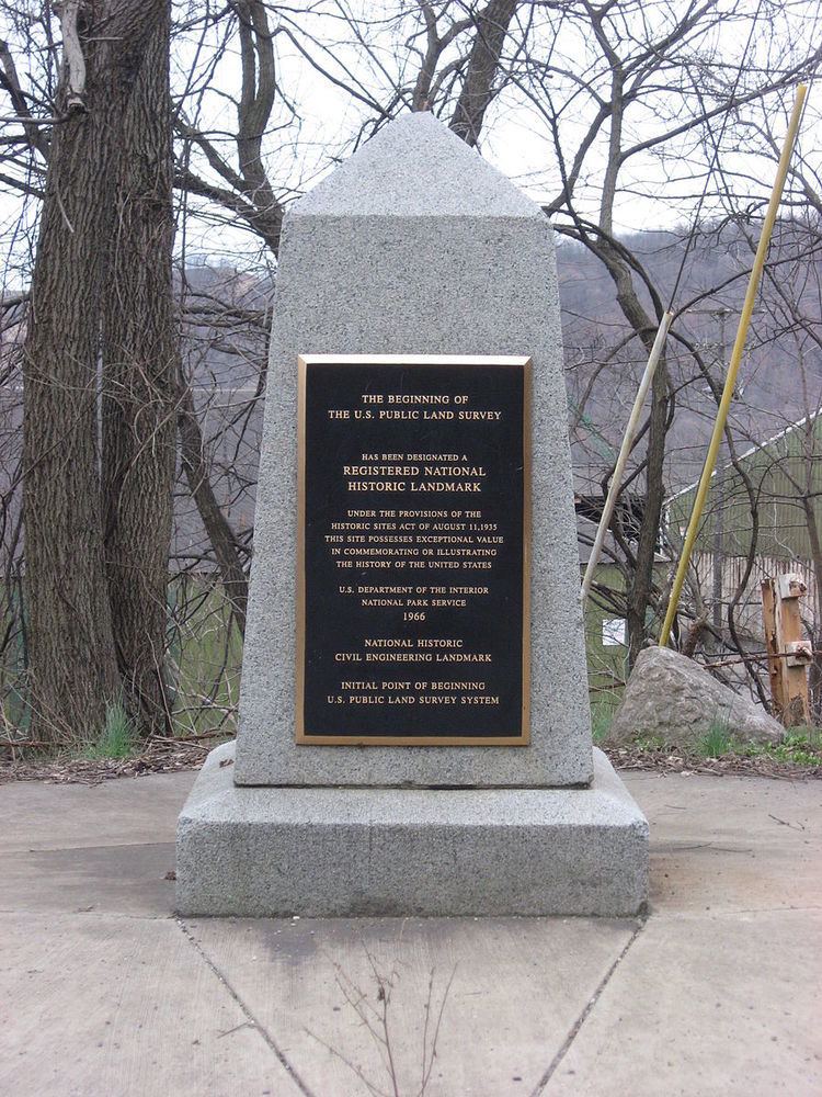
The Beginning Point of the U.S. Public Land Survey is a monument at the border between the U.S. states of Ohio and Pennsylvania, on the north side of the Ohio River. It is near the three-way intersection of Ohio, Pennsylvania, and the northern tip of West Virginia, in both the Pittsburgh metropolitan area and the East Liverpool micropolitan area. It is significant as being the point from which the Public Land Survey System was performed, starting in 1785, which would open what was then the Northwest Territory for settlement. The survey was "the first mathematically designed system and nationally conducted cadastral survey in any modern country" and is "an object of study by public officials of foreign countries as a basis for land reform." It was conducted in the late 18th century by Geographer of the U.S. Thomas Hutchins surveying the Seven Ranges.
Contents
- Youtube beginning point of the u s public land survey
- Micro flats tackle hong kong s high housing prices
- References
Built in 1881, it was declared a National Historic Landmark in 1965.
The area that is landmarked includes a part of Ohio and a part of Pennsylvania. A plaque at the site states that the true starting point was 1,112 feet further south. The commemorative site is located about 2 miles east of the center of East Liverpool on Ohio State Route 39 and Pennsylvania Route 68.