
Width 10 km (6.2 mi) E-W | Length 50 km (31 mi) N-S State/Province Victoria Elevation 633 m | |
 | ||
Types of rock Igneous rock, Sedimentary rock, Metamorphic rock Similar Mount Dandenong, Hanging Rock - Victoria, Mount Donna Buang, Mount Hotham, Mount Baw Baw | ||
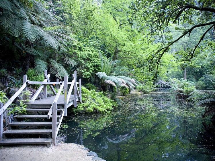
The Dandenong Ranges (commonly just the Dandenongs) are a set of low mountain ranges, rising to 633 metres at Mount Dandenong, approximately 35 km east of Melbourne, Victoria, Australia. The ranges consist mostly of rolling hills, steeply weathered valleys and gullies covered in thick temperate rainforest, predominantly of tall Mountain Ash trees and dense ferny undergrowth.
Contents
- Map of Dandenong Ranges Mount Dandenong VIC 3767 Australia
- Etymology
- Geology and ecology
- Waterfalls
- Summits
- Climate
- Settlements in the Dandenong Ranges
- Human History
- Transmission towers
- Tourism and Attractions
- Regulations
- Bushfires
- References
Map of Dandenong Ranges, Mount Dandenong VIC 3767, Australia
After European settlement in the region, the range was used as a main source of timber for Melbourne. The ranges were popular with day-trippers from the 1870s onwards. Much of the Dandenongs were protected by parklands as early as 1882 and by 1987 these parklands were amalgamated to form the Dandenong Ranges National Park, which was added to again in 1997. The range experiences light to moderate snow falls a few times most years, frequently between late winter and late spring.
Today, the Dandenongs are home to over 100,000 residents and the area is popular amongst visitors, many of which stay for the weekend at the various Bed & Breakfasts through the region. The popular Puffing Billy Railway, a heritage steam railway, runs through the southern parts of the Dandenongs.
Etymology
The etymology of the Dandenongs is a complicated one. Two names have been used to refer to the ranges; Corhanwarrabul and Dandenong, both derived from the Woiwurrung language of the Wurundjeri people.
It is suspected that the name Dandenong was applied to the ranges because Dandenong Creek originates there, however, the original name for Dandenong Creek was Narra Narrawong. It is not known where the name Dandenong came from nor what it means, or even its correct spelling, other variations include; Tanjenong, Tangynon and Bangeong. In any case, both names relate at least to watercourses in general, and not to mountains or ranges, as indicated by the ong ending.
So as the name Dandenong may not actually apply to anything in the immediate area, the relevance of the name Corhanwarrabul becomes apparent. Carhanwarrabul (pronounced either "corhan-warrabul" with a silent "h", or "cor-hana-warrabul") was the original name for one of the two main summits, perhaps both or perhaps the entire range. The name applied to the main summits and was in continued use up until around 1900, when the name Dandenong appeared. At any rate, Corhanwarrabul remains the most relevant name for the ranges to date.
Geology and ecology
The range is the remains of an extinct volcano last active 373 million years ago. It consists predominantly of Devonian dacite and rhyodacite.
The topography consists of a series of ridges dissected by deeply cut streams. Sheltered gullies in the south of the range are home to temperate rain forest, fern gullies and Mountain Ash forest Eucalyptus regnans, whereas the drier ridges and exposed northern slopes are covered by dry sclerophyll forest of stringybarks and box. The entire range is highly prone to bushfires, the most recent of which have been the 1983 Ash Wednesday bushfires, the 1997 Dandenong Ranges bushfires and small fires during the Black Saturday bushfires in 2009.
A number of watercourses originate in the Dandenongs, these include:
Waterfalls
Summits
Climate
The Dandenong Ranges climate is generally mild and wet, with daily temperature variation generally low, often as low as 1 degree in the winter months. Rainfall is fairly uniform through the year, tending to peak between April and October with lower rainfall during the months of January and February. The mean annual rainfall is between 1000 and 1500 mm, increasing with elevation and from west to east [1]. The elevation means that temperatures are typically 2 to 5 degrees °C cooler than the lower suburbs of Melbourne to the west [2], with temperatures typically lowering by 1 degree C for every 150 m of elevation. Due to the elevation, fog is common in winter months.
As a result of its elevation snow typically falls one or two times a year at higher elevations, mostly between the months of June and October. A rare summer snow occurred on Christmas Day 2006 [3]. The local region has experienced substantial warming in recent decades [4][5] and heavy snowfalls which were once common have become rare. The last significant snowfall to affect the Dandenongs Ranges was on August 10, 2008, when as much 15 cm fell at the highest elevations.
A Bureau of Meteorology weather station sits at an elevation of 513 m in the Ferny Creek Reserve in the southern part of the Dandenongs Ranges. This weather station replaced one that was previously located on the summit of Dunns Hill.
Settlements in the Dandenong Ranges
Around 120,000 people live in and around the Dandenong Ranges, depending on the definition. The following settlements are located in the Dandenongs themselves (72,500~):
Some settlements located on and around the plateau to the east of the ranges are sometimes included (14,200~):
Settlements in the western foothills are also sometimes included (34,500~):
Human History
The ranges are located near the boundary between the Wurundjeri and Bunurong nations territories. The two nations were part of the Kulin alliance and were most often on friendly terms. The mountain range however was not often frequented by either nations people as mountainous areas were often considered one of many resting places for various spirits.
In 1938, the aircraft Kyeema crashed on the western face of Mount Corhanwarrabul due to heavy fog and poor navigation, 18 people died.
Transmission towers
There are several large television transmission towers on various summits that were initially constructed to broadcast TV to Central Victoria
Tourism and Attractions
Regulations
Camping is not permitted within the National Park and fire restrictions may apply during the summer months. There are no rubbish bins in the national parks and visitors must leave with all items that they arrived with.
Bushfires
Due to the climate of the region, the type of vegetation and the topography, the Dandenong Ranges periodically experience bushfires. Some of the recent occurrences included: