
Population 1,660 (2011 census) Postcode(s) 3159 Founded 1901 Federal division Division of La Trobe | Established 1901 LGA(s) Shire of Yarra Ranges Area 250 ha Postal code 3159 | |
 | ||
Location 47 km (29 mi) from Melbourne2 km (1 mi) from Belgrave | ||
Selby is a suburb in Melbourne, Victoria, Australia, 37 km south-east from Melbourne's central business district. Its local government area is the Shire of Yarra Ranges. At the 2011 census, Selby had a population of 1,660.
Contents
Map of Selby VIC 3159, Australia
The town hosts the second station on the narrow-gauge railway to Gembrook (now the Puffing Billy Railway).
History
The settlement of Selby occurred in conjunction with Menzies Creek, a short distance to the east. After the narrow-gauge railway opened in 1900, the provision of a station in May 1904 required a name. Selby was chosen, as a compliment to a local landowner and councillor, George Selby. The post office opened on 1 August 1913, closing in 1994.
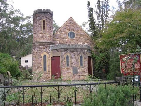
The land around Selby is particularly hilly, as evidenced by the curves in both the road and the railway. The eastern side of the township is dominated by the steep Black Hill, on which there is a reserve. Whilst the topography put restraints on farming it attracted tourists and weekenders. In the 1920s Selby's weekend population rivalled Belgrave's, but scarcity of subdivided land drew holiday makers and others away from Selby. Some notable Melburnians built homes in Selby, and the Carlotta Tye memorial Anglican church commemorates the wife of Allen Tye, son of George Tye, owner of a Melbourne furniture emporium.
Selby's proximity to Belgrave ultimately attracted residential subdivisions, and a primary school was built in 1951. The township has several reserves and shops, including a general store which continues to serve local needs.
Following a landslide beyond Selby in 1953, the narrow-gauge railway fell into disuse as a regular railway and was closed the following year, only to be re-opened in 1962 as the current Puffing Billy Railway. Regular trains only stop at Selby if required, but this is rare.
Selby's census population rose from 159 in 1933 to 1,660 in 2011.
Wildlife abounds in and around Selby. King parrots, galahs, yellow-tailed black cockatoos, black wallabies, echidnas, koalas and wombats are often sighted. Visits from barking owls have been recorded as recently as 2005.
Business
Selby has, amongst other businesses, a general store and a medical practice.
Facilities
Selby contains a CFA fire brigade, whose area of primary protection includes the township of Selby, parts of the Dandenong Ranges National Park, farmland, and other areas of bushland both private and public. It also includes a craft and produce market which opens on the third Saturday of each month, and a community house which offers community development as well as educational and IT services.
Selby Primary School was established in 1951. Puffing Billy and the historic trestle bridge are featured on the school logo. The school population has levelled out around 320 students. The school currently has nine classes, as well as specialist programs in art and craft, music, library, Japanese and physical education.
Reserves in Selby
Selby Conservation Reserve, Minak Reserve, Selby Park, Black Hill Reserve.