
 | ||
Mountains Ai‑Petri, Chatyr‑Dag, Roman‑Kosh, Ayu‑Dag, Demir‑Kapu | ||
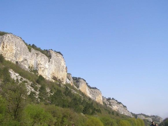
Crimean mountains and balaklava traveline in ukraine
The Crimean Mountains (Ukrainian: Кримські гори, translit. Krymski hory; Russian: Крымские горы, translit. Krymskie gory; Crimean Tatar: Qırım dağları) is a range of mountains running parallel to the south-east coast of Crimea, between about 8–13 kilometer (5–8 miles) from the sea. Toward the west, the mountains drop steeply to the Black Sea, and to the east, they change slowly into a steppe landscape.
Contents
- Crimean mountains and balaklava traveline in ukraine
- Map of Crimean Mountains
- Pis saro tattoo making in crimean mountains 2016
- Highest PeaksEdit
- Passes and RiversEdit
- HistoryEdit
- References
Map of Crimean Mountains
The Crimean Mountains consist of three subranges. The highest is the Main range. The Main range is subdivided into several massives, known as yaylas or mountain plateaus (Yayla is Crimean Tatar for "Alpine Meadow"). They are:
Pis saro tattoo making in crimean mountains 2016
Highest PeaksEdit
The Crimea's highest peak is the Roman-Kosh (Ukrainian: Роман-Кош; Russian: Роман-Кош, Crimean Tatar: Roman Qoş) on the Babugan Yayla at 1,545 metres (5,069 ft). Other important peaks over 1,200 metres include:
Passes and RiversEdit
The most important passes over the Crimean Mountains are:
Rivers of the Crimean Mountains include the Alma River, Chernaya River, and Salhir River on the northern slope and Uchan-su River on the southern slope which forms the Uchan-su waterfall, a popular tourist attraction and highest waterfall in Ukraine.
HistoryEdit
Archaeologists have found the earliest anatomically modern humans in Europe in the Crimean mountains' Buran-Kaya caves. The fossils are 32,000 years old, with the artifacts linked to the Gravettian culture. The fossils have cut marks suggesting a post-mortem defleshing ritual.