
Country Capital Port Laoise Area 1,720 km2 | ||
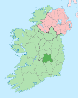
Map of County Laois
County Laois ( ; Irish: Contae Laoise) is a county in Ireland. It is located in the south of the Midlands Region and is also located in the province of Leinster, and was formerly known as Queen's County. The modern county takes its name from Loígis, a medieval kingdom.
Contents
- Map of County Laois
- Newtown house and mill durrow county laois ireland
- Prehistoric
- Introduction of Christianity
- Norman invasion
- County status
- Geography and political subdivisions
- Baronies
- Climate
- National parliament
- Local government
- Places of interest
- Demography
- Economy
- Performing arts
- Railways
- Road transport
- People
- Sport
- Twin towns
- References
Laois County Council is the local authority for the county. The population of the county is 80,559, according to the 2011 census - 20% higher than it was in the 2006 census, which is the highest percentage of population growth in the country.
Newtown house and mill durrow county laois ireland
Prehistoric
The first people in Laois were bands of hunters and gatherers who passed through the county about 8,500 years ago. They hunted in the forests that covered Laois and fished in its rivers, gathering nuts and berries to supplement their diets.
Next came Ireland’s first farmers. These people of the Neolithic period (4000 to 2500 BC) cleared forests and planted crops. Their burial mounds remain in Clonaslee and Cuffsborough.
Starting around 2500 BC, the people of the Bronze Age lived in Laois. They produced weapons, tools and golden objects. Visitors to the county can see a stone circle they left behind at Monamonry, as well as the remains of their hill forts at Clopook and Monelly. Skirk, near Borris-in-Ossory, has a Bronze Age standing stone and ring fort. The body of Cashel Man indicates that ritual killing took place around 2000 BC.
The next stage is known as the pre-Christian Celtic Iron Age. For the first time iron appeared in Ireland, as factions fought bloody battles for control of the land. At Ballydavis, archaeologists have discovered ring barrows that date from this time period.
The county name derives from Loígis, of which the modern county is only a part. In the 11th century, its dynastic rulers adopted the surname Ua/Ó Mórdha. They claimed descent from a member of the Red Branch Knights
By the first century AD, the western third of Laois was part of the Kingdom of Ossory. The eastern part was divided roughly into seven parts, which were ruled by the Seven Septs of Loígis: O’More (O’Moore), O’Lalor, O’Doran, O’Dowling, O’Devoy (O’Deevy), O’Kelly and McEvoy.
Introduction of Christianity
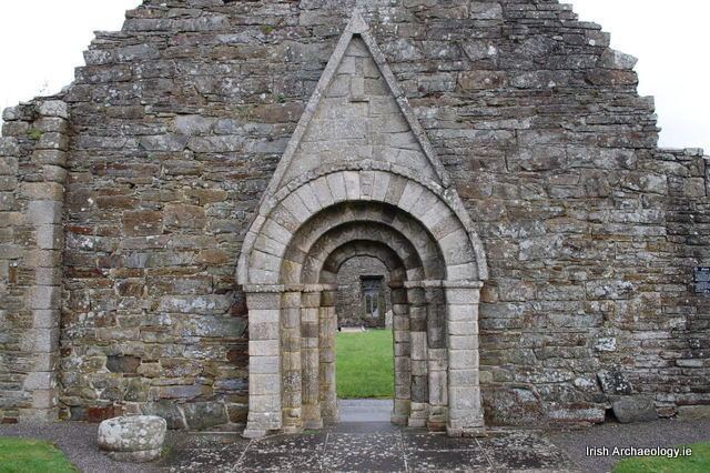
When Ireland was Christianized, holy men and women founded religious communities in Loígis. St. Ciarán of Saighir (called "The Elder" to distinguish him from the younger St. Ciarán of Clonmacnoise) founded his monastic habitation in the western Slieve Bloom Mountains as the first bishop of Ossory, reputedly before St. Patrick. His mother Liadán had an early convent nearby at what is now Killyon. Between 550 and 600, St. Canice founded Aghaboe Abbey and St. Mochua founded a religious community at Timahoe. An early Christian community lived at Dun Masc or Masc’s fort, on the Rock of Dunamase.
The Synod of Rathbreasail that established the Irish dioceses was held near Mountrath in 1111, moving the Church away from its monastic base. As religious orders with strong ties to Rome replaced older religious communities, the wooden buildings of the early Christian churches in Laois gave way to stone monasteries. The Augustinians and Dominicans established themselves at Aghaboe Abbey, while the Cistercians took over an older religious community at Abbeyleix.
Norman invasion
The Norman invasion of Ireland in 1169-71 affected Laois as it was a part of the Kingdom of Leinster. In Laois, the fortress on the Rock of Dunamase was part of the dowry of the Irish princess Aoife, who was given in marriage in 1170 to the Norman warrior Strongbow. Advancing Normans surveyed the county from wooden towers built on top of earthen mounds, known as mottes. They also built stone fortresses, such as Lea Castle, just outside Portarlington. Several of the county’s towns were first established as Norman boroughs, including Castletown, Durrow and Timahoe.
From 1175 until about 1325, Normans controlled the best land in the county, while Gaelic society retreated to the bogs, forests and the Slieve Bloom Mountains. The early 14th century saw a Gaelic revival, as the chieftains of Loígis caused the Normans to withdraw. The Dempseys seized Lea Castle, while Dunamase came into the ownership of the O’Mores. Examples of tower houses built by the Irish Mac Giolla Phádraig chieftains are found at Ballaghmore and Cullahill Castle, both decorated with Sheela na gigs.
In 1548, the English confiscated the lands of the O’Mores, and built "Campa," known as the Fort of Leix, today’s Portlaoise.
County status
It was shired in 1556 by Queen Mary as Queen's County, covering the countries of Leix (Loígis), Slewmarge, Irry, and that part of Glimnaliry on the southwest side of the River Barrow. Laois received its present Irish language name following the Irish War of Independence. Laois was also sometimes spelt "Leix". Portlaoise (previously Maryborough) is the county town.
Loígis was the subject of two Plantations or colonisations by a mix of Scottish and English settlers. The first occurred in 1556, when Thomas Radclyffe, 3rd Earl of Sussex dispossessed the O'Moore clan and attempted to replace them with Scottish and English settlers. However, this only led to a long drawn-out guerilla war in the county and left a small Scottish and English community clustered around garrisons. There was a more successful plantation in the county in the 17th century, which expanded the existing Scottish and English settlement with more landowners and tenants from both Scotland and England. Neither plantation was fully successful due to a lack of tenants and because of continuous raids and attacks by the O'Moores.
In 1659, a group of Quakers settled in Mountmellick, while a group of Huguenots were given refuge in Portarlington in 1666 after their service to William of Orange in the Williamite War in Ireland.
What followed was a period of relative calm. Anglo-Irish landowners enclosed the land and built fine houses, including Durrow Castle, Heywood House and Emo Court. In 1836, a branch of the Grand Canal stretched to Mountmellick, further stimulating industry in that town.
The Great Famine of 1845-49 devastated the county. The county’s workhouses could not cope with the number of destitute people seeking shelter. By the time the workhouse opened at Donaghmore in 1853, many of the poorest had emigrated or died.
The county was formerly known as Queen's County (Irish: Contae na Banríona) until its name was informally changed on establishment of the Irish Free State in 1922. The county's name was formerly spelt as Laoighis and Leix. Despite the county's name being upheld as Laois through the 2001 Local Government Act, no legislation was ever enacted after independence explicitly changing the name from Queen's County, the name formally established under the 1898 Local Government Act which continued to have legal effect. When land is sold in the county the relevant title deeds are still updated as being in Queen's County.
Geography and political subdivisions
Laois is the 23rd largest of Ireland’s 32 counties in area and also has the 23rd largest population. It is the seventh largest of Leinster’s 12 counties in size and tenth largest in population. The county is landlocked and, uniquely, does not border any other county which touches the coast. This is known as being doubly landlocked. It is therefore considered to be "the most landlocked county in Ireland".
Baronies
There are nine baronies in the county:
Climate
For climatological information please visit: durrow.ie for averages and extremes.
The weather station at east Durrow was set up in May 2008. The equipment used is a Davis Vantage Pro II that measures temperature, humidity, wind speed, wind direction, rainfall and barometric pressure. This data is transmitted every 2 seconds to a website where the data can be freely accessed. The station also reports to the Irish Weather Network which displays live weather data from similar stations all around Ireland.
In addition, a Met Éireann climatological station (Number: 472) was installed in September 2010 and the data collected is sent to headquarters in Glasnevin, Dublin on a monthly basis. The climatological station measures rainfall in a manual gauge, soil temperatures at 5 cm, 10 cm and 20 cm depths, air temperature including wet-bulb, daily maximum and daily minimum temperatures. The climatological station is a project that is envisaged to last thirty years and collect a climate profile for Durrow and Laois in general.
National parliament
In the Irish national parliament, Dáil Éireann, Laois is traditionally included in the Laois–Offaly constituency. However, for one election, in 2016, Laois had its own 3 seater constituency (which included six electoral divisions from Kildare South). A Constituency Commission was set up in 2016 to act on the full results of the most recent Census. One of its key recommendations is that the Laois-Offaly become a five-seater again.[1]
Local government
Local matters are dealt with by Laois County Council which elects 25 members. For the purpose of elections it is divided into three local electoral areas: Borris-in-Ossory-Mountmellick Municipal District (6), Portlaoise Municipal District (7), Graiguecullen-Portarlington Municipal District (6). Laois historically supported Fianna Fáil party in Irish elections. However, in the Irish general election, 2016 and Irish local elections, 2014, there was a sharp swing to Fine Gael and Sinn Féin. Due to major local government reform implemented by Minister Phil Hogan town councils in Mountmellick and Portlaoise are now abolished. Also there are now 19 seats in the new Laois council with 3 electoral areas: Portlaoise - Abbeyleix (7 seats), Borris-in-Ossory - Mountmellick (6 seats) and Portarlington - Graigecullen (6 seats). The results in the 2014 local election were 7 Fianna Fáil, 6 Fine Gael, 2 Sinn Féin, 1 Labour and 3 Independents. Labour's success in Portlaoise is notable as it was their first victory in the town for 50 years.
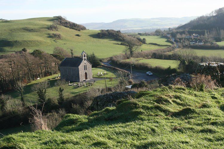
Places of interest
Also County Laois has a mixture of castles, mansions, forts and old structures that are now in ruins but are still worth visiting.
Demography
The population of County Laois is expanding, given its easy commute to the employment centres of Kildare and Dublin, and affordable housing. Laois’s population growth during the period 2002-2006 (14%) was stronger than the national average (8.2%), as follows:
As of the 2011 census, ethnically Laois was 85% white Irish, 8% other white, 2% black, 1% Asian, 1% 'other', with 2% not stated.
Economy
Over 1500 people work in the industrial sector in the county. Industrial parks are located in Portlaoise, Portarlington and Mountmellick. The county receives EU funding as it is part of the cluster of three regions (Border, Midland and West), colloquially known as "BMW", that qualifies for special funding aid.
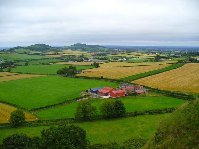
Agricultural activities occupy approximately 70% of the land area of the county (1,200 km2 or 460 sq mi). However agriculture's share of income in the "BMW" region has declined sharply in the past decade, and represented only approximately 3.9% of annual income (GVA) in 2005 Central Statistics Office. There are over 230,000 cattle in the county - three for every person. The remaining area includes considerable stretches of raised bog and the Slieve Bloom mountains, which are partially covered by coniferous forest.
Performing arts
The county's largest theatre is the Dunamaise Theatre in Portlaoise which opened in 1999. There are many festivals held in Laois each year including:
Railways
Iarnród Éireann train services along the Dublin-Cork line connects the county between Heuston station and Cork, Limerick, travel through the county, with railway stations at Portarlington, Portlaoise and Ballybrophy. From Portarlington trains run on the Dublin-Galway/Westport/Ballina line to Athlone as well as Galway, Westport and Ballina. From Ballybrophy trains run on the Ballybrophy line to Nenagh and Limerick direct.
Road transport
The M7 road runs through County Laois. This is one of the busiest roadways in Ireland connecting Dublin and Limerick and acts as a trunk route for the M8 which connects Cork to Dublin. The M8 joins the M7 to the south of Portlaoise. Road infrastructure has improved greatly in the county over the past decade. Most major interurban routes through Laois have now been upgraded to motorway standard. All major traffic bottlenecks in Laois such as Abbeyleix and Mountrath have been bypassed following the opening of the M7/M8 tolled motorway project in May 2010. Both towns were major intercity bottlenecks for motorists especially Abbeyleix where delays of up to 30 minutes or more were common.
Bus Éireann provides regular intercity bus services in the county. The Dublin to Limerick service runs every hour through towns and villages on the old N7 road (now R445) while the Dublin to Cork inter city bus service runs every two hours through towns in the county.
People
Sport
Laois has a strong tradition of Gaelic games, enjoying success at both Gaelic football and hurling. Laois are one of few counties to contest an All-Ireland final in both Gaelic football and hurling. In recent times Laois have been more successful footballers than hurlers. Laois minors have had considerable success over the past two decades, and the Laois senior footballers reached the Leinster final in 2003 (victorious), 2004, and 2005. Laois hurlers currently compete in the Liam MacCarthy Cup, a competition reserved for the premiere hurling counties while the footballers compete in the Sam Maguire Cup. Laois play home games at O'Moore Park, the county's largest sporting venue, which is often used for hurling Championship games because of its central location.
In Rugby football, Portlaoise RFC and Portarlington RFC compete in Division 2A of the Leinster League.
Twin towns
County Laois is a participant in the Twin Towns program and has a relationship with the following municipalities:
Arlington, Massachusetts, United States Carleton Place, Ontario, Canada (2008) Coulounieix-Chamiers, France (1996) Franklin, Tennessee, United States (2008)