
Founded February 9, 1854 Area 1,562 km² | Website coffeecountygov.com Population 43,220 (2013) Unemployment rate 6.6% (Apr 2015) | |
 | ||
Rivers Ocmulgee River, Hog Creek, Willacoochee River | ||
Coffee County is a county located in the U.S. state of Georgia. As of the 2010 census, the population was 42,356. The county seat is Douglas.
Contents
Map of Coffee County, GA, USA
Coffee County comprises the Douglas, GA Micropolitan Statistical Area.
History
Coffee County was created by an act of the Georgia General Assembly on February 9, 1854, from portions of Clinch, Irwin, Telfair, and Ware counties. These lands were originally ceded by the Creek in the Treaty of Fort Jackson in (1814) and the Treaty of the Creek Agency (1818) and apportioned to the above counties before becoming Coffee County.
Berrien (1856), Jeff Davis (1905), and Atkinson (1917) counties were subsequently formed from sections of Coffee County.
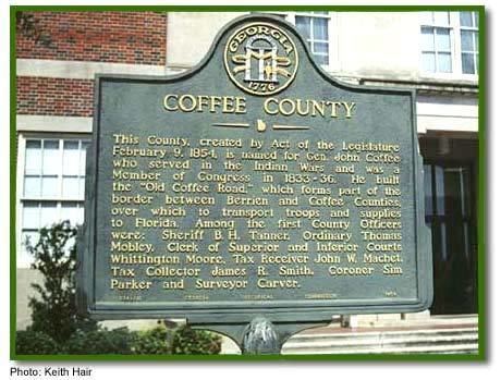
The County is named for General John E. Coffee, a state legislator and a U. S. representative.
Coffee County Correctional Facility is located in Nicholls, Georgia. It is privately owned and operated by Corrections Corporation of America (CCA), the largest prison company in the nation.
Geography
According to the U.S. Census Bureau, the county has a total area of 603 square miles (1,560 km2), of which 575 square miles (1,490 km2) is land and 28 square miles (73 km2) (4.6%) is water.
The vast majority of Coffee County is located in the Satilla River sub-basin of the St. Marys-Satilla River basin. The northern corner of the county, well north of Broxton, an area bisected by State Route 107, is located in the Lower Ocmulgee River sub-basin of the Altamaha River basin. The very southwestern corner of Coffee County, northeast of Alapaha, is located in the Alapaha River sub-basin of the Suwannee River basin.
2000 census
As of the census of 2000, there were 37,413 people, 13,354 households, and 9,788 families residing in the county. The population density was 62 people per square mile (24/km²). There were 15,610 housing units at an average density of 26 per square mile (10/km²). The racial makeup of the county was 68.23% White, 25.88% Black or African American, 0.32% Native American, 0.56% Asian, 0.04% Pacific Islander, 4.04% from other races, and 0.92% from two or more races. 6.82% of the population were Hispanic or Latino of any race.
There were 13,354 households out of which 37.30% had children under the age of 18 living with them, 53.50% were married couples living together, 15.20% had a female householder with no husband present, and 26.70% were non-families. 22.60% of all households were made up of individuals and 8.90% had someone living alone who was 65 years of age or older. The average household size was 2.69 and the average family size was 3.14.
In the county, the population was spread out with 28.30% under the age of 18, 11.00% from 18 to 24, 30.30% from 25 to 44, 20.50% from 45 to 64, and 9.90% who were 65 years of age or older. The median age was 32 years. For every 100 females there were 98.60 males. For every 100 females age 18 and over, there were 97.00 males.
The median income for a household in the county was $30,710, and the median income for a family was $35,936. Males had a median income of $26,642 versus $20,644 for females. The per capita income for the county was $15,530. About 15.30% of families and 19.10% of the population were below the poverty line, including 23.90% of those under age 18 and 21.10% of those age 65 or over.
2010 census
As of the 2010 United States Census, there were 42,356 people, 14,817 households, and 10,630 families residing in the county. The population density was 73.7 inhabitants per square mile (28.5/km2). There were 17,061 housing units at an average density of 29.7 per square mile (11.5/km2). The racial makeup of the county was 64.7% white, 26.6% black or African American, 0.7% Asian, 0.3% American Indian, 6.3% from other races, and 1.4% from two or more races. Those of Hispanic or Latino origin made up 10.3% of the population. In terms of ancestry, 14.6% were English, 10.7% were American, and 5.8% were Irish.
Of the 14,817 households, 38.8% had children under the age of 18 living with them, 49.1% were married couples living together, 17.4% had a female householder with no husband present, 28.3% were non-families, and 24.1% of all households were made up of individuals. The average household size was 2.68 and the average family size was 3.18. The median age was 34.8 years.
The median income for a household in the county was $35,202 and the median income for a family was $39,880. Males had a median income of $33,590 versus $26,129 for females. The per capita income for the county was $16,664. About 18.3% of families and 21.3% of the population were below the poverty line, including 29.6% of those under age 18 and 18.4% of those age 65 or over.