
Length 99.5 km | ||
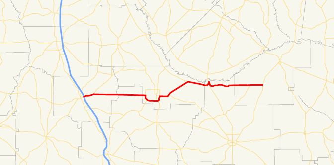 | ||
Georgia State Route 107 is a route in southern Georgia that runs from Interstate 75 in Ashburn to U.S. Route 221 in rural Jeff Davis County.
Contents
Map of GA-107, Georgia, USA
Route description
From its western terminus with Interstate 75 in Ashburn, State Route 107 travels east toward Fitzgerald. The route begins with a brief concurrency with State Route 112 for approximately three miles before departing State Route 112. The route then goes through rural Turner and Irwin counties before its intersection with State Route 125 just west of Fitzgerald. Once in Fitzgerald, State Route 107 has an intersection with U.S. Route 129 and U.S. Route 319. State Route 107 shares a concurrency with U.S. 319 as the route leaves Fitzgerald and goes through rural Ben Hill County. The route has intersections with State Route 206 and State Route 182 before entering Coffee County. Soon after entering Coffee County, the route intersects with U.S. Route 441 and leaves it concurrency with U.S. Route 319. State Route 107 shares a brief concurrency with U.S. 441 before turning east into rural Coffee and Jeff Davis counties. State Route 107 has an intersection with State Route 268 in Snipesville before reaching its eastern terminus with U.S. Route 221 north of Denton.