
Country United States Settled 1805 Time zone Eastern (EST) (UTC-5) Elevation 338 m Zip code 16830 | State Pennsylvania Incorporated 1840 Area code(s) 814 Population 6,113 (2013) | |
 | ||
Weather 7°C, Wind S at 6 km/h, 71% Humidity University Clearfield County Career and Technology Center | ||
World s largest hamburgers clearfield pennsylvania
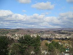
Clearfield is a borough and second most populous community in Clearfield County, Pennsylvania, United States, behind DuBois. Clearfield is also the county seat of Clearfield County. As of the 2010 census the population was 6,215 people. The borough is part of the DuBois, PA Micropolitan Statistical Area, as well as the larger State College-DuBois, PA Combined Statistical Area. The settled area surrounding the borough consists of the nearby census-designated places of Hyde and Plymptonville, which combined with Clearfield have a population of approximately 8,595 people.
Contents
- World s largest hamburgers clearfield pennsylvania
- Map of Clearfield PA 16830 USA
- Merger
- History
- National Register of Historic Places
- All America City
- Geography
- Neighborhoods
- Schools
- Demographics
- Notable people
- Television
- Movies
- Newspaper
- References
Map of Clearfield, PA 16830, USA
Merger
As of October 2015, meetings between Clearfield Borough and Lawrence Township members have been discussed for possible merger and consolidation of the two municipalities to become one municipality or city. As of October 1, 2016 both Clearfield Borough and Lawrence Township still remain separate municipalities. However meetings as of September 29, 2016 show the process is moving forward, and consolidation would occur around January 6, 2020 if vote passes.
History
There were many trade routes and paths for Native Americans living and passing through Clearfield County up to the 1600s. One major Indian path at the time was the Great Shamokin Path, which started near the Indian village of Shamokin (now Sunbury) on the Susquehanna River and continued west past Lock Haven, to Chinklacamoose, now the borough of Clearfield. Finally the path ended at the village of Kittanning on the Allegheny River, which is now the modern town of the same name.
National Register of Historic Places
Clearfield is home to four of Clearfield County's list of twenty National Registered Historic Places.
All-America City
In 1966, Clearfield was one of the winners of the All-America City Award, given annually to the top ten cities in the United States. The other nine cities included in the top ten list in 1966 were Pinellas County, Florida; Malden, Massachusetts; Ann Arbor, Michigan; Detroit, Michigan; Cohoes, New York; Greensboro, North Carolina; Richmond, Virginia; and Seattle, Washington.
Geography
Clearfield is located near the center of Clearfield County at 41°01′21″N 78°26′25″W, along the West Branch of the Susquehanna River. Clearfield Creek joins the West Branch 2 miles (3 km) to the east (downstream) of town.
U.S. Route 322 passes through the borough, and Interstate 80 passes just to the north, with access from Exit 120 (Pennsylvania Route 879). Via US-322 and I-80 it is 22 miles (35 km) northwest to the city of DuBois. US-322 leads southeast 40 miles (64 km) to State College.
Neighborhoods
The borough of Clearfield has many neighborhoods, not all of which are within the borough boundary. These locations are not separate communities, and have the same ZIP code as Clearfield.
Schools
Demographics
As of the census of 2010, there were 6,215 people, a drop of 6.3% from the 2000 census.3,070 households, and 1,740 families residing in the borough. The population density was 3,649.7 people per square mile (1,406.7/km2). There were 3,326 housing units at an average density of 1,830.6 per square mile (705.6/km2). The racial makeup of the borough was 93.1% White, 2.6% African American, 0.08% Native American, 1.6% Asian, 0.06% from other races, and 0.9% from two or more races. Hispanic or Latino of any race were 1.4% of the population.
There were 3,070 households, out of which 24.5% had children under the age of 18 living with them, 42.4% were married couples living together, 10.4% had a female householder with no husband present, and 43.3% were non-families. 38.5% of all households were made up of individuals, and 17.2% had someone living alone who was 65 years of age or older. The average household size was 2.13 and the average family size was 2.83.
In the borough the population was spread out, with 20.4% under the age of 18, 8.4% from 18 to 24, 28.3% from 25 to 44, 22.7% from 45 to 64, and 20.2% who were 65 years of age or older. The median age was 41 years. For every 100 females there were 89.6 males. For every 100 females age 18 and over, there were 84.9 males.
The median income for a household in the borough was $27,414, and the median income for a family was $40,095. Males had a median income of $29,972 versus $22,607 for females. The per capita income for the borough was $17,374. About 8.3% of families and 13.4% of the population were below the poverty line, including 14.6% of those under age 18 and 15.4% of those age 65 or over.
According to the United States Census Bureau, the borough has a total area of 1.9 square miles (4.9 km2), of which, 1.8 square miles (4.7 km2) of it is land and 0.1 square miles (0.26 km2) of it (3.70%) is water.
Notable people
Television
Clearfield receives television programming from the Johnstown-Altoona-State College, Pennsylvania media market.
Movies
Two feature films were shot on location in Clearfield County and downtown Clearfield by native Spencer T. Folmar. Once in 2009 for the feature film, "Guilt & Sentence" (2010), and again in 2016 for the upcoming fearture film "Generational Sins" (2017) starring the Australian actor, Daniel MacPherson.
Newspaper
Clearfield is covered by The Progress, published daily since 1913, and Gant Daily, published online since 2006.