
Length 1,609 km Discharge 1,200 m³/s | Basin area 281,300 km² Basin area 281,300 km² Country Canada | |
 | ||
- average 1,200 m/s (42,378 cu ft/s) Sources Winefred Lake, Beaver River, Peter Pond Lake | ||
The Churchill River (French: Rivière Churchill) is a major river in Alberta, Saskatchewan and Manitoba, Canada. From the head of the Churchill Lake it is 1,609 kilometres (1,000 mi) long. It was named after John Churchill, 1st Duke of Marlborough and governor of the Hudson's Bay Company from 1685 to 1691.
Contents
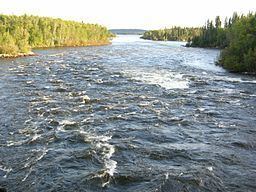
Map of Churchill River, Canada
The Cree name for the river is Missinipi, meaning "big waters".
The river is located entirely within the Canadian Shield. The drainage basin includes a number of lakes in Central-East Alberta which flow into a series of lakes in Saskatchewan and Manitoba. The main tributary, the Beaver River (Canada), joins at Lac Île-à-la-Crosse.
Nistowiak Falls—the tallest falls in Saskatchewan—are on the Rapid River, which flows north, out of Lac la Ronge into Nistowiak Lake on the Churchill just north of La Ronge.
A large amount of flow of the Churchill River after Manitoba–Saskatchewan border comes from the Reindeer River, which flows from Wollaston and Reindeer lakes. Flow from Reindeer Lake is regulated by the Whitesand Dam. From there, the Churchill River flows east through a series of lakes (Highrock, Granville, Southern Indian and Gauer), then flows via a diversion for hydro-electric generation into the Nelson River (60% of flow), and the rest flows as the Churchill River into Hudson Bay at Churchill, Manitoba. (see also Nelson River Hydroelectric Project)
History
The Churchill formed a major part of the "voyageur highway" in the 18th to 20th centuries after Dene people showed Peter Pond the Methye Portage which connects the Hudson Bay watershed with the Clearwater – Athabasca – MacKenzie rivers which flow to the Arctic Ocean. See Canadian Canoe Routes (early).
Fish species
The Churchill is also home of several fish species including: walleye, sauger, yellow perch, northern pike, lake trout, lake whitefish, cisco, white sucker, shorthead redhorse, longnose sucker, lake sturgeon and burbot.