
Surface area 1,413 km (546 sq mi) Surface elevation 364 m Number of islands 1,305 | Area 1,413 km² | |
 | ||
Primary inflows Catchment area 10,000 km (3,900 sq mi) Outflow location Rapid River, Nistowiak Falls, Churchill River | ||
Lac la ronge indian band s public works department
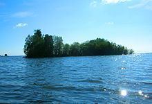
Lac la Ronge is a glacial lake in Saskatchewan, Canada. It is the fifth largest lake in the province.
Contents
- Lac la ronge indian band s public works department
- Map of Lac La Ronge Division No 18 Unorganized SK Canada
- Skating lac la ronge dec 1st 2015
- Access
- Fish Species
- References
Map of Lac La Ronge, Division No. 18, Unorganized, SK, Canada
It is approximately 250 kilometres (160 mi) north of Prince Albert, on the edge of the Canadian Shield. La Ronge, Air Ronge and the Lac La Ronge First Nation are on the west shore. The lake is a popular vacation spot. Recreational activities include fishing, boating, canoeing, hiking, and camping.
Lac la Ronge Dam, (an embankment dam) was constructed on the source of the Rapid River in 1966 to regulate the lake's water level. The dam is 3.1 metres high and contains four gates. The dam was upgraded in 2007 and a fish ladder was installed.
Skating lac la ronge dec 1st 2015
Access
Lac La Ronge Provincial Park extends around the lake on 3 sides, starting at La Ronge and ending along the east shore. The park contains 4 RV parks, 2 of which are on the west shore of the lake and one is on 2 streets in the town of Missinipe, which is on the southwest shore of Otter Lake. Missinipe is the Woodland Cree name for the Churchill River, which flows through the north side of the park. The fourth one is on the east shore of Nemeiben Lake. There is also a hunting and fishing lodge 26 km north of La Ronge. Nistowiak Falls, on the Rapid River (Churchill River), which is the lake's primary outflow into the Churchill River and one of the tallest falls in Saskatchewan can be observed by canoe trails on the north side of the park.
Highway 2 passes the lake on the west side, ending at La Ronge, where it becomes Highway 102. Stanley Mission can be accessed by Highway 915 on the north side of the park. The community is on the shores of the Churchill River across from the Holy Trinity Anglican Church, Saskatchewan's oldest building.
Fish Species
The lake's fish species include: walleye, sauger, yellow perch, northern pike, lake trout, lake whitefish, cisco, white sucker, longnose sucker and burbot.
Unlike other lakes in Saskatchewan, in addition to the usual angling licence a special endorsement is required in order to fish on Lac la Ronge. The endorsement itself is free of charge and is available from the office of the Ministry of Environment in La Ronge. Beginning in 2015, the Ministry also requires anglers to keep a "Harvest Ledger," which is given alongside the endorsement.