
Area 266.6 km² Local time Sunday 10:17 PM | Phone number 026-273-1111 Population 55,251 (Oct 2016) | |
 | ||
Weather 2°C, Wind S at 3 km/h, 92% Humidity University Tokyo University of Science, Suwa | ||
Chino (茅野市, Chino-shi) is a city located in central Nagano Prefecture, in the Chūbu region of Japan. As of 1 October 2016, the city had an estimated population of 55,251 and a population density of 207 persons per km². Its total area was 266.59 square kilometres (102.93 sq mi).
Contents
- Map of Chino Nagano Prefecture Japan
- Geography
- Surrounding municipalities
- History
- Education
- Railway
- Highway
- Sister city relations
- Local attractions
- References
Map of Chino, Nagano Prefecture, Japan
Geography
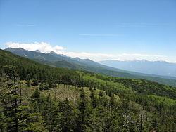
Chino is located in a mountainous area of east-central Nagano prefecture. Notable mountains within the city limits include Mount Yatsugatake, Mount Tateshina and Mount Kirigamine. Chino city hall is located at an elevation of 801 meters, and is thus the highest city hall location in Japan.
Surrounding municipalities
History
The area of present-day Chino was part of ancient Shinano Province and was part of Suwa Domain under the Tokugawa shogunate in the Edo period. The village of Eimei in Suwa District was established by the creation of the municipalities system on April 1, 1889. It was elevated to town status and renamed Chino on May 3, 1948. Chino was elevated to city status on August 1, 1958.
Education
Chino has nine public elementary schools and four public middle schools. There is one public high school operated by the Nagano Prefectural Board of Education, and one private high school. The Tokyo University of Science, Suwa is also located in Chino.