
Elevation 1,925 m | Last eruption 0.75 Ma | |
 | ||
Similar Kurumayama, Utsukushigahara, Mount Tateshina, Mount Norikura, Mount Asama | ||
Mitsubishi electric kirigamine fh utbildningsfilm
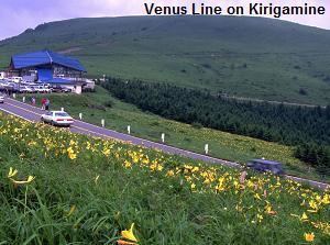
Mount Kirigamine (霧ヶ峰, Kiri-ga-mine) is a 1,925m volcano, located in Nagano Prefecture, Japan.
Contents
- Mitsubishi electric kirigamine fh utbildningsfilm
- Map of Kirigamine Kamisuwa Suwa Nagano Prefecture 392 0003 Japan
- Mitsubishi electric msz fh35 new varmepumpe heatpump kirigamine hara 6 6 with malfunction
- Outline
- Access
- References
Map of Kirigamine, Kamisuwa, Suwa, Nagano Prefecture 392-0003, Japan
Mitsubishi electric msz fh35 new varmepumpe heatpump kirigamine hara 6 6 with malfunction
Outline
The tallest peak of Mount Kirigamine is Mount Kuruma, on which there is a weather radar site. Most of the mountain is covered in grass with sparse bushes and rocks. The south and east sides are suitable for gliding with a narrow landing zone in the vicinity of a parking lot and a huge emergency landing at the west side of the mountain. The southeast cliffs are a launching point for gliders, with winds above 3 meters. The north part is equipped with ski-lifts.
Access
Vehicle access to the bottom of Kirigamine does not require four-wheel drive but snow chains may be necessary if there is heavy snow.
References
Mount Kirigamine Wikipedia(Text) CC BY-SA