
Named for The Cheyenne Nation Founded 1889 | Seat Cheyenne Wells Website www.co.cheyenne.co.us Population 1,890 (2013) Unemployment rate 3.4% (Apr 2015) | |
 | ||
Area 4,613 km² (4,605 km² Land / 8.288 km² Water) Rivers Smoky Hill River, Big Sandy Creek, Alfred Camp Spring | ||
Cheyenne County is the sixth-least densely populated of the 64 counties of the U.S. state of Colorado. The county population was 1,836 at 2010 census. The county seat is Cheyenne Wells.
Contents
- Map of Cheyenne County CO USA
- History
- Geography
- Adjacent counties
- Antipode
- Demographics
- Historic Trails
- Historic Sites
- Communities
- References
Map of Cheyenne County, CO, USA
History
Cheyenne County was created with its present borders by the Colorado State Legislature on March 25, 1889, out of portions of northeastern Bent County and southeastern Elbert County. It was named after the Cheyenne Indians who occupied eastern Colorado.
Geography
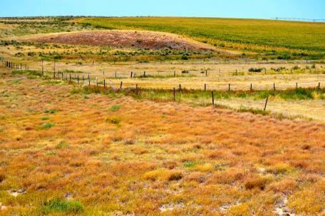
According to the U.S. Census Bureau, the county has a total area of 1,781 square miles (4,610 km2), of which 1,778 square miles (4,600 km2) is land and 3.2 square miles (8.3 km2) (0.2%) is water.
The drainage basins in Cheyenne County include Bellyache, Big Timber, East and Middle Fork Big Spring, Eureka, Goose, Ladder, Little Spring, Pass, Rock, Sand, Turtle, White Woman, Wild Horse and Willow Creeks, as well as the Smoky Hill River. The Smoky Hill drains into the Republican River in Kansas. The creeks in the northern and eastern part of the county drain to the Republican or Smoky Hill Rivers; those in the central and southeastern part of the county drain ultimately to the Arkansas River. All of the creeks in Cheyenne County are generally dry with some flow when drawing snowmelt or rainfall. There are four summits in Cheyenne County: Agate Mound (4,457 ft.), Eureka Hill (4,700 ft.), Landsman Hill (4,695 ft.), and Twin Buttes (4,621 ft.) The highest point in the county is in the extreme northwest corner of the county on the Bledsoe Ranch (5,255 ft.)
Adjacent counties
Antipode
Cheyenne County is home of the Antipode of Île Saint-Paul making it one of the few places in the continental United States with a non-oceanic antipode.
Demographics
As of the census of 2000, there were 2,231 people, 880 households, and 602 families residing in the county. The population density was 1 people per square mile (0/km²). There were 1,105 housing units at an average density of 1 per square mile (0/km²). The racial makeup of the county was 92.87% White, 0.49% Black or African American, 0.76% Native American, 0.13% Asian, 5.11% from other races, and 0.63% from two or more races. 8.11% of the population were Hispanic or Latino of any race.
There were 880 households out of which 34.10% had children under the age of 18 living with them, 59.30% were married couples living together, 5.70% had a female householder with no husband present, and 31.50% were non-families. 29.00% of all households were made up of individuals and 12.40% had someone living alone who was 65 years of age or older. The average household size was 2.50 and the average family size was 3.12.
In the county, the population was spread out with 28.80% under the age of 18, 7.10% from 18 to 24, 26.20% from 25 to 44, 21.30% from 45 to 64, and 16.60% who were 65 years of age or older. The median age was 38 years. For every 100 females there were 100.60 males. For every 100 females age 18 and over, there were 98.40 males.
The median income for a household in the county was $37,054, and the median income for a family was $44,394. Males had a median income of $32,250 versus $19,286 for females. The per capita income for the county was $17,850. About 8.70% of families and 11.10% of the population were below the poverty line, including 12.90% of those under age 18 and 10.90% of those age 65 or over.