
Country Area 22,905 km2 Capital Governor Cristian Moreno Panezo | Region Caribbean Region Founded December 1967 Population 1,004,064 | |
 | ||
Destinations | ||
University Popular University of Cesar | ||
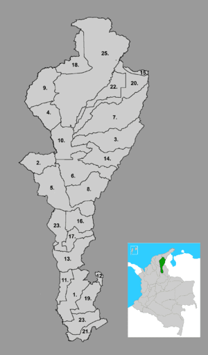
Map of Cesar Department
Cesar Department (Spanish: Departamento del Cesar) or simply Cesar ([seˈsaɾ]) is a department of Colombia located in the north of the country in the Caribbean region, bordering to the north with the Department of La Guajira, to the west with the Department of Magdalena and Department of Bolivar, to the south with Department of Santander, to the west with the Department of North Santander, and to the east with the country of Venezuela (Zulia State). The department capital city is Valledupar.
Contents
- Map of Cesar Department
- Etymology
- Geography
- Ecoregions
- Serrana del Perij mountain range
- Sierra Nevada de Santa Marta mountain range
- Cienaga de Zapatosa marshes
- Climate
- Pre Columbian
- Spanish conquest and colonization
- Republican era
- Municipalities
- Economy
- References

The region was first inhabited by indigenous peoples known as Euparíes in the Valley of Upar and Guatapuríes in the Valley of the Cesar river, among these were the Orejones pertaining to the Tupe, Acanayutos pertaining to the Motilon and Alcoholados pertaining to the Chimila. The first European to explore the area was Spanish Captain Pedro de Vadillo, but German Ambrosio Alfínger savagely conquered the region in 1532. In 1550 the village of Valle de Upar was founded by Hernando de Santana and Juan de Castellanos.
In 1813, María de la Concepción Loperena proclaimed the independence in Valledupar and donated 300 horses to Simón Bolívar. In 1829 Valledupar became a cantón of the province of Santa Marta. By Law 15 of 1850, Valledupar was segregated from Santa Marta becoming the province of Valledupar. In 1857 became a province of the state of Magdalena and by Law of December 29, 1864 became the department of Valledupar pertaining to state of Magdalena. On December 21, 1967 the department of Cesar was created officially.
Etymology
The "Cesar" name is an adaptation from the Chimila indigenous word Chet-tzar or Zazare ("calm water") into Spanish, in reference to the Cesar River. The valley that its basin covers is also named after the river and extends through most of the department. The department of Cesar was created in 1967 by decree and the name officially adopted.
Geography
The department of Cesar is located in northern Colombia bordering to the north with the department of La Guajira, to the east with the Bolivarian Republic of Venezuela, to the west with the department of Magdalena, to the southwest with the Department of Bolivar and to the south with the departments of North Santander and Santander covering a total area of 22,905 km².
The majority of the Department is flat in 57% of the total area and 43% mountainous mainly in the Serranía del Perijá and the Sierra Nevada de Santa Marta mountain ranges.
Ecoregions
The Department of Cesar contains five Ecoregions; the Serranía del Perijá mountain range, the valley of the Cesar River, the Sierra Nevada de Santa Marta mountain range, the valley of the Magdalena River and the Cienaga de Zapatosa marshes complex.
Serranía del Perijá mountain range
The Serranía del Perijá mountain range covers most of the eastern side of the Department of Cesar between its border with Venezuela and the Department of North Santander, approximately 300 km in length penetrating into the Department of La Guajira to the north and covering 27% of the total area of Cesar. The Serranía del Perijá covers, partially or totally the area of 17 municipalities in the Department of Cesar; Aguachica, Codazzi, Becerril, Chimichagua, Chiriguana, Curumani, Gonzalez, La Gloria, La Jagua de Ibirico, Los Robles La Paz, Manaure, Pailitas, Pelaya, Rio de Oro, San Alberto, San Diego and San Martin. There are also the indigenous reserves pertaining to the Yukpas people; Iroka, Socorpa and Menkue-Misaya-La Pista; and to the Wiwas people; Caño Padilla, El Rosario-Bella Vista-Yucatán and Campoalegre.
Approximately 70% of the mountain range preserves unique flora and fauna and some 20 rivers are born in the mountain range among other minor streams, flowing into the Department of Cesar and feeding the Magdalena and Cesar river basins and the Cienaga de Zapatosa marshes. The Colombian government declared it a National Forest Reserve.
Sierra Nevada de Santa Marta mountain range
The Sierra Nevada de Santa Marta mountain range is an isolated mountain range located in the northwestern region of the Department of Cesar. The mountain range is shared with by Department of La Guajira, which covers the northern area, the Department of Magdalena to the western side and the Department of Cesar which covers the southern face, covering a total area of 16,615 km² (1'661,500 ha) of which 380,000 ha pertain to the Department of Cesar. The Cesar River and the western side of its basin is born on the Sierra Nevada de Santa Marta, including the Guatapuri, Badillo, Ariguani, Cesarito, Los Clavos, Garupal and Rio Seco rivers. The mountains are within the boundaries of the municipalities of Pueblo Bello, Valledupar, El Copey and Bosconia.
The Sierra Nevada de Santa Marta was declared by UNESCO as a Biosphere Reserve on October 29, 1993.
Cienaga de Zapatosa marshes
Climate
Climate in the Department of Cesar presents variations in climate depending on altitude, as well as rainfall precipitations. Mountain climate in the Sierra Nevada de Santa Marta and the Serranía del Perijá cools downs the higher the altitude reachin freezing low temperatures at the snowy peaks and the region has two rainy seasons and two dry seasons, averaging a temperature throughout the year of 28°C. Lower lands present a warm and dry climate, annual precipitations are less than 1,300 mm a year. The mountainous regions are characterized by low temperatures with snow at high altitude peaks and precipitations ranging more than 2,000 mm a year.
Pre-Columbian
The region was first inhabited by indigenous peoples known as Euparíes in the Valley of Upar and Guatapuríes in the Valley of the Cesar river, among these were the Orejones pertaining to the Tupe, Acanayutos pertaining to the Motilon and Alcoholados pertaining to the Chimila.
Spanish chronicles describe the tribes as being part of a federation of tribes led by a single chief (Cacique), with the village of Eupari as the largest and central to the other villages. These tribes are believed to be related to the Mesoamerican culture, the Caribs and Arawaks, directly associated to the Muisca culture in the Colombian eastern branch of the Andes.
Archeological findings has shown that the indigenous in the area worked with stones and wood, including a boomerang shaped weapon found in a cemetery at Los Robles La Paz.
Spanish conquest and colonization
The first European to explore the area was Spanish Captain Pedro de Vadillo, but German Ambrosio Alfínger savagely conquered the region in 1531. In 1550 the village of Valle de Upar was founded by Hernando de Santana and Juan de Castellanos.
Republican era
In 1813, María de la Concepción Loperena proclaimed the independence of Valledupar and donated 300 horses to Simón Bolívar. In 1829 Valledupar became a Cantón of the Province of Santa Marta. By Law 15 of 1850, Valledupar was segregated from Santa Marta becoming the Province of Valledupar. In 1857 became a province of the State of Magdalena and by Law of December 29, 1864 became the Department of Valledupar pertaining to State of Magdalena. On December 21, 1967 the Department of Cesar was created officially.
Municipalities
The Department of Cesar is formed by 25 municipalities, some 171 corregimientos, 990 veredas and 10 indigenous reserves. For administrative reasons the Department of Cesar is subdivided into 4 strategic regions; the Northern Subregion covering the municipalities of Valledupar, Codazzi, Pueblo Bello, La Paz, Manaure and San Diego. The Northwestern Subregion covering the municipalities of Bosconia, El Copey, El Paso and Astrea. The Central Subregion covering the municipalities of Curumani, Becerril, Chiriguana, La Jagua de Ibirico, Chimichagua, Tamalameque and Pailitas; and the Southern Subregion covering the municipalities of Aguachica, Gamarra, Gonzalez, La Gloria, Pelaya, Rio de Oro, San Alberto and San Martin.
Economy
The economy of the César Department is sustained by the agricultural sector, secondly by a services industry following with commercial industry and mining. Cattle raising is exploited extensively (using large farms), and for this reason large portions of forests have been chopped off to create corrals. In agriculture, plantations of cotton, rice, sugar cane, oil palm, cassava and plantain. Services are centered on commerce and the industry is represented by oil products, fats and milk derived products. As one of the biggest water resources areas of Colombia, if not America, part of the Magdalena River crosses the Department and helps create the Cienaga de Zapatosa (Zapatosa Marsh) along with the Cesar river. It has a great potential to develop a fishing industry also.
The area between La Loma and La Jagua de Ibirico is the major coal-producing region of Colombia.