
Department Cesar Area 1,568 km² Local time Sunday 12:59 AM | Region Caribbean Foundation 1748 Population 30,658 (2015) | |
 | ||
Website chimichagua-cesar.gov.co/ Weather 28°C, Wind N at 8 km/h, 60% Humidity | ||
Chimichagua ([tʃimiˈtʃaɣwa]) is a city and municipality in the central region of the Department of Cesar, Colombia. Approximately one third of the municipality of Chimichagua is water. The municipality seat lies by the Cienaga de Zapatosa marshes.
Contents
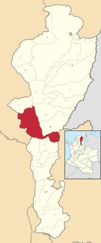
- Map of Chimichagua Cesar Colombia
- Etymology
- Pre Columbian
- Spanish conquest and colonization
- Republicanism
- Corregimientos
- References
Map of Chimichagua, Cesar, Colombia
Etymology
Chimichagua was the name of the Chimila cacique that inhabited the area at the time of the Spanish conquest. Chimichagua or Chiminigagua is the name of the supreme being of the Muisca. Muisca and Chimila pertain to the same language family; the Chibcha language.
Pre-Columbian
The territory of the municipality of Chimichagua was inhabited by the indigenous group known as the Chimila who at the time of the Spanish arrival were established in most of the Cesar River basin and its valley between the Sierra Nevada de Santa Marta and the Serranía del Perijá mountain ranges and bordering the Magdalena River.
Spanish conquest and colonization
Chimichagua was founded by Jose Fernando de Mier y Guerra on December 8, 1748 accompanied by Sebastian de Eslava who was in representation of the Viceroy. The village was first named Nuestra Señora de la Purísima Concepción de Chimichagua. The population of this village migrated to other nearby villages such as Tamalameque, Santa Cruz de Mompox, Valencia de Jesús and Valledupar due to accessibility problems.
Republicanism
Chimichagua became a municipality by Ordinance 54 of 1892. In 1967 with the creation of the Department of Cesar Chimichagua became one of its municipalities.
Corregimientos
Chimichagua has 9 corregimientos: