
Country United States Elevation 351 ft (107 m) Local time Wednesday 11:22 AM | Founded 1793 Time zone Central (CST) (UTC-6) Population 38,816 (2013) | |
 | ||
Weather 16°C, Wind SW at 11 km/h, 31% Humidity Points of interest | ||
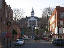
Cape girardeau missouri then and now
Cape Girardeau (/ˈkeɪp dʒᵻˈrɑːrdoʊ/, French: Cap-Girardeau [kap ʒiʁaʁdo]; colloquially referred to as "Cape") is a city in Cape Girardeau and Scott counties in the U.S. state of Missouri. It is located approximately 115 miles (185 km) southeast of St. Louis and 175 miles (282 km) north of Memphis. As of the 2010 U.S. Census, the city's population was 37,941, making it the 16th-largest city in Missouri, and the largest city in Southeast Missouri. An emerging college town, it is the home of Southeast Missouri State University.
Contents
- Cape girardeau missouri then and now
- Map of Cape Girardeau MO USA
- Cape girardeau missouri
- History
- Historic landmarks
- Geography
- Climate
- Demographics
- 2010 Census
- 2000 Census
- Economy
- Health
- Municipal Government
- State Federal Government
- Politics
- Education
- Public Schools
- Private schools
- Colleges
- Transportation
- Bus and taxi services
- Air
- In popular culture
- References
Map of Cape Girardeau, MO, USA
Cape girardeau missouri
History
The city is named after Jean Baptiste de Girardot, who established a temporary trading post in the area around 1733. He was a French soldier stationed at Kaskaskia between 1704–1720 in the French colony of La Louisiane. The "Cape" in the city name referred to a rock promontory overlooking the Mississippi River; it was later destroyed by railroad construction. As early as 1765, a bend in the Mississippi River, about 60 miles (97 km) south of the French village of Ste. Genevieve, had been referred to as Cape Girardot or Girardeau.
The settlement of Girardeau is said to date from 1798 when the Spanish government, which had acquired Louisiana in 1764 following the French defeat in the Seven Years' War, granted Louis Lorimier, a French-Canadian, the right to establish a trading post. This gave him trading privileges and a large tract of land surrounding his posorimier was made commandant of the district and prospered from the returns on his land sales and trade with indigenous peoples, such as the Ozark Bluff Dwellers and the Mississippian people.
Also in 1798, Baron Carondelet granted land near Cape Girardeau to the Black Bob Band of the Hathawekela Shawnee, who had migrated from across the Mississippi River. The Band became known as the Cape Girardeau Shawnee. They successfully resisted removal to Indian Territory with the rest of the Shawnee tribe until 1833.
In 1800, American settlers founded the first English school west of the Mississippi River in Cape Girardeau at a landmark called Mount Tabor, named by the settlers for the Biblical Mount Tabor.
The town of Cape Girardeau was incorporated in 1808, prior to Missouri statehood. It was reincorporated as a city in 1843. The advent of the steamboat in 1835 and related river trade stimulated the development of Cape Girardeau as the biggest port on the Mississippi River between St. Louis, Missouri and Memphis, Tennessee.
During the Civil War, the city was the site of the Battle of Cape Girardeau on April 26, 1863. The Union and Confederate armies engaged in a minor four-hour skirmish, each sustaining casualties generally believed to be in the low double-digits.
For years travelers had to use ferries to cross the Mississippi River from Cape Girardeau. In September 1928 a bridge was completed between Missouri and Illinois. Built to accommodate cars, it was 20 feet (6.1 m) wide under standards of the time.
The Old Federal Courthouse, located at Broadway and Fountain Streets and built in the late 1940s, was the subject of a U.S. Supreme Court case when it was being developed. In United States v. Carmack, 329 U.S. 230 (1946), the Court upheld the federal government's authority under the Condemnation Act of 1888 to seize land owned by a state or locality.
In December 2003, the "Old Bridge" was succeeded by a new four-lane cable-stay bridge crossing the Mississippi River at Cape Girardeau. Its official name is "The Bill Emerson Memorial Bridge.", honoring former U.S. Rep. Bill Emerson (R-Mo.) The two towers of the bridge reach a height of approximately 91 meters. The "Old Bridge" was completed in September 1928 to replace a ferry and was only 20 feet (6.1 m) wide. The "Old Bridge" was demolished after the Emerson Bridge opened.
The City of Cape Girardeau was recognized in January 2008 by First Lady Laura Bush as a Preserve America Community for its work in surveying and protecting historic buildings, as well as .
The city is known to some as "The City of Roses" because of a 9-mile (14 km) stretch of highway that was once lined with dozens of rose bushes. Although there used to be many prominent rose gardens around the community, few of these gardens have been maintained. The city is also known as "Cape Girardeau: Where the River Turns a Thousand Tales," due to the history of the town and the Mississippi River.
Historic landmarks
Numerous murals commemorate the city's history. The largest is the Mississippi River Tales Mural, located on the city's downtown floodwall. Covering nearly 18,000 square feet (1,700 m2), it spans the length of the downtown shopping district and features 24 panels. Behind the floodwall lies the Riverfront Park of Cape Girardeau Missouri, where riverboats dock and visitors can view the Mississippi River.
There are 39 historic sites in Cape Girardeau that are listed on the National Register of Historic Places. Of these, eight are historic districts, such as Cape Girardeau Commercial Historic District, which was listed in 2000 and includes multiple contributing properties. The growth of the town can be documented through Sanborn Maps, over 80 of which are available online. Other landmarks include the Fort D Historic Site and the Confederate War Memorial.
Among the city's older cemeteries are Apple Creek Cemetery, Salem Cemetery. and Old Lorimier Cemetery
Geography
Cape Girardeau is located at 37°18′33″N 89°32′47″W (37.309042, -89.546498). According to the United States Census Bureau, the city has a total area of 28.49 square miles (73.79 km2), of which, 28.43 square miles (73.63 km2) is land and 0.06 square miles (0.16 km2) is water. The "cape" that the city is named after no longer exists. A rock which remains from the previously existing cape can be seen on a promontory which overlooks the Mississippi River in Cape Rock Park.
Climate
Cape Girardeau has a humid subtropical climate (Köppen Cfa) with four distinct seasons and is located in USDA Plant Hardiness Zone 6b. Winter typically brings a mix of rain, sleet, and snow, with occasional heavy snowfall and icing. The city has a January daily average of 33.1 °F (0.6 °C) and averages 14 days annually with temperatures staying at or below freezing; the first and last freezes of the season on average fall on October 23 and April 7, respectively. Summer is typically hazy, hot, and humid with a July daily average of 78.6 °F (25.9 °C), and there is an average of 48 days a year with high temperatures at or above 90 °F (32 °C). The average annual precipitation is 46.8 inches (1,190 mm), with the rainiest season being spring. Extremes in temperature range from 107 °F (42 °C), which last occurred on June 29, 2012, down to −18 °F (−28 °C) on January 11, 1977.
Demographics
The Cape Girardeau-Jackson, MO-IL Metropolitan Statistical Area encompasses Alexander County, Illinois, Bollinger County, Missouri and Cape Girardeau County, Missouri and has a population of 96,275.
2010 Census
As of the census of 2010, there were 37,941 people, 15,205 households, and 8,466 families residing in the city. The population density was 1,334.5 inhabitants per square mile (515.3/km2). There were 16,760 housing units at an average density of 589.5 per square mile (227.6/km2). The racial makeup of the city was 81.13% White, 12.75% Black or African American, 0.23% Native American, 1.89% Asian, 0.04% Native Hawaiian or Pacific Islander, 1.54% from other races, and 2.40% from two or more races. Hispanic or Latino of any race were 2.76% of the population.
There were 15,205 households out of which 26.0% had children under the age of 18 living in them, 38.8% were married couples living together, 12.8% had a female householder with no husband present, 4.0% had a male householder with no wife present, and 44.3% were non-families. 33.6% of all households were made up of individuals and 11.4% had someone living alone who was 65 years of age or older. The average household size was 2.27 and the average family size was 2.89.
In the city, the population was spread out with 19.3% under the age of 18, 20.2% between the ages of 18 and 24, 23.5% from 25 to 44, 22.2% from 45 to 64, and 14.7% who were 65 years of age or older. The median age in the city was 32.1 years. The gender makeup of the city was 47.4% male and 52.6% female.
2000 Census
As of the census of 2000, there were 35,349 people, 14,380 households, and 8,297 families residing in the city. The population density was 1,456.5 people per square mile (562.4/km²). There were 15,827 housing units at an average density of 652.1 per square mile (251.8/km²). The racial makeup of the city was 87.32% White, 9.30% Black or African American, 1.13% Asian, 0.39% Native American, 0.04% Pacific Islander, 0.43% from other races, and 1.40% from two or more races. Hispanic or Latino of any race were 1.10% of the population.
There were 14,380 households of which 25.7% had children under the age of 18 living in them, 43.8% were married couples living together, 10.9% had a female householder with no husband present, and 42.3% were non-families. 33.6% of all households were made up of individuals and 11.5% had someone living alone who was 65 years of age or older. The average household size was 2.24 and the average family size was 2.90.
In the city, the population was spread out with 20.5% under the age of 18, 18.4% from ages 18 to 24, 25.6% from 25 to 44, 19.9% from 45 to 64, and 15.5% were 65 years of age or older. The median age was 34 years. For every 100 females, there were 89.5 males. For every 100 females age 18 and over, there were 86.9 males.
The median income for a household in the city was $36,502, and the median income for a family was $47,592. Males had a median income of $31,575 versus $21,392 for females. The per capita income for the city was $21,877. About 8.5% of families and 15.2% of the population were below the poverty line, including 16.5% of those under age 18 and 8.6% of those age 65 and over.
Economy
According to the Cape Girardeau Chamber of Commerce, there are more than 100 employers in Cape Girardeau who employ at least 100 workers. The top employers in the city are:
Health
St. Francis HealthCare System serves the Cape Girardeau area. This system contains six different centers. St. Francis offers immediate care in Cape Girardeau and Perryville. Landmark Hospital is a 30-bed facility that treats patients with catastrophic or chronic medical conditions. St. Francis also has joint partnership with the Physician Alliance Surgery Center, which performs ear, nose, throat, and general surgery. The Black River Medical Center offers three beds and an emergency room. The main medical center is a 280-bed facility in Cape Girardeau that serves over 650,000 people. Patients come from Missouri, Kentucky, Tennessee, Illinois, and Arkansas. Some of the services offered at the main campus are the Neurosciences Institute, Orthopedic Institute, Family BirthPlace, Heart Hospital, Emergency and Trauma Center, Cancer Institute, and Fitness Plus.
Southeast Health is a health care system with its main facility, Southeast Missouri Hospital, located in Cape Girardeau. This healthcare system serves patients from southeast Missouri, western Kentucky, southern Illinois, and northern Arkansas. Southeast Health also has a cancer center, heart center, fitness center, breast care and diagnostic center, campus health clinic, diabetes center, pharmacy, and hospice.
Municipal Government
Cape Girardeau is a home rule city that utilizes the council-manager form of government. The Cape Girardeau City Council is the elected governing body. The city council consists of the mayor and six city council members. The mayor is directly elected at-large (citywide) for a four-year term and the city council members are elected from six wards for staggered four-year terms.
Harry E. Rediger is currently serving his second term as Mayor of Cape Girardeau.
State & Federal Government
In the Missouri General Assembly, Cape Girardeau is in the 27th Senate District and is currently represented by Republican Wayne Wallingford. Most of the city is included in the 147th Legislative District and is currently represented by Republican Kathy Swan; small northern portions of the city are in the 146th Legislative District, represented by Republican Donna Lichtenegger.
In the U.S. House of Representatives, Cape Girardeau is in Missouri's 8th Congressional District and is currently represented by Republican Jason T. Smith.
Politics
Like its namesake county, the City of Cape Girardeau is relatively conservative as Republicans routinely carry the city safely in most elections; however, the city itself is not as solidly Republican as the county proper. While former Governor Mitt Romney won the city with 62.40 percent of the vote in 2012 compared to President Barack Obama’s 35.34 percent, the Republican presidential nominee carried the county with 70.81 percent while the incumbent Democratic president received 27.15 percent countywide. And during the same election, while the county backed embattled Republican U.S. Representative Todd Akin with 53.67 percent of the vote for the U.S. Senate, incumbent Democratic Senator Claire McCaskill won the city with a plurality (47.38 percent) of the vote by 26 votes over Akin’s 47.19 percent with Libertarian candidate Jonathan Dine siphoning a substantial 5.30 percent of the vote.
Education
There are over 20 different schools in Cape Girardeau. These range from pre-K to higher education. Public and private and parochial school systems are present within the city.
Public Schools
Private schools
Colleges
Transportation
The City of Cape Girardeau has established a Transportation Trust Fund that implements a .5% local sales tax. All of that money is used on transportation improvement projects. General projects are also included to keep the city’s streets in good condition.
On June 15, 2000 the Cape Girardeau County Commission passed Resolution 00-06 which formed the Cape Girardeau County Transportation Commission. The CGCTA now offers transportation to the citizens of Cape Girardeau County, which ultimately benefits the citizens of the city of Cape Girardeau. The services that the CGCTA offer are essentially buses and taxis.
In 2011, Cape Girardeau launched the Ride the City campaign. This dedicated 16 miles of bicycle lanes in city streets. There are lanes that are used only by bicycles and lanes where cars and bicycles can share space.
Bus and taxi services
Buses are offered to the citizens by the Cape Transit Authority and have several stops throughout the city. A general admission is $2, senior citizens are $1, and children ages 6 and under are free. Special pick-ups can be made to those who are disabled and live within three-fourths of mile from a designated stop. Greyhound buses are also available for long distance transit. The Cape Girardeau County Transit Authority handles the city's taxi service.
Air
The City of Cape Girardeau owns the Cape Girardeau Regional Airport. This is a full service airport that offers flights to and from Lambert International Airport in St. Louis, MO.