
Subdivisions 11 municipalities Joined 1352 Area 239 km² | ISO 3166 code CH-ZG Founded 1352 | |
 | ||
Points of interest Destinations | ||
Film zug small world big business
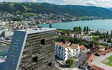
The canton of Zug ( [tsuːɡ]) is one of the 26 cantons of Switzerland. It is located in central Switzerland and its capital is Zug. At 239 km2 the canton is one of the smallest of the cantons in terms of area. It is not subdivided into districts, but eleven municipalities. Zug, a European tax haven, is the wealthiest area in Switzerland where the average average purchasing power per resident is €65,990.
Contents
- Film zug small world big business
- Map of Canton of Zug Switzerland
- History
- Geography
- Diverse landscape
- Political subdivisions
- Municipalities
- Demographics
- Economy
- Transport
- Federal election results
- References
Map of Canton of Zug, Switzerland
History
The earlier history of the canton is practically identical with that of its capital Zug. From 1728 to 1738 it was distracted by violent disputes about the distribution of the French pensions. In 1798 its inhabitants opposed the French. The canton formed part of the Tellgau and was later a district of the large canton of the Waldstätten in the Helvetic Republic. The canton of Waldstätten also included what are today the cantons of Schwyz, Lucerne, Unterwalden and Uri.
In 1803, under the Act of Mediation, the canton of Zug regained its independence as a separate canton. The constitution of 1814 abolished public assemblies (Landsgemeinde), which had existed in the canton since 1376. In 1845 the canton of Zug became a member of the Sonderbund and participated in the war of 1847 which was lost to the Swiss confederation. In 1848 the remaining functions of the Landsgemeinde were abolished. Both in 1848 and in 1874 the canton voted against the federal constitutions. The constitution of 1876 was amended in 1881, and replaced by a new one in 1894.
Near the southern shore of the lake of Ägeri is the site of the Battle of Morgarten, won by the Swiss in 1315. In this battle the powerful Habsburgs were defeated. The hamlet of Morgarten (Municipality of Oberägeri) borders the Canton of Schwyz and is home to the Morgarten Battle Monument (Morgarten Denkmal). The actual battle ground is just across the border in the hamlet of Schornen (Municipality of Sattel) in the Canton of Schwyz.
Geography
The canton of Zug is located in central Switzerland and covers an area of 239 square kilometres (92 sq mi). The cantons of Lucerne and Aargau lie to its west. To the north, the canton is bounded by the canton of Zurich, whereas to the east and south lies the canton of Schwyz.
Most of the land is considered productive. The Lake of Zug (German: Zugersee) and Lake Ägeri (German: Ägerisee) make up a considerable part of the canton's area. Lake Ägeri is wholly within the canton, whereas the Zugersee is shared with the cantons of Lucerne and Schwyz.
The canton is located on a hilly plateau. The Höhronen (near Höhboden) is the highest elevation (1,229 m) in the east of the canton. The Zugerberg (1,039 m) in the south is another notable elevation. It connects in the south with the Rossberg massif which rises to the Wildspitz (1,583 m) east of the Zugersee. This massif separates the Zugersee from the basin and Ägerisee. It also separates the hilly district of Menzingen from the Zugersee.
The river Lorze is the principal drainage in the canton. It originates in Ägerisee, from where it flows northward through moraine deposits in a deep gorge with fine stalactite caverns. The river eventually enters the Zugersee, very near to where the Reuss originates. The Reuss forms the boundary of the canton in the north west.
Canton Zug's borders were mainly established by nature itself: the rivers Sihl and Biber, and the Höhronen ridge in the east; the Rossberg mountain in the south, and the Rooterberg mountain, and the Reuss in the west. Only the 87.5 km-long border between the cantons of Zurich and Zug is not naturally defined. With its 1580 m peak, the Wildspitz is the highest point in the canton. The lowest point in the north of the canton is at 388 m, at Rüssspitz (German: Reussspitz) on the border, the confluence of the rivers Lorzen and Reuss.
Diverse landscape
The canton of Zug is multi-faceted, despite its small size. In rough terms, there are two zones, divided by the north-south axis of Lake Zug: the western part with Ennetsee and the plateau of Zug, Steinhausen and Baar; and the eastern part consisting of the hilly and mountainous zone. In the latter is the Zugerberg with the Rossberg mountain chain, the valley of Oberägeri and Unterägeri, with Lake Ägeri, and the mountain ridge of Höhronen and the countryside of Menzingen and Neuheim.
The power of the glaciers in the ice ages are impressively shown in the lateral moraines of the mountains Walchwilerberg and Zugerberg. These are the remaining traces of the Reuss Glacier. The moraine and drumlin landscape of Menzingen and Neuheim are the result of the convergence of the Reuss Glacier and the Linth Glacier. The Swiss geologist Albert Heim (1849–1937) once noted that "this must be the most impressive moraine landscape in Switzerland". The glaciation of the Zug mountains stopped in around 15,000 BCE.
The Lorze is the only large river flowing wholly within the canton. The Sihl and Reuss both follow cantonal borders. The Lorze flows from Lake Ägeri through the deep valley of the Lorzentobel to Baar and Lake Zug. In Cham, the Lorze leaves Lake Zug and joins the Reuss at the aforementioned Reussspitz.
Political subdivisions
The canton forms a single administrative district, which comprises eleven municipalities. The legislature (Kantonsrat) has 80 members.The executive (Regierungsrat) has seven members. Members of both governments are elected directly by popular vote. The term of office in both cases is four years. The two members of the Federal Ständerat, as well as the three members of the Federal Nationalrat, are also elected by a popular vote.
Municipalities
The eleven municipalities of the canton are: Zug, Oberägeri, Unterägeri, Menzingen, Baar, Cham, Hünenberg, Steinhausen, Risch, Walchwil, Neuheim
Demographics
The population of the canton (as of 31 December 2015) is 122,134. As of 2014, the population included 31,643 foreigners, or about 26% of the total population, up from 15.6% in 1990. The largest foreign population is to be found in the municipality of Walchwil with 33.2% foreign nationals, then Zug (31.7%), Baar (28.1%), Risch (26.3%), and Oberägeri (25.3%). The lowest rate is to be found in Menzingen (18.9%) and Hünenberg (16.5%).
The majority of the population (as of 2000) is Roman Catholic (62%) with a Protestant minority (18%). Until 1814, Zug was in the Diocese of Konstanz, but on the reconstruction of the diocese of Basel in 1828 it was assigned to the latter.
While the majority of the population understands standard German, most residents speak the Swiss German dialect of central Switzerland.
Economy
Many companies have headquarters in the capital, Zug, as the canton has one of the lowest tax rates in Switzerland. Notable institutions and corporations headquartered within canton Zug includes Glencore plc, Nestlé S.A., Roche, Johnson & Johnson and Siemens. Trade in particular is of great significance. There are many small and medium-sized businesses in all areas of the economy. There are over 24,300 registered companies and over 70,000 jobs in the canton, with 12,900 of the registered companies based in the city of Zug.
The Encyclopaedia Britannica Eleventh Edition (1910–1911) described the economy as follows:
In the higher regions of the canton the population is mainly engaged in pastoral pursuits and cattle-breeding. There are 61 alps (high pastures) in the canton. At Cham is a well-known factory of condensed milk, now united with that of Nestlé of Vevey. The Anglo-Swiss Condensed Milk Co. was founded in Cham in 1866. At Baar there are factories. Round the town of Zug there are great numbers of fruit trees, and Kirsch (a high grade clear cherry schnapps) and cider are largely manufactured. Apiculture flourishes in the canton. A number of factories have sprung up in the new quarter of the town. The formerly important silk-weaving industry has now disappeared.
Today's main industries are the manufacture of metal goods, textiles, machinery, electronics, crypto- and distributed ledger technologies, and alcoholic beverages (Kirsch).
Transport
Railways connect the canton of Zug with (inter alia)
Motorways also link the canton with many areas. The motorway through the St. Gotthard massif is of particular importance.