
District n.a. Highest elevation (Hagegg (mountain)) 1,250 m (4,100 ft) Local time Friday 6:41 AM Postal code 6318 | Elevation (Railway station) 449 m (1,473 ft) Lowest elevation (Lake Zug) 415 m (1,362 ft) Population 3,485 (31 Dec 2008) | |
 | ||
Weather 3°C, Wind W at 5 km/h, 89% Humidity | ||
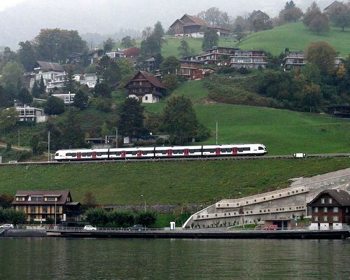
Walchwil is a village and a municipality in the canton of Zug in Switzerland.
Contents
Map of Walchwil, Switzerland
History
Walchwil is first mentioned in 1283 as Walchwile.
Geography
Walchwil has an area, as of 2006, of 13.5 km2 (5.2 sq mi). Of this area, 41.5% is used for agricultural purposes, while 45.5% is forested. Of the rest of the land, 8.2% is settled (buildings or roads) and the remainder (4.7%) is non-productive (rivers, glaciers or mountains).
The municipality is located on the eastern shore of Lake Zug on the south side of Zugerberg (1,000 m (3,300 ft)). It consists of the villages of Walchwil and Oberdorf (also known as Emmeten).
Demographics
Walchwil has a population (as of 31 December 2015) of 3,584. As of 2007, 29.9% of the population was made up of foreign nationals. Over the last 10 years the population has grown at a rate of 7.6%. Most of the population (as of 2000) speaks German (82.4%), with English being second most common ( 6.1%) and French being third ( 1.8%).
In the 2007 federal election the most popular party was the CVP which received 35.5% of the vote. The next three most popular parties were the SVP (30.1%), the FDP (16.6%) and the Green Party (10.1%).
In Walchwil about 82% of the population (between age 25-64) have completed either non-mandatory upper secondary education or additional higher education (either university or a Fachhochschule).
Walchwil has an unemployment rate of 1.29%. As of 2005, there were 161 people employed in the primary economic sector and about 46 businesses involved in this sector. 247 people are employed in the secondary sector and there are 29 businesses in this sector. 451 people are employed in the tertiary sector, with 137 businesses in this sector.
The historical population is given in the following table: