
Primary inflows Basin countries United Kingdom Max. depth 44.5 m (146 ft) Lake type Loch | Max. length 5 km (3.1 mi) Length 5 km | |
 | ||
Similar Ben Ledi, Loch Achray, Loch Katrine, Stùc a' Chroin, Garbh Uisge | ||
Airborne lens loch lubnaig
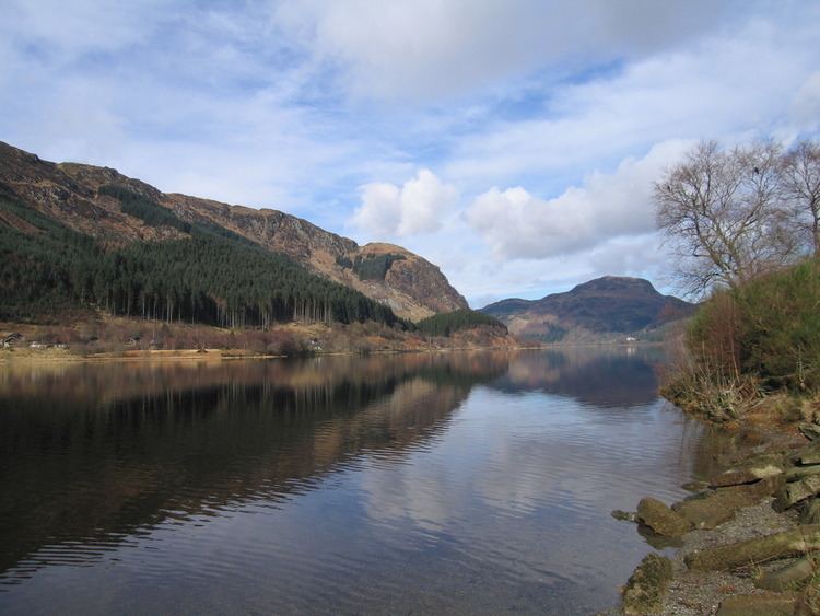
Loch Lubnaig (Loch Lùbnaig in Gaelic) is a small freshwater loch near Callander in the Stirling council area, Scottish Highlands. It lies in the former county of Perthshire. It is part of the Loch Lomond & Trossachs National Park.
Contents
- Airborne lens loch lubnaig
- Map of Loch Lubnaig Callander UK
- Day road trip to highlands scotland loch lubnaig glencoe glenfinnan and ben nevis
- References
Map of Loch Lubnaig, Callander, UK
It is around 5 km long, and has depths of up to 44.5 metres. The loch nestles in the space between Ben Ledi and Ben Vorlich. Fed by the River Balvaig from the north and drained by the Garbh Uisge to the south, Loch Lubnaig offers fishing from the shore while canoes can be rented at the north end. Alternatively, two car parking areas on the east shore offer perfect, albeit sometimes busy, canoe launching points.
The route of the former Callander and Oban Railway runs along the west shore of the loch. This route has now been converted to a part of the National Cycle Network's 'Route 7' allowing cyclists and walkers to travel the 9 miles between Callander and Strathyre.
The name is derived from the Gaelic Lùbnaig, meaning crooked. Like many lochs of the Highlands, the name is almost identical to its Gaelic version.