
Existed: 1934 – present Constructed 1934 | Length 317 km | |
 | ||
East end: SR 89 near Markleeville | ||
State Route 4 (SR 4) is a state highway in the U.S. state of California, routed from Interstate 80 in the San Francisco Bay Area to State Route 89 in the Sierra Nevada. It passes through Ebbetts Pass and contains the Ebbetts Pass Scenic Byway, a National Scenic Byway.
Contents
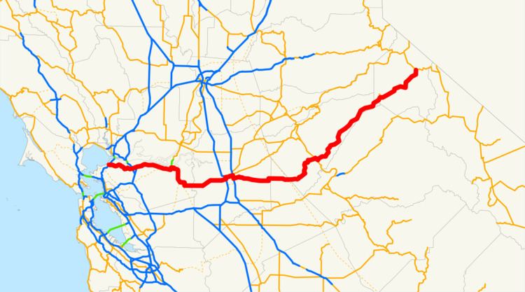
- Map of CA 4 California USA
- Route description
- History
- Major intersections
- Angels Camp business route
- References
Map of CA-4, California, USA
SR 4 roughly parallels the Sacramento-San Joaquin River Delta, a popular area for boating and fishing. There are a number of accesses to marinas and other attractions.
Route description
State Route 4 is part of the California Freeway and Expressway System and is eligible for the State Scenic Highway System. However, it is only a scenic highway as designated by Caltrans from a point east of Arnold to SR 89. SR 4 is also known as the John Muir Parkway from I-80 in Hercules to I-680 near Martinez, named for the environmentalist John Muir. The stretch through Franklin Canyon was once known as "Blood Alley."
SR 4, an east–west highway, begins in Hercules at San Pablo Avenue next to the Interstate 80 junction as part of John Muir Parkway. (The actual parkway extends a bit past the western terminus.) The road is an expressway from its starting point until it approaches Martinez, at which point it becomes a full freeway (the California Delta Highway) passing Concord, Pittsburg, and Antioch. The John Muir National Historic Site is located directly north of Route 4 on Alhambra Avenue in Martinez. Alhambra Avenue at SR 4 is also the site of the Franklin Canyon Adobe. BART tracks run in the median of the freeway from the Port Chicago Highway interchange in Concord to the Bailey Road interchange in Bay Point, where the line currently ends at the Pittsburg/Bay Point Station. Access to that station is provided by a pedestrian bridge crossing over the eastbound lanes of Highway 4. After Antioch, the freeway turns southward at its intersection with State Route 160, turning into a suburban and rural road bypassing the Bay Area's outermost eastern suburbs (Oakley and Brentwood); this section is also known as the John Marsh Heritage Highway.
Route 4 east continues to Stockton, where it briefly joins I-5 and then enters a separate freeway (known locally as the Crosstown Freeway) routing almost directly through downtown Stockton. The route then runs concurrent with State Route 99 before running eastward into the Sierra through Angels Camp, one of the richest quartz mining sections of the Mother Lode and home of "The Celebrated Jumping Frog of Calaveras County", and Calaveras Big Trees State Park. The route runs through the 8,050 ft (2,450 m). Pacific Grade Summit on its way up to the 8,730 ft (2,660 m) Ebbetts Pass and ends at State Route 89 ten miles (16 km) west of Topaz Lake, on the California–Nevada border. The portion from Arnold to its terminus is designated the Ebbetts Pass Scenic Byway, which is eventually one lane.
Through the mountains, SR 4 is not suitable for large trucks, buses, or RVs, as it becomes very steep and narrow, with no center dividing line shortly after the Mount Reba Turnoff to Bear Valley Ski area, with tight switchbacks. The pass is not plowed for snow, and thus closes during the winter months often from November through as late as May. Thus, no passage between the Mount Reba Turnoff and Markleeville is possible. The western slope is plowed and rarely closes, even for a few hours, but often has chain restrictions during and immediately following storms, usually just east of Arnold. The eastern slope is not plowed.
History
Although segments of Route 4 were part of the state highway system since 1909, Route 4 was officially designated as such between US Route 40 (now Interstate 80) and State Route 99 in 1934. Prior to that date, the then existing segment was officially known as the "Borden Highway", and the bridge over the San Joaquin River is still referred to as the "Borden Highway Bridge" in tidal tables. Construction of Route 4 did not finish until 1935, however.
The portion of Route 4 from US Route 40 to State Route 24 was added to the highway system in 1933 as Legislative Route Number (LRN) 106. East of the concurrency with State Route 24 to State Route 49, Route 4 was designated as LRN 75 from 1931-1934. Finally, the segment from State Route 49 to State Route 89 was signed as LRN 24 from 1909 to 1934.
In the 1970s, a significant portion of the Filipino American community of "Little Manila" was demolished when the "Crosstown Freeway" was constructed, displacing what was once the largest population of Filipinos outside of the Philippines.
From 1998 to 2009, a road built by the State Route 4 Bypass Authority, named the State Route 4 Bypass, opened in three phases, bypassing Route 4 in Oakley and Brentwood to the south and west. Many of the signs and local maps designated this extension as simply "Bypass Road." A section of Marsh Creek Road was widened to serve as the connection between the bypass built by the authority and the original Route 4 towards Stockton. In 2012, Caltrans handed over authority for State Route 4 in Oakley and Brentwood to the respective cities. In return, it gained control of the bypass and the upgraded section of Marsh Creek Road, which officially became State Route 4.
Construction is currently underway on widening the freeway section of Route 4 through Antioch, Oakley and Brentwood, with the final configuration as three mixed use lanes and one High Occupancy Vehicle (HOV) lane in each direction and auxiliary lanes between interchanges as far as the interchange with Route 160. The median will accommodate an extension of the Bay Area Rapid Transit (BART) system. All work at the Loveridge Road and Somersville Road/Auto Center Drive interchanges has been completed; however, the HOV lane east of the Loveridge Road overpass remains closed pending completion of construction at the L Street/Contra Loma Boulevard and A Street/Lone Tree Way interchanges. Speed on the freeway through the Antioch portion of Route 4 is limited to 55 miles per hour (90 kph), as there is severe congestion, as well as areas where no shoulder exists due to temporary concrete barriers in place.
Only the portion of the bypass from California SR 160 to the Sand Creek Road interchange is a multi-lane freeway. The portion from Sand Creek Road to Vasco Road is single-lane each way and has signal-controlled grade crossings at Balfour Road and Marsh Creek Road. In May 2010, this narrow stretch of the road handled 27,000 to 30,000 vehicles per day. In 2011, Caltrans awarded $25 million toward upgrading the section from Lone Tree Way to Sand Creek Road to a full freeway and constructing an interchange at Sand Creek Road.
Effective in early March 2016, reconfiguration of the intersection of SR 4 and SR 160 was officially opened, allowing westbound SR 4 traffic to access northbound SR 160 directly and southbound SR 160 to access eastbound SR 4.
The freeway segment of SR 4 in Stockton is part of a proposed route to upgrade SR 99 into I-7 or I-9. Under one proposal, the new interstate would go along SR 99 from the split with I-5 at Wheeler Ridge north through Fresno to Stockton, where the proposed route would then turn west via the SR 4 freeway to a terminus at I-5.
In 2016, Pittsburg moved to install surveillance cameras along their portion of the route, in response to a series of 20 freeway shootings in the area that had taken the lives of six people, and injured 11, in the past year.
Major intersections
This table reflects the transfer of the State Route 4 Bypass to Caltrans in 2012. Except where prefixed with a letter, postmiles were measured on the road as it was in 1964, based on the alignment that existed at the time, and do not necessarily reflect current mileage. R reflects a realignment in the route since then, M indicates a second realignment, L refers an overlap due to a correction or change, and T indicates postmiles classified as temporary (for a full list of prefixes, see the list of postmile definitions). Segments that remain unconstructed or have been relinquished to local control may be omitted. The numbers reset at county lines; the start and end postmiles in each county are given in the county column.
Angels Camp business route
State Route 4 Business is a locally maintained business loop within the city of Angels Camp, California. It was established in August 2013 to attract customers to businesses along the parent route's former alignment, prior to the completion of the Angels Camp Bypass. It runs along South Main Street (co-signed with State Route 49), between State Route 4 and Vallecito Road, then turns east along Vallecito Road.