
County Calaveras FIPS code 06-02770 Elevation 1,219 m Zip code 95223 Area code Area code 209 | Time zone Pacific (PST) (UTC-8) GNIS feature IDs 1656296, 2407763 Area 38.46 km² Population 3,843 (2010) | |
 | ||
Neighborhoods Blue Lake Springs, California | ||
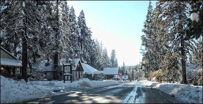
Arnold is a census-designated place (CDP) in Calaveras County, California, United States. The population was 3,843 at the 2010 census, down from 4,218 at the 2000 census. Arnold is located on State Route 4.
Contents
Map of Arnold, CA, USA
History
Arnold is named after Bob and Bernice Arnold, who, in 1927 opened the Ebbetts Pass Inn. Prior to that, the community consisted of two large ranches where logging was the main industry. The inn served as a stop for people traveling along the Ebbetts Pass route as well as lodging for those visiting nearby Calaveras Big Trees State Park. In 1928, Camp Wolfeboro was established nearby as a Boy Scout camp and continues to be in operation today. The first post office was opened in 1934. Bernice was its postmistress at one time.
Geography
According to the United States Census Bureau, the CDP has a total area of 14.9 square miles (39 km2), of which, 14.8 square miles (38 km2) of it is land and 0.1 square miles (0.26 km2) of it (0.47%) is water.
Climate
Area has a Köppen Climate Classification of Csb, which is a dry-summer subtropical climate often referred to as "Mediterranean".
2010
The 2010 United States Census reported that Arnold had a population of 3,843. The population density was 258.8 people per square mile (99.9/km²). The racial makeup of Arnold was 3,590 (93.4%) White, 20 (0.5%) African American, 28 (0.7%) Native American, 46 (1.2%) Asian, 3 (0.1%) Pacific Islander, 60 (1.6%) from other races, and 96 (2.5%) from two or more races. Hispanic or Latino of any race were 259 persons (6.7%).
The Census reported that 3,842 people (100% of the population) lived in households, 0 (0%) lived in non-institutionalized group quarters, and 1 (0%) were institutionalized.
There were 1,761 households, out of which 340 (19.3%) had children under the age of 18 living in them, 1,024 (58.1%) were opposite-sex married couples living together, 113 (6.4%) had a female householder with no husband present, 50 (2.8%) had a male householder with no wife present. There were 87 (4.9%) unmarried opposite-sex partnerships, and 11 (0.6%) same-sex married couples or partnerships. 472 households (26.8%) were made up of individuals and 201 (11.4%) had someone living alone who was 65 years of age or older. The average household size was 2.18. There were 1,187 families (67.4% of all households); the average family size was 2.60.
The population was spread out with 613 people (16.0%) under the age of 18, 184 people (4.8%) aged 18 to 24, 563 people (14.7%) aged 25 to 44, 1,436 people (37.4%) aged 45 to 64, and 1,047 people (27.2%) who were 65 years of age or older. The median age was 54.1 years. For every 100 females there were 104.4 males. For every 100 females age 18 and over, there were 99.8 males.
There were 4,897 housing units at an average density of 329.8 per square mile (127.3/km²), of which 1,422 (80.7%) were owner-occupied, and 339 (19.3%) were occupied by renters. The homeowner vacancy rate was 4.8%; the rental vacancy rate was 16.8%. 2,978 people (77.5% of the population) lived in owner-occupied housing units and 864 people (22.5%) lived in rental housing units.
2000
As of the census of 2000, there were 4,218 people, 1,864 households, and 1,325 families residing in the CDP. The population density was 284.5 people per square mile (109.9/km²). There were 4,456 housing units at an average density of 300.6 per square mile (116.1/km²). The racial makeup of the CDP was 95.12% White, 0.24% Black or African American, 0.95% Native American, 0.50% Asian, 0.12% Pacific Islander, 0.71% from other races, and 2.37% from two or more races. 3.34% of the population were Hispanic or Latino of any race.
There were 1,864 households out of which 21.7% had children under the age of 18 living with them, 61.5% were married couples living together, 6.7% had a female householder with no husband present, and 28.9% were non-families. 23.8% of all households were made up of individuals and 9.3% had someone living alone who was 65 years of age or older. The average household size was 2.26 and the average family size was 2.65.
In the CDP, the population was spread out with 18.8% under the age of 18, 4.5% from 18 to 24, 19.1% from 25 to 44, 36.6% from 45 to 64, and 20.9% who were 65 years of age or older. The median age was 50 years. For every 100 females there were 103.0 males. For every 100 females age 18 and over, there were 97.2 males.
The median income for a household in the CDP was $42,785, and the median income for a family was $49,364. Males had a median income of $42,941 versus $22,344 for females. The per capita income for the CDP was $23,169. About 7.6% of families and 10.8% of the population were below the poverty line, including 11.9% of those under age 18 and 5.6% of those age 65 or over.
Economy
Arnold has a chamber of commerce, the Greater Arnold Business Association.
Parks and recreation
Arnold is located in Stanislaus National Forest. Parks located in the area include White Pines Park and Calaveras Big Trees State Park. The Arnold Rim Trail, which was created in 2007, is a 17.5 mile multi-use trail that traverses protected land from Arnold to Avery.
Government
In the state legislature, Arnold is in the 8th Senate District, represented by Republican Tom Berryhill, and the 5th Assembly District, represented by Republican Frank Bigelow. Federally, Arnold is in California's 4th congressional district, represented by Republican Tom McClintock.