
Length 322 km | ||
 | ||
- location Vernon Parish, Louisiana, United States Bridges Calcasieu River Bridge, Israel LaFleur Bridge Similar Israel LaFleur Bridge, L'Auberge du Lac Resort, Sudduth Coliseum, Bayou Lafourche, Church of the Good Shepherd | ||
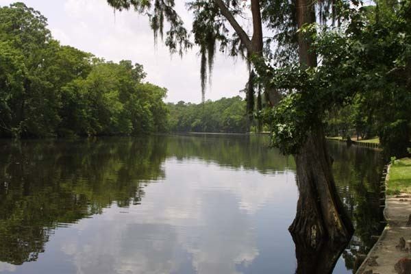
Westfork of the calcasieu river janurary 20th 2016
The Calcasieu River (/ˈkælkəˌʃuː/ KAL-kə-SHOO) is a river on the Gulf Coast in southwestern Louisiana. Approximately 200 miles (320 km) long, it drains a largely rural area of forests and bayou country, meandering southward to the Gulf of Mexico. The name "Calcasieu" comes from the Native American Atakapa language katkosh, for "eagle", and yok, "to cry".
Contents
Map of Calcasieu River, 8, LA, USA
The Calcasieu rises in Vernon Parish, north of Leesville, and flows initially southeast, passing through the Kisatchie National Forest southwest of Alexandria. It then turns southwest, flowing past Oakdale and Lake Charles, the largest city on the river. It enters the north end of the brackish Calcasieu Lake, an estuary on the Gulf of Mexico approximately 10 miles (16 km) southwest of Lake Charles. The lake, which is referred to by locals as "Big Lake", is connected by a 5-mile (8 km) channel to the gulf on the south end. The lower portion of the river south of Lake Charles is paralleled by a navigable canal which connects to the Gulf Intracoastal Waterway.
In the early 19th century, the area of present-day Louisiana and Texas west of the Calcasieu River extending roughly north-south to the Arroyo Hondo in Natchitoches Parish and east of the Neches River was disputed between the United States and Mexico. The dispute arose from differing interpretations of the western boundary of Louisiana under the terms of the Louisiana Purchase. The area became known as Neutral Ground and became a haven for privateers outside the legal jurisdiction of both nations.
Because the river passes through areas intensive in petroleum refining and other industries, petrochemical wastes have been found contaminating the river and estuarine environment along the lower Calcasieu River. In 1994 Condea Vista leaked about 47 million pounds of highly carcinogenic ethylene dichloride into the river, and then tried to cover up. Most of it drained into the Gulf.