
 | ||
Similar Madewood Plantation House, Mississippi River Delta, River Road African American, Atchafalaya Basin, Laurel Valley Sugar Pla | ||
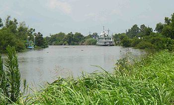
Bayou lafourche
Bayou Lafourche, originally called Chetimachas River or La Fourche des Chetimaches, (the fork of the Chitimacha), is a 106-mile-long (171 km) bayou in southeastern Louisiana, United States, that flows into the Gulf of Mexico. The bayou is between Louisiana Highway 1 on the west, and Louisiana Highway 308 on the east and is known as "the longest Main Street in the world." It flows through parts of Ascension, Assumption, and Lafourche parishes. Today, approximately 300,000 Louisiana residents drink water drawn from the bayou.
Contents
- Bayou lafourche
- Map of Bayou Lafourche Donaldsonville LA USA
- History
- Mississippi River reintroduction
- Crossings
- In popular culture
- References
Map of Bayou Lafourche, Donaldsonville, LA, USA
History
The name Lafourche is from the French for "the fork", and alludes to the bayou's large outflow of Mississippi River water. The first settlements of Acadians in southern Louisiana were near Bayou Lafourche and Bayou des Écores, which led to a close association of the bayou with Cajun culture.
It was formerly a Mississippi River outlet (distributary), but was dammed at Donaldsonville in 1905. The dam cut off nourishment and replenishment of a huge wetland area of central Louisiana. It changed the formerly flowing bayou into a stagnant ditch.
The Bollinger Shipyards, founded by Donald G. Bollinger, was launched on Bayou Lafourche in 1946.
Mississippi River reintroduction
A project to reconnect Bayou Lafourche to the Mississippi River at Donaldsonville is under design. The plan is to use a control structure to regulate the water discharge. The purpose is to mitigate the accelerated land loss that followed the interruption of the distributary flow, and to improve water quality in the bayou.
Crossings
From north to south, the following roads and railroads cross the bayou (almost all connecting LA 1 to LA 308):
In popular culture
The film Southern Comfort is set on Bayou Lafourche.
At the end of Post Office by Charles Bukowski, protagonist Henry Chinaski quits his job at the Los Angeles post office to "pick up 10 or 20 grand for 3 months trapping at Bayou La Fourche. [...] Muskrats, nutria, mink, otter... coon. All I need is a pirogue."