
Address Quilcene Bay, WA, USA Established 1984 | Governing body U.S. Forest Service Area 179.1 km² | |
 | ||
Hours Open today · Open 24 hoursSundayOpen 24 hoursMondayOpen 24 hoursTuesdayOpen 24 hoursWednesdayOpen 24 hoursThursdayOpen 24 hoursFridayOpen 24 hoursSaturdayOpen 24 hours Management United States Forest Service Similar Marmot Pass, Mount Skokomish Wilderness, Clearwater Wilderness, Camp Wooten Retreat C, Steptoe Battlefield State Park | ||
Backpacking gray wolf in buckhorn wilderness and olympic national park
The Buckhorn Wilderness is a 44,319-acre (17,935 ha) mountainous wilderness area on the northeastern Olympic Peninsula in Washington, USA. Named after Buckhorn Mountain (6,988 ft or 2,130 m), the wilderness abuts the eastern boundary of Olympic National Park which includes nearby Mount Constance (7,756 ft or 2,364 m), Inner Constance (7,667 ft or 2,337 m), Warrior Peak (7,320 ft or 2,230 m), and Mount Deception (7,788 ft or 2,374 m).
Contents
- Backpacking gray wolf in buckhorn wilderness and olympic national park
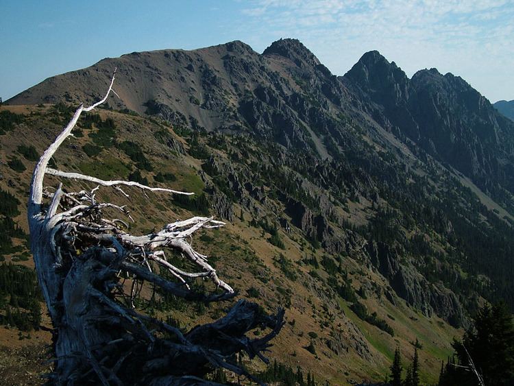
- Backpacking marmot pass olympic national forest buckhorn wilderness
- HistoryEdit
- GeographyEdit
- EcologyEdit
- RecreationEdit
- References
Backpacking marmot pass olympic national forest buckhorn wilderness
HistoryEdit
In 1984, the U.S. Congress established five wilderness areas within the Olympic National Forest:
Buckhorn Wilderness is the largest of the five, all of which sit on the eastern flank of the Olympic Wilderness within Olympic National Park. Buckhorn Wilderness is administered by the Hood Canal Ranger District of the Olympic National Forest.
GeographyEdit
The lowest elevations of the Buckhorn Wilderness are found in the lower parts of the three principal drainages: 2,470 feet (750 m) at the Big Quilcene River, 2,700 feet (820 m) at the Dungeness River, and 3,300 feet (1,000 m) at Townsend Creek. The highest point in the wilderness is 7,139 feet (2,176 m) at the summit of Mount Fricaba, which lies on the western boundary of the wilderness area, shared by Olympic National Park. The tallest peak entirely within the wilderness is Buckhorn Mountain at 6,988 feet (2,130 m). A notable historical site in the Buckhorn Wilderness is the Tubal Cain mine.
EcologyEdit
The wilderness lies within the rain shadow of the Olympic Range, resulting in a relatively drier climate. Despite this, the lowland forests (below about 4,000 feet) are still dominated by stands of old-growth western red cedar, western hemlock, and Douglas fir, in addition to numerous understory organisms such as devil's club, salal, thimbleberry, fungi, and mosses. Above about 6,000 feet (1,800 m), alpine vegetation prevails where conditions are not too dry. Some slopes, such as the south side of Buckhorn Mountain, are rather arid above tree line due to fast-draining soils, sunny exposure, and low precipitation in the summer months.
RecreationEdit
More than 54 miles (87 km) of trails provide access to the wilderness for backpacking, horseback riding, mountain climbing, hunting, hiking, camping, viewing wildlife, and fishing.