
Founded December 22, 1852 Website www.co.jefferson.wa.us Population 30,076 (2013) | Area 5,657 km² Unemployment rate 6.7% (Apr 2015) | |
 | ||
University Northwest School of Wooden Boat Building Destinations | ||
Jefferson County is a county located in the U.S. state of Washington. As of the 2010 census, the population was 29,872. The county seat and only incorporated city is Port Townsend. The county is named for Thomas Jefferson.
Contents
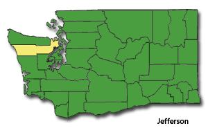
- Map of Jefferson County WA USA
- Geography
- Major highways
- Adjacent counties
- National protected areas
- 2000 census
- 2010 census
- Politics
- Economy
- City
- Census designated places
- References
Map of Jefferson County, WA, USA
Jefferson County was formed out of Thurston County on December 22, 1852, by the legislature of Oregon Territory, and included the northern 4,854 square miles (12,571.8 km2) portion of the Olympic Peninsula. On April 26, 1854, the legislature of Washington Territory created Clallam County from the northwestern 2,670 square miles (6,915.3 km2) portion of this original area.
The Hood Canal Bridge connects Jefferson County to Kitsap County, Washington. The Coupeville-Port Townsend route of the Washington State Ferries connects the county to Whidbey Island in Island County, Washington.
Geography
According to the U.S. Census Bureau, the county has a total area of 2,183 square miles (5,650 km2), of which 1,804 square miles (4,670 km2) is land and 379 square miles (980 km2) (17%) is water.
The county is split in three parts by its landforms:
Because of the mountainous barrier, there is no road lying entirely within Jefferson County that connects the eastern and western parts. The most direct land route between the two ends of the county involves a drive of approximately 100 miles (160 km) along U.S. Route 101 through neighbouring Clallam County. The mountains also block the damp Chinook winds, which make the climate much wetter in the west than the so-called eastern "banana belt" in the rain shadow.
Major highways
Adjacent counties
National protected areas
2000 census
As of the census of 2000, there were 25,953 people, 11,645 households, and 7,580 families residing in the county. The population density was 14 people per square mile (6/km²). There were 14,144 housing units at an average density of 8 per square mile (3/km²). The racial makeup of the county was 92.17% White, 0.42% Black or African American, 2.31% Native American, 1.19% Asian, 0.13% Pacific Islander, 0.76% from other races, and 3.02% from two or more races. 2.06% of the population were Hispanic or Latino of any race. 17.4% were of German, 14.8% English, 9.9% Irish and 7.5% Norwegian ancestry. 97.1% spoke English and 1.0% Spanish as their first language.
There were 11,645 households out of which 23.20% had children under the age of 18 living with them, 53.60% were married couples living together, 8.20% had a female householder with no husband present, and 34.90% were non-families. 28.50% of all households were made up of individuals and 11.70% had someone living alone who was 65 years of age or older. The average household size was 2.21 and the average family size was 2.67.
In the county, the population was spread out with 19.80% under the age of 18, 5.00% from 18 to 24, 21.60% from 25 to 44, 32.50% from 45 to 64, and 21.10% who were 65 years of age or older. The median age was 47 years. For every 100 females there were 95.80 males. For every 100 females age 18 and over, there were 94.40 males.
The median income for a household in the county was $37,869, and the median income for a family was $45,415. Males had a median income of $37,210 versus $25,831 for females. The per capita income for the county was $22,211. About 7.20% of families and 11.30% of the population were below the poverty line, including 16.60% of those under age 18 and 6.00% of those age 65 or over.
2010 census
As of the 2010 United States Census, there were 29,872 people, 14,049 households, and 8,394 families residing in the county. The population density was 16.6 inhabitants per square mile (6.4/km2). There were 17,767 housing units at an average density of 9.9 per square mile (3.8/km2). The racial makeup of the county was 91.0% white, 2.3% American Indian, 1.6% Asian, 0.8% black or African American, 0.2% Pacific islander, 0.7% from other races, and 3.4% from two or more races. Those of Hispanic or Latino origin made up 2.8% of the population. In terms of ancestry, 20.8% were English, 20.3% were German, 13.9% were Irish, 8.3% were Norwegian, 5.9% were Scottish, and 4.2% were American.
Of the 14,049 households, 18.2% had children under the age of 18 living with them, 49.1% were married couples living together, 7.3% had a female householder with no husband present, 40.3% were non-families, and 32.2% of all households were made up of individuals. The average household size was 2.08 and the average family size was 2.57. The median age was 53.9 years.
The median income for a household in the county was $46,048 and the median income for a family was $59,964. Males had a median income of $45,616 versus $29,508 for females. The per capita income for the county was $28,528. About 8.9% of families and 13.5% of the population were below the poverty line, including 20.8% of those under age 18 and 7.4% of those age 65 or over.
Politics
Jefferson County is a staunchly Democratic area, with Democrats having carried the county in every election cycle since Ronald Reagan's landslide victory in 1980. In 2016, Democratic candidate Hillary Clinton won the county 60.62% to Donald Trump's 28.91%.
The communities in the eastern and western halves of Jefferson County tend to not mingle much, because of the barrier dividing the county. The communities also differ in amount and sources of family income, and population size and density, with the west being more dependent on logging, somewhat less prosperous, and having fewer people for roughly the same area. Areas of East Jefferson County located south of Port Townsend remain largely rural and can be divided into two parts, those communities located on the Hood Canal and those on the Admiralty Inlet. Perennial discussions and attempts to separate the west half from the east half gained little support during the twentieth century.
County seat Port Townsend casts a significant number of votes and gave Obama 82% of its votes in the 2012 General Election (source: www.wa.gov). Areas outside of Port Townsend (such as Cape George) gave Obama 2-to-1 victory margins. Democrats also do well in many of the small towns of northern Jefferson County, with strong Democratic leans in Coyle, Discovery Bay, Gardiner, and Nordland, as well as in the towns just southeast of Port Townsend (Chimacum, Irondale, Kala Point, and Port Hadlock). Democrats also perform strongly in the sparsely populated western part of the county, where much of the population is Native American.
Republicans tend to win victories in several parts of the county, particularly the rural areas in the southeast part of the county including Center, Crocker Lake, Brinnon, and Quilcene. Although it has trended Democratic in recent years, Port Ludlow — an affluent area that casts a notable number of votes — still has a Republican lean.
Economy
The largest private employer in Jefferson County is the Port Townsend Paper Mill. The largest employer overall (private and public) is Jefferson Healthcare, which operates Jefferson Healthcare Hospital.