
Founded March 1, 1818 Population 44,264 (2013) University Chatfield College | Named for General Jacob Brown Area 1,277 km² | |
 | ||
Website www.browncountyohio.gov Points of interest John Rankin House, Grant Lake Wildlife Area, US Grant Boyhood Home an, US Grant Homestead Association, US Grant Native Son Statue | ||
Ufo brown county ohio v july 19 2012
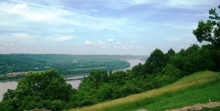
Brown County is a county located in the U.S. state of Ohio. As of the 2010 census, the population was 44,846. The county seat is Georgetown. The county was created in 1818 and is named for Major General Jacob Brown, an officer in the War of 1812 who was wounded at the Battle of Lundy's Lane.
Contents
- Ufo brown county ohio v july 19 2012
- Map of Brown County OH USA
- Ufo sighting brown county ohio august 2 2012
- History
- Geography
- Adjacent counties
- 2000 census
- 2010 census
- Government
- Radio
- Newspapers
- Census designated places
- References
Map of Brown County, OH, USA
Brown County is part of the Cincinnati, OH-KY-IN Metropolitan Statistical Area.
Ufo sighting brown county ohio august 2 2012
History
Brown County was said to be the place of origin of the White Burley type of tobacco, grown in 1864 by George Webb and Joseph Fore on the farm of Captain Frederick Kautz near Higginsport from seed from Bracken County, Kentucky. He noticed it yielded a different type of light leaf shaded from white to yellow, and cured differently. By 1866, he harvested 20,000 pounds of Burley tobacco and sold it in 1867 at the St. Louis Fair for $58 per hundred pounds. By 1883, the principal market for this tobacco was Cincinnati, but it was grown throughout central Kentucky and Middle Tennessee. Later the type became referred to as burley tobacco, and it was air-cured.
Geography
According to the U.S. Census Bureau, the county has a total area of 493 square miles (1,280 km2), of which 490 square miles (1,300 km2) is land and 3.4 square miles (8.8 km2) (0.7%) is water.
Adjacent counties
2000 census
As of the census of 2000, there were 42,285 people, 15,555 households, and 11,790 families residing in the county. The population density was 86 people per square mile (33/km²). There were 17,193 housing units at an average density of 35 per square mile (14/km²). The racial makeup of the county was 98.08% White, 0.92% Black or African American, 0.18% Native American, 0.13% Asian, 0.08% from other races, and 0.60% from two or more races. 0.44% of the population were Hispanic or Latino of any race. 29.5% were of American, 28.2% German, 10.7% English and 10.2% Irish ancestry according to Census 2000.
There were 15,555 households out of which 37.10% had children under the age of 18 living with them, 61.30% were married couples living together, 10.00% had a female householder with no husband present, and 24.20% were non-families. 20.20% of all households were made up of individuals and 8.50% had someone living alone who was 65 years of age or older. The average household size was 2.69 and the average family size was 3.09.
In the county, the population was spread out with 27.60% under the age of 18, 8.10% from 18 to 24, 30.30% from 25 to 44, 22.40% from 45 to 64, and 11.60% who were 65 years of age or older. The median age was 35 years. For every 100 females there were 96.80 males. For every 100 females age 18 and over, there were 94.80 males.
The median income for a household in the county was $38,303, and the median income for a family was $43,040. Males had a median income of $32,647 versus $22,483 for females. The per capita income for the county was $17,100. About 8.80% of families and 11.60% of the population were below the poverty line, including 15.20% of those under age 18 and 9.40% of those age 65 or over.
2010 census
As of the 2010 United States Census, there were 44,846 people, 17,014 households, and 12,379 families residing in the county. The population density was 91.5 inhabitants per square mile (35.3/km2). There were 19,301 housing units at an average density of 39.4 per square mile (15.2/km2). The racial makeup of the county was 97.5% white, 0.9% black or African American, 0.2% Asian, 0.2% American Indian, 0.2% from other races, and 1.0% from two or more races. Those of Hispanic or Latino origin made up 0.6% of the population. In terms of ancestry, 27.0% were German, 14.2% were Irish, 12.5% were American, and 9.7% were English.
Of the 17,014 households, 34.5% had children under the age of 18 living with them, 55.7% were married couples living together, 11.2% had a female householder with no husband present, 27.2% were non-families, and 22.6% of all households were made up of individuals. The average household size was 2.60 and the average family size was 3.02. The median age was 39.9 years.
The median income for a household in the county was $45,887 and the median income for a family was $54,184. Males had a median income of $39,049 versus $30,890 for females. The per capita income for the county was $20,167. About 9.0% of families and 12.4% of the population were below the poverty line, including 18.2% of those under age 18 and 8.4% of those age 65 or over.
Government
Brown County has three County Commissioners who oversee the various County departments. Current Commissioners are: .
Barry Woodruff (R), Daryll Gray (R), Tony Applegate (R).