
Website www.adamscountyoh.com Founded 10 July 1797 | Area 1,518 km² Population 28,105 (2013) Unemployment rate 7.1% (Apr 2015) | |
 | ||
Rivers Ohio Brush Creek, Scioto Brush Creek, Buck Run | ||
Adams County is a county in the U.S. state of Ohio. As of the 2010 census, the population was 28,550. Its county seat is West Union. The county is named after John Adams, the second President of the United States.
Contents
- Map of Adams County OH USA
- Adams county ohio drum circle
- Geography
- Adjacent counties
- State protected areas
- 2000 census
- 2010 census
- Government
- Library
- Hospital
- Census designated places
- Places of interest
- Notable people
- References
Map of Adams County, OH, USA
Adams county ohio drum circle
Geography
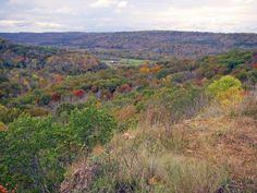
According to the U.S. Census Bureau, the county has an area of 586 square miles (1,520 km2), of which 584 square miles (1,510 km2) is land and 2.4 square miles (6.2 km2) (0.4%) is water. It includes many parks and preserves, including one of Ohio's greatest archeological wonders, the Serpent Mound at the Serpent Mound State Memorial in Locust Grove. Serpent Mound lends its name to the Serpent Mound crater, the eroded remnant of a huge ancient meteorite impact crater. Other areas of note include state parks and national forests like Edge of Appalachia, Shawnee State Park, Adams Lake Park and Robert H. Whipple State Nature Preserve.
Adjacent counties
State protected areas
2000 census
As of the census of 2000, 27,330 people, 10,501 households, and 7,613 families resided in the county. The population density was 47 people per square mile (18/km²). There were 11,822 housing units at an average density of 20 per square mile (8/km²). The racial makeup of the county was 97.77% White, 0.18% Black or African American, 0.68% Native American, 0.12% Asian, 0.03% Pacific Islander, 0.11% from other races, and 1.10% from two or more races. 0.64% of the population were Hispanic or Latino of any race. 38.5% were of American, 19.8% German, 11.7% Irish and 8.9% English ancestry according to Census 2000.
There were 10,501 households out of which 34.00% had children under the age of 18 living with them, 57.10% were married couples living together, 10.40% had a female householder with no husband present, and 27.50% were non-families. 24.00% of all households were made up of individuals and 11.00% had someone living alone who was 65 years of age or older. The average household size was 2.57 and the average family size was 3.03.
In the county, the population was spread out with 26.40% under the age of 18, 8.70% from 18 to 24, 28.20% from 25 to 44, 23.40% from 45 to 64, and 13.30% who were 65 years of age or older. The median age was 36 years. For every 100 females there were 96.10 males. For every 100 females age 18 and over, there were 94.80 males.
The median income for a household in the county was $29,315, and the median income for a family was $34,714. Males had a median income of $30,000 versus $20,433 for females. The per capita income for the county was $14,515. About 12.80% of families and 17.40% of the population were below the poverty line, including 20.30% of those under age 18 and 16.00% of those age 65 or over.
2010 census
As of the 2010 United States Census, 28,550 people, 11,147 households, and 7,793 families resided in the county. The population density was 48.9 inhabitants per square mile (18.9/km2). There were 12,978 housing units at an average density of 22.2 per square mile (8.6/km2). The racial makeup of the county was 97.7% white, 0.4% American Indian, 0.3% black or African American, 0.1% Asian, 0.2% from other races, and 1.3% from two or more races. Those of Hispanic or Latino origin made up 0.9% of the population. In terms of ancestry, 17.6% were German, 16.5% were American, 15.3% were Irish, and 9.8% were English.
Of the 11,147 households, 33.5% had children under the age of 18 living with them, 52.2% were married couples living together, 12.1% had a female householder with no husband present, 30.1% were non-families, and 25.9% of all households were made up of individuals. The average household size was 2.53 and the average family size was 3.01. The median age was 39.6 years.
The median income for a household in the county was $32,791 and the median income for a family was $40,305. Males had a median income of $37,277 versus $25,746 for females. The per capita income for the county was $17,693. About 18.8% of families and 23.0% of the population were below the poverty line, including 30.0% of those under age 18 and 16.8% of those age 65 or over.
Government
Adams County has a three-member Board of County Commissioners who oversee the various County departments, similar to all but two of the 88 Ohio counties. Adams County's elected commissioners are: Brian Baldridge, Ty Pell, and Paul Worley.
Library
The Adams County Public Library serves the communities of Adams County, Ohio from its administrative location in Peebles and branches in Manchester, West Union, and Seaman.
In 2005, the library system loaned more than 264,000 items to its 14,000 cardholders. Total holdings (as of 2005) were over 101,000 volumes with over 250 periodical subscriptions.
Hospital
Adams County is served by the Adams County Regional Medical Center at 230 Medical Center Drive in Seaman. The hospital was previously known as Adams County Hospital, and was in West Union. It was renamed and relocated to Seaman, and is easily accessible from the Appalachian Highway.