
Country United States County Brown FIPS code 39-35168 Elevation 156 m Local time Saturday 12:28 AM Area code 937 | State Ohio Time zone Eastern (EST) (UTC-5) GNIS feature ID 1064835 Zip code 45131 Population 247 (2013) | |
 | ||
Weather -2°C, Wind N at 14 km/h, 43% Humidity Area 75 ha (65 ha Land / 10 ha Water) | ||
Higginsport is a village in Brown County, Ohio, United States, along the Ohio River. The population was 251 at the 2010 census.
Contents
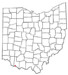
Map of Higginsport, OH, USA
History
The town of White Haven was laid out in 1804, but the attempt at a settlement did not prove successful. In 1816, the town was replatted and named in honor of Colonel Robert Higgins, a Revolutionary War veteran and early settler in the area.
White burley tobacco was first grown in Higginsport in 1864 from seed brought in from Kentucky.
Geography
Higginsport is located at 38°47′23″N 83°58′1″W (38.789585, -83.967055).
According to the United States Census Bureau, the village has a total area of 0.29 square miles (0.75 km2), of which 0.25 square miles (0.65 km2) is land and 0.04 square miles (0.10 km2) is water.
2010 census
As of the census of 2010, there were 251 people, 104 households, and 65 families residing in the village. The population density was 1,004.0 inhabitants per square mile (387.6/km2). There were 138 housing units at an average density of 552.0 per square mile (213.1/km2). The racial makeup of the village was 96.8% White, 0.4% Native American, 0.8% from other races, and 2.0% from two or more races. Hispanic or Latino of any race were 1.2% of the population.
There were 104 households of which 26.9% had children under the age of 18 living with them, 44.2% were married couples living together, 11.5% had a female householder with no husband present, 6.7% had a male householder with no wife present, and 37.5% were non-families. 32.7% of all households were made up of individuals and 19.2% had someone living alone who was 65 years of age or older. The average household size was 2.41 and the average family size was 2.94.
The median age in the village was 44.5 years. 19.5% of residents were under the age of 18; 10.5% were between the ages of 18 and 24; 20.4% were from 25 to 44; 31.2% were from 45 to 64; and 18.7% were 65 years of age or older. The gender makeup of the village was 49.0% male and 51.0% female.
2000 census
As of the census of 2000, there were 291 people, 114 households, and 77 families residing in the village. The population density was 1,305.0 people per square mile (510.7/km²). There were 134 housing units at an average density of 600.9 per square mile (235.2/km²). The racial makeup of the village was 99.31% White, and 0.69% from two or more races. Hispanic or Latino of any race were 0.34% of the population.
There were 114 households out of which 29.8% had children under the age of 18 living with them, 58.8% were married couples living together, 8.8% had a female householder with no husband present, and 31.6% were non-families. 30.7% of all households were made up of individuals and 13.2% had someone living alone who was 65 years of age or older. The average household size was 2.55 and the average family size was 3.18.
In the village, the population was spread out with 25.8% under the age of 18, 5.8% from 18 to 24, 27.1% from 25 to 44, 23.7% from 45 to 64, and 17.5% who were 65 years of age or older. The median age was 40 years. For every 100 females there were 92.7 males. For every 100 females age 18 and over, there were 77.0 males.
The median income for a household in the village was $32,000, and the median income for a family was $37,188. Males had a median income of $30,625 versus $20,000 for females. The per capita income for the village was $10,989. About 9.6% of families and 11.5% of the population were below the poverty line, including 10.5% of those under the age of eighteen and 8.8% of those sixty five or over.