
Population 1,501 (2011 census) Mean max temp Mean min temp Postal code 4804 | Postcode(s) 4804 Elevation 187 m Local time Thursday 1:38 PM | |
 | ||
Weather 25°C, Wind SE at 11 km/h, 74% Humidity | ||
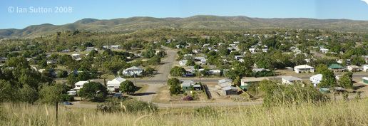
Collinsville is a town and locality in the Whitsunday Region, Queensland, Australia. In the 2011 census, Collinsville had a population of 1,501 people.
Contents
- Map of Collinsville QLD 4804 Australia
- Geography
- History
- Heritage listings
- Mining
- Facilities
- Education
- References
Map of Collinsville QLD 4804, Australia
Geography
Collinsville is in the coal-rich Bowen Basin region of Central Queensland, 1,245 kilometres (774 mi) north of Brisbane and 87 kilometres (54 mi) south-west of the coastal town of Bowen. The Bowen Developmental Road passes through the town connecting with Bowen to the north-east and the Gregory Highway at Belyando Crossing to the south-west.
History
European settlement of the region began in 1861 with the opening of the lands to pastoralists, with some cattle stations still in operation. Coal was discovered in 1866 but it wasn't until 1912 that large-scale mining operations commenced. The town was originally known as 'Moongunya', an aboriginal word that roughly translates to 'place of coal'. On 20 September 1921 it was officially renamed Collinsville after Charles Collins who was the Labor Member of the Queensland Legislative Assembly for Bowen from 1915 to 1936.
Collinsville State School opened on 27 June 1921. Collinsville Post Office opened on 21 May 1923 (a receiving office had been open from 1922). The St John Bosco Catholic School was established in 1936 under the Sisters of Mercy. The school is named after Saint John Bosco, a Roman Catholic priest who devoted himself to the betterment of children through love and education. Collinsville State High School opened on 28 January 1986.
On 13 October 1954, seven men were killed in the deepest part of the Collinsville State Coal Mine about 1.5 kilometres from the entrance of the No. 1 tunnel, when an outburst dislodged 900 tonnes of earth. The Collinsville mine disaster was the largest loss of life in a Queensland mine since the Mount Mulligan mine disaster in 1921.
The town has a historical association with radicalism to the extent that it earned the nickname "little Moscow". This has been attributed to the involvement of the Communist Party in the local miners' union.
At the 2006 census, Collinsville had a population of 2,063.
Heritage listings
Collinsville has a number of heritage-listed sites, including:
Mining
The town is home to a number of coal mines. This includes the Collinsville coal mine and the Sonoma Mine.
Facilities
Facilities in four churches (Catholic, Anglican, Uniting, Assembly of God), a pharmacy, a district hospital, some shops and sporting facilities. Sporting facilities include a golf course, rugby league grounds, tennis courts, a public swimming pool, squash courts, and lawn bowls. The town has one newsagent, a bakery, two fuel stations, two medium size grocery stores, two places to buy clothing and a hardware shop.
Education
Collinsville has two primary schools, Collinsville State School and St John Bosco's Catholic Primary School and the Collinsville State High School. In 2014, the Collinsville State School had an enrolment of 42 students with 4 teachers. In 2014, the Collinsville State High School had an enrolment of 77 students with 12 teachers (11 full-time equivalent). In 2016, St John Bosco's Catholic Primary School had an enrolment of 50 students.