
West end: Central Parkway | ||
 | ||
Global cities local streets bloor street toronto
Bloor Street is a major east–west residential and commercial thoroughfare in Toronto, Ontario, Canada. Bloor Street runs from the Prince Edward Viaduct, which spans the Don River Valley, westward into Mississauga where it ends at Central Parkway. East of the viaduct, Danforth Avenue continues along the same right-of-way. The street, approximately 25 kilometres (16 mi) long, contains a significant cross-sample of Toronto's ethnic communities. It is also home to Toronto's famous shopping street, the Mink Mile.
Contents
- Global cities local streets bloor street toronto
- Map of Bloor St W Toronto ON Canada
- Leo burnett the intern of bloor street
- History
- Route description
- Shopping
- References
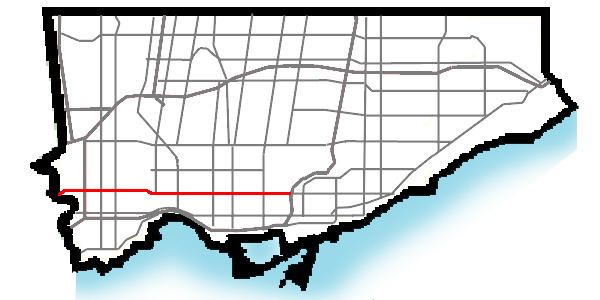
Map of Bloor St W, Toronto, ON, Canada
The street is named after Joseph Bloore (a clerical error caused his name to drop an "e"), a brewer and land speculator of this area in the 19th century who founded the Village of Yorkville in 1830. He is buried at Necropolis Cemetery on Bayview Avenue and Rosedale Valley Road.
A portion of Line 2 of the Bloor-Danforth subway line runs along Bloor from Kipling Avenue to Yonge Street, and then continues east along Danforth Avenue.
Leo burnett the intern of bloor street
History
Originally surveyed as the first concession road north of the baseline (now Queen Street), it was known by many names, including the Tollgate Road (as the first tollgate on Yonge north of Lot Street was constructed there in 1820), then St. Paul's Road (after the nearby church, constructed 1842), and possibly Sydenham Road (after Lord Sydenham, Governor General 1839–1841). Although Bloore had an "e" at the end of his surname, Bloor Street was never spelled with it, as evidenced on numerous maps produced before his death.
The idea of installing bicycle lanes on Bloor had been debated since at least the early 1970s. On 4 May 2016, city council voted 38-3 to implement physically separated bike lanes along a 2.6-km stretch of the street. Mayor John Tory stated, in support of the project, that if council sought to make Toronto a "21st century city", it must improve at providing "alternate ways to move people around the city."
Route description
Bloor street begins at the eastern edge of the Prince Edward Viaduct, which passes over the ravine holding the Don River. The street continues through to the Rosedale Ravine, marking the southern border of the affluent community of Rosedale. West of Parliament Street, the street passes just to the north of the large St. James Town housing project, which stretches west to Sherbourne Street. On the northern side of this section of Bloor are the forested slopes of the Rosedale Ravine. Between Sherbourne and Church Streets the street is lined by large office towers, mostly home to insurance companies. This area has long been the centre of the insurance industry in Canada.
West of Church the street becomes more commercial and is an important shopping district. In downtown, especially around the intersection with Bay Street, Bloor is one of the most exclusive stretches of real estate in Canada. Rents on the upscale Bloor Street have doubled in 4 years, ranking as the 22nd most expensive retail location in the world in 2006, up two spots from 2005. Nationally, Vancouver's upscale Robson Street tied with Bloor Street West as the most expensive street in Canada, with an annual average rental price of $208 per square foot.
Under the intersection of Yonge and Bloor Streets is the Bloor-Yonge subway station, which is the busiest in the city, serving approximately 368,800 people a day. Above ground, the intersection encompasses commercial stores and condominiums.
In the downtown, Bloor Street serves as the northern edge of the University of Toronto campus, and is host to several historic sites, including the Bata Shoe Museum, the Royal Conservatory of Music, and the southern edge of Yorkville, in an area now known as the Bloor Street Culture Corridor.
West of the university, which ends at Spadina Avenue, Bloor Street runs through a diverse series of neighbourhoods such as The Annex, Koreatown, Dufferin Grove, Brockton, Roncesvalles, High Park and Runnymede. It generally retains its commercial character, and serves as the main shopping area for most of these communities. Numerous sections of the street have named 'business improvement areas' such as Bloorcourt Village, Bloordale Village and Bloor West Village.
In Toronto's west end, Bloor Street crisscrosses Dundas Street twice, between Lansdowne Avenue and Parkside Drive and again in the Six Points area (Kipling Avenue) as these streets follow the old trails. Markland Wood is the westernmost residential community in the city of Toronto. Through Mississauga, Bloor Street links the residential communities of Applewood Hills and Applewood Heights, terminating at Central Parkway, about one kilometre east of Hurontario Street.
A second section of Bloor once continued a short distance west of Hurontario, but was incorporated into Central Parkway which runs both north and west from the street's western terminus as the only completed part of an aborted ring road project around Mississauga City Centre.
Until 1998, Bloor Street was designated as Ontario Highway 5 from Kipling Avenue east to the Don River. Like many urban stretches of provincial roadway, it was formally decommissioned as a connecting link on January 1.
Shopping
The stretch of Bloor between Yonge Street and Avenue Road, in Yorkville, is called Mink Mile, and it is the most prestigious shopping street in Toronto.