
Founded 1840 Population 60,179 (2013) | Website www.belknapcounty.org Area 1,215 km² Unemployment rate 3.6% (Apr 2015) | |
 | ||
Colleges and Universities Lakes Region Communi, Immaculate Conception Apostolic, Empire Beauty School‑Laconia Points of interest | ||
Belknap County (/ˈbɛlnæp/) is one of ten counties in the U.S. state of New Hampshire. As of the 2010 census, the population was 60,088. The county seat is Laconia. It is located in New Hampshire's Lakes Region, slightly southeast of the state's geographic center.
Contents
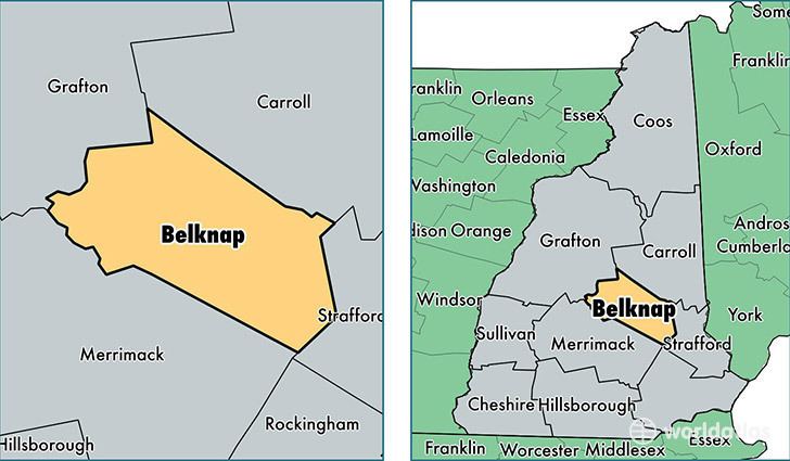
- Map of Belknap County NH USA
- History
- Geography
- Adjacent counties
- 2000 census
- 2010 census
- Politics
- Communities
- City
- Census designated places
- References
Map of Belknap County, NH, USA
Belknap County comprises the Laconia, NH Micropolitan Statistical Area, which is also included in the Boston-Worcester-Providence, MA-RI-NH-CT Combined Statistical Area.
History
Belknap County was organized in 1840 by removing parts of northeastern Merrimack County and northwestern Strafford County. It is named for Dr. Jeremy Belknap, a renowned preacher, historian, and author of The History of New Hampshire. The first County Court was held within the town of Meredith, at a village known as Meredith Bridge on the Winnipesaukee River. In 1855, the town of Laconia was separated from Meredith.
Geography
According to the U.S. Census Bureau, the county has a total area of 469 square miles (1,210 km2), of which 400 square miles (1,000 km2) is land and 68 square miles (180 km2) (15%) is water. It is the second-smallest county in New Hampshire by area. Most of the county's water area is part of Lake Winnipesaukee.
Adjacent counties
2000 census
As of the census of 2000, there were 56,325 people, 22,459 households, and 15,496 families residing in the county. The population density was 140 people per square mile (54/km²). There were 32,121 housing units at an average density of 80 per square mile (31/km²). The racial makeup of the county was 97.61% White, 0.29% Black or African American, 0.30% Native American, 0.55% Asian, 0.02% Pacific Islander, 0.16% from other races, and 1.06% from two or more races. 0.74% of the population were Hispanic or Latino of any race. 17.2% were of English, 13.6% Irish, 13.3% French, 12.2% French Canadian, 8.5% American, 6.9% Italian and 5.7% German ancestry according to Census 2000. 95.0% spoke English, 2.7% French and 1.2% Spanish as their first language.
There were 22,459 households out of which 30.4% had children under the age of 18 living with them, 55.7% were married couples living together, 9.20% had a female householder with no husband present, and 3% were non-families. 24.40% of all households were made up of individuals and 9.70% had someone living alone who was 65 years of age or older. The average household size was 2.45 and the average family size was 2.91.
In the county, the population was spread out with 23.60% under the age of 18, 6.70% from 18 to 24, 28.10% from 25 to 44, 26.40% from 45 to 64, and 15.10% who were 65 years of age or older. The median age was 40 years. For every 100 females there were 97.10 males. For every 100 females age 18 and over, there were 95.10 males.
The median income for a household in the county was $43,605, and the median income for a family was $50,510. Males had a median income of $34,741 versus $25,445 for females. The per capita income for the county was $22,758. About 4.50% of families and 6.10% of the population were below the poverty line, including 7.60% of those under age 18 and 4.90% of those age 65 or over.
2010 census
As of the 2010 United States Census, there were 60,088 people, 24,766 households, and 16,609 families residing in the county. The population density was 150.1 inhabitants per square mile (58.0/km2). There were 37,386 housing units at an average density of 93.4 per square mile (36.1/km2). The racial makeup of the county was 96.6% white, 1.2% Asian, 0.5% black or African American, 0.2% American Indian, 0.2% from other races, and 1.3% from two or more races. Those of Hispanic or Latino origin made up 1.2% of the population. In terms of ancestry, 20.8% were English, 20.7% were Irish, 8.5% were Italian, 8.0% were German, 7.1% were French Canadian, and 6.6% were American.
Of the 24,766 households, 28.5% had children under the age of 18 living with them, 52.5% were married couples living together, 9.8% had a female householder with no husband present, 32.9% were non-families, and 25.7% of all households were made up of individuals. The average household size was 2.39 and the average family size was 2.84. The median age was 44.7 years.
The median income for a household in the county was $54,929 and the median income for a family was $64,875. Males had a median income of $46,378 versus $34,690 for females. The per capita income for the county was $28,517. About 5.2% of families and 8.6% of the population were below the poverty line, including 8.7% of those under age 18 and 10.0% of those age 65 or over.
Politics
The Republican party is the majority political party in Belknap County, holding all 20 seats in the state legislature as of 2012. In the 2004 U.S. Presidential election, George W. Bush carried Belknap by an 11.9% margin over John Kerry, with Kerry winning statewide by 1.4%. But in 2008, the county voted for Barack Obama by a 1.2% margin over John McCain, with Obama carrying the Granite State by 9.6% over McCain. No Democrat has won a majority of the county since 1964, with Obama only receiving 49.97% in 2008.
Communities
There are ten towns and one city in Belknap County.