
Country United States County Belknap Time zone Eastern (UTC-5) Elevation 160 m Population 2,165 (2010) | State New Hampshire Incorporated 1777 Area code(s) 603 Zip code 03256 Local time Saturday 7:18 AM | |
 | ||
Weather 1°C, Wind NW at 8 km/h, 91% Humidity | ||
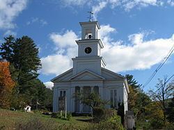
New Hampton is a town in Belknap County, New Hampshire, United States. The population was 2,165 at the 2010 census. A winter sports resort area, New Hampton is home to George Duncan State Forest and to the New Hampton School, a private preparatory school established in 1821.
Contents
- Map of New Hampton NH USA
- History
- Geography
- Demographics
- Government
- Sites of interest
- Notable people
- References
Map of New Hampton, NH, USA
The primary village in town, where 351 people resided at the 2010 census, is defined as the New Hampton census-designated place (CDP), and is located along New Hampshire Route 132, just south of its intersection with Route 104.
History
Granted in 1765 by Colonial Governor Benning Wentworth, New Hampton was originally known as Moultonborough Addition after then-Colonel Jonathan Moulton, who held the position of town moderator. Moulton, who was born in Hampton, changed the name to New Hampton in 1777 when it was incorporated.
In 1821 the New Hampton School, a Free Will Baptist institution, was founded in the town. From 1854 to 1870, the institute was affiliated with Cobb Divinity School (later part of Bates College).
In 1920, the New Hampton Fish Hatchery, the state's oldest fish hatchery, was established in the town.
Geography
According to the United States Census Bureau, the town has a total area of 38.3 square miles (99.1 km2), of which 36.7 sq mi (95.0 km2) is land and 1.6 sq mi (4.1 km2) is water, comprising 4.14% of the town. New Hampton is bounded on the west and southwest by the Pemigewasset River. Pemigewasset Lake is in the center, and Winona Lake and Lake Waukewan are in the northeast. The highest point in New Hampton is 1,840 feet (561 m) above sea level atop the west ridge of Hersey Mountain, whose 2,001-foot (610 m) summit lies just over the town boundary in Sanbornton.
The geographic center of New Hampshire is located in the eastern part of New Hampton, between Winona Lake and Jackson Pond, at 43.67925 N, 71.580375 W.
The town is served by Interstate 93 and state routes 104 and 132. I-93 serves the town at Exit 23 and leads north to Plymouth and south to Concord. NH 104 passes east–west through the town, connecting Bristol to the west with Meredith to the east. NH 132 parallels I-93 as a local road, connecting Sanbornton and Tilton to the south with Ashland to the north.
Demographics
As of the census of 2000, there were 1,950 people, 726 households, and 538 families residing in the town. The population density was 53.1 people per square mile (20.5/km²). There were 944 housing units at an average density of 25.7 per square mile (9.9/km²). The racial makeup of the town was 97.28% White, 0.31% African American, 0.05% Native American, 0.26% Asian, 0.21% from other races, and 1.90% from two or more races. Hispanic or Latino of any race were 0.62% of the population.
There were 726 households out of which 35.0% had children under the age of 18 living with them, 62.3% were married couples living together, 6.7% had a female householder with no husband present, and 25.8% were non-families. 18.7% of all households were made up of individuals and 8.1% had someone living alone who was 65 years of age or older. The average household size was 2.68 and the average family size was 3.06.
In the town, the population was spread out with 26.8% under the age of 18, 6.2% from 18 to 24, 30.0% from 25 to 44, 24.6% from 45 to 64, and 12.4% who were 65 years of age or older. The median age was 38 years. For every 100 females there were 98.8 males. For every 100 females age 18 and over, there were 98.5 males.
The median income for a household in the town was $47,583, and the median income for a family was $52,366. Males had a median income of $32,095 versus $26,181 for females. The per capita income for the town was $20,336. About 2.7% of families and 4.7% of the population were below the poverty line, including 4.2% of those under age 18 and 6.8% of those age 65 or over.
Government
In the New Hampshire Senate, New Hampton is in the 2nd District, represented by Republican Bob Giuda. On the New Hampshire Executive Council, New Hampton is in the 1st District, represented by Republican Joe Kenney. In the United States House of Representatives, New Hampton is in New Hampshire's 1st congressional district, represented by Democrat Carol Shea-Porter.