
Founded 1771 Website www.co.strafford.nh.us Unemployment rate 3.2% (Apr 2015) | Area 994.6 km² Population 124,593 (2013) | |
 | ||
Points of interest Woodman Institute, Flag Hill Winery, Merrymeeting Lake, Baxter Lake, Swains Lake Destinations | ||
Strafford County is a county in the U.S. state of New Hampshire. As of the 2010 census, the population was 123,143. Its county seat is Dover. Strafford County was one of the five original counties identified for New Hampshire in 1769. It was named after William Wentworth, 2nd Earl of Strafford in the mistaken belief that he was the ancestor of governor John Wentworth. Although they were distantly related, William had no descendants.
Contents
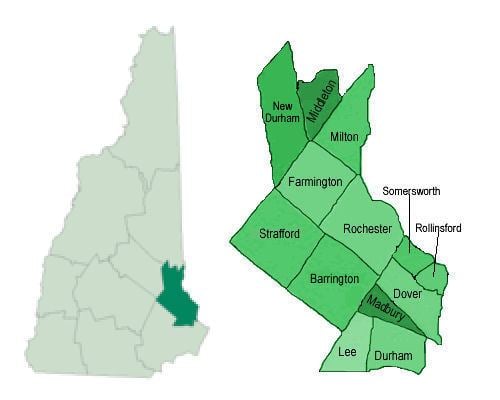
- Map of Strafford County NH USA
- Geography
- Adjacent counties
- 2000 census
- 2010 census
- Cities
- Census designated places
- Villages
- References
Map of Strafford County, NH, USA
The county was organized at Dover in 1771. In 1840 the original size of the county was reduced with the creation of Belknap County.
Strafford County is included in the Boston-Cambridge-Newton, MA-NH Metropolitan Statistical Area.
Geography
Strafford County is in southeastern New Hampshire, separated from York County in the state of Maine by the Salmon Falls River. The southern part of the Salmon Falls, from Rollinsford to Dover, is a tidal river that flows into the Piscataqua River.
According to the U.S. Census Bureau, the county has a total area of 384 square miles (990 km2), of which 369 square miles (960 km2) is land and 15 square miles (39 km2) (3.9%) is water. It is the smallest county in New Hampshire by area.
Adjacent counties
2000 census
As of the census of 2000, there were 112,233 people, 42,581 households, and 27,762 families residing in the county. The population density was 304 people per square mile (118/km²). There were 45,539 housing units at an average density of 124 per square mile (48/km²). The racial makeup of the county was 96.29% White, 0.63% Black or African American, 0.21% Native American, 1.39% Asian, 0.05% Pacific Islander, 0.30% from other races, and 1.14% from two or more races. 1.03% of the population were Hispanic or Latino of any race. 15.8% were of English, 14.9% Irish, 14.0% French, 10.5% French Canadian, 7.6% American, 6.3% Italian and 6.2% German ancestry according to Census 2000. 93.7% spoke English and 3.2% French as their first language.
There were 42,581 households out of which 32.60% had children under the age of 18 living with them, 51.10% were married couples living together, 10.00% had a female householder with no husband present, and 34.80% were non-families. 24.80% of all households were made up of individuals and 8.20% had someone living alone who was 65 years of age or older. The average household size was 2.50 and the average family size was 2.98.
In the county, the population was spread out with 23.70% under the age of 18, 13.60% from 18 to 24, 30.60% from 25 to 44, 20.90% from 45 to 64, and 11.20% who were 65 years of age or older. The median age was 34 years. For every 100 females there were 94.30 males. For every 100 females age 18 and over, there were 91.10 males.
The median income for a household in the county was $44,803, and the median income for a family was $53,075. Males had a median income of $36,661 versus $26,208 for females. The per capita income for the county was $20,479. About 5.00% of families and 9.20% of the population were below the poverty line, including 9.10% of those under age 18 and 6.60% of those age 65 or over.
The largest cities in Strafford County are Dover (population) and Rochester (land area) .
2010 census
As of the 2010 United States Census, there were 123,143 people, 47,100 households, and 29,862 families residing in the county. The population density was 333.7 inhabitants per square mile (128.8/km2). There were 51,697 housing units at an average density of 140.1 per square mile (54.1/km2). The racial makeup of the county was 93.8% white, 2.6% Asian, 1.0% black or African American, 0.2% American Indian, 0.5% from other races, and 1.9% from two or more races. Those of Hispanic or Latino origin made up 1.8% of the population. In terms of ancestry, 19.7% were Irish, 17.4% were English, 9.5% were Italian, 8.7% were German, 8.2% were French Canadian, 5.2% were American, and 5.0% were Scottish.
Of the 47,100 households, 30.6% had children under the age of 18 living with them, 48.4% were married couples living together, 10.5% had a female householder with no husband present, 36.6% were non-families, and 26.3% of all households were made up of individuals. The average household size was 2.44 and the average family size was 2.93. The median age was 36.9 years.
The median income for a household in the county was $57,809 and the median income for a family was $72,286. Males had a median income of $50,489 versus $37,178 for females. The per capita income for the county was $28,059. About 6.7% of families and 11.3% of the population were below the poverty line, including 12.3% of those under age 18 and 8.0% of those age 65 or over.