
Founded March 12, 1800 Congressional district 12th Website www.beavercountypa.gov Area 1,150 km² | Designated July 5, 1982 Population 170,115 (2013) Unemployment rate 5.3% (Apr 2015) | |
 | ||
Points of interest Colleges and Universities Community College of Beaver C, Geneva College, Beaver Falls Beauty A, Trinity School for Ministry | ||
Beaver County is a county located in the U.S. state of Pennsylvania. As of the 2010 census, the population was 170,539. Its county seat is Beaver. The county was created on March 12, 1800, from parts of Allegheny and Washington Counties. It took its name from the Beaver River.
Contents
- Map of Beaver County PA USA
- Geography
- Bodies of water
- Adjacent counties
- Protected areas
- Demographics
- Government and politics
- County commissioners
- Other county offices
- State Senate
- State House of Representatives
- United States House of Representatives
- Attractions
- Major highways
- Airports
- Public transit
- Colleges and universities
- Community junior and technical colleges
- Public school districts
- Charter schools
- Private schools
- Former school districts
- Communities
- Cities
- Census designated places
- Unincorporated communities
- Former community
- Population ranking
- Notable people
- References
Map of Beaver County, PA, USA
Beaver County is part of the Pittsburgh, PA Metropolitan Statistical Area.
Geography
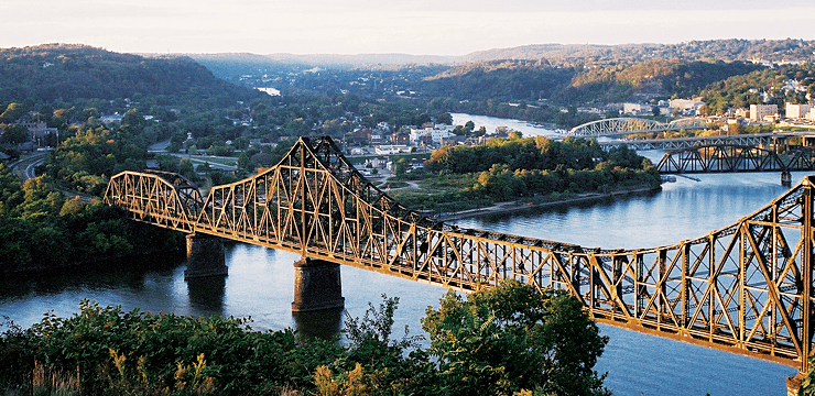
According to the U.S. Census Bureau, the county has a total area of 444 square miles (1,150 km2), of which 435 square miles (1,130 km2) is land and 9.3 square miles (24 km2) (2.1%) is water.
Bodies of water
Adjacent counties
Protected areas
Demographics
As of the census of 2000, there were 181,412 people, 72,576 households, and 50,512 families residing in the county. The population density was 418 people per square mile (161/km²). There were 77,765 housing units at an average density of 179 per square mile (69/km²). The racial makeup of the county was 92.55% White, 5.96% Black or African American, 0.10% Native American, 0.25% Asian, 0.01% Pacific Islander, 0.20% from other races, and 0.92% from two or more races. 0.72% of the population were Hispanic or Latino of any race. 23.0% were of German, 17.4% Italian, 9.9% Irish, 6.5% English, 6.4% Polish and 5.8% American ancestry according to Census 2000.
There were 72,576 households out of which 28.60% had children under the age of 18 living with them, 54.50% were married couples living together, 11.40% had a female householder with no husband present, and 30.40% were non-families. 26.90% of all households were made up of individuals and 13.10% had someone living alone who was 65 years of age or older. The average household size was 2.44 and the average family size was 2.96.
In the county, the age distribution of the population shows 22.60% under the age of 18, 7.40% from 18 to 24, 27.30% from 25 to 44, 24.20% from 45 to 64, and 18.40% who were 65 years of age or older. The median age was 41 years. For every 100 females there were 91.90 males. For every 100 females age 18 and over, there were 88.20 males.
Beaver County's live birth rate was 2,437 births in 1990. Beaver County's live birth rate in 2000 was 1,891 births, while in 2011 it had declined to 1,690 babies. Over the past 50 years (1960 to 2010), rural Pennsylvania saw a steady decline in both the number and proportion of residents under 18 years old. In 1960, 1.06 million rural residents, or 35 percent of the rural population, were children.
Beaver County reported 1,069 babies born to teens (age15-19) in 2011. In 2015, the number of teen births in Beaver County was 1,025.
According to research by The Center for Rural Pennsylvania, which is a legislative Agency of the Pennsylvania General Assembly, the poverty rate for Beaver County was 11.7% in 2014. The statewide poverty rate was 13.6% in 2014. The 2012 childhood poverty rate by school district was: Ambridge Area School District – 40.6% living at 185% or below than the Federal Poverty Level, Aliquippa School District – 82.7%, Beaver Area School District – 17.4%, Big Beaver Falls Area School District – 71.3%, Blackhawk School District – 27.9%, Central Valley School District – 30.8%, Freedom Area School District – 40.8%, Hopewell Area School District – 24.9%, Midland Borough School District – 64.9%, New Brighton Area School District – 54.4%, Riverside Beaver County School District – 31.9%, Rochester Area High School – 66.3%, South Side Area School District – 31.5%, and Western Beaver County School District – 36.5%. The child poverty rate is collected by the school districts as part of the federal free school lunch program.
Government and politics
In November 2008, there were 118,269 registered voters in Beaver County.
By April 2016, there were 109,091 registered voters, a decrease of 7.7% since 2008. The county is also divided into 129 precincts.
Beaver County used to be a Democratic stronghold. In 2015, however, the GOP took majority status in the Commissioners' Office for the first time since 1955. Multiple Democratic seats in both houses of the Pennsylvania Legislature have been lost to Republicans over the past few years. In statewide and federal elections it has been moving rightward as well. In 2004 Democrat John Kerry won Beaver County over Republican George Bush 51% to 48%. In 2008 Republican John McCain defeated Democrat Barack Obama 50% to 47%, becoming the first republican to win there since 1972. Each of the three state row office winners carried Beaver. In 2010 Republican Governor Tom Corbett and Republican Senator Pat Toomey both carried Beaver in their successful statewide bids. However, Beaver County voted for Bob Casey Jr. in his reelection bid in 2012 50% to 47%.
County commissioners
Other county offices
State Senate
State House of Representatives
United States House of Representatives
Attractions
Beaver County offers many shops and places to eat. Beaver County is home to the Beaver Valley Mall located in Center Township which is home to hundreds of shops and restaurants.
Near Koppel there is Buttermilk Falls, a naturally occurring waterfall.
Major highways
Airports
Public transit
Public transit is provided by the Beaver County Transit Authority.
Colleges and universities
Community, junior, and technical colleges
Public school districts
The 498 school districts of Pennsylvania, that have high schools, were ranked for student academic achievement as demonstrated by three years of math and reading PSSA results by the Pittsburgh Business Times in 2008.
Charter schools
As reported by the Pennsylvania Department of Education – EdNA. April 2010.
Private schools
As reported by the Pennsylvania Department of Education – EdNA. April 2010.
Former school districts
In 2009, Center Area School District and Monaca School District merged to form Central Valley School District.
Communities
Under Pennsylvania law, there are four types of incorporated municipalities: cities, boroughs, townships, and, in at most two cases, towns. The following cities, boroughs and townships are located in Beaver County:
Cities
Census-designated places
Unincorporated communities
Former community
Population ranking
The population ranking of the following table is based on the 2010 census of Beaver County.
† county seat