
Country Area 1,372.98 km2 Capital Balanga City Population 687,482 | Region Governor LP | |
 | ||
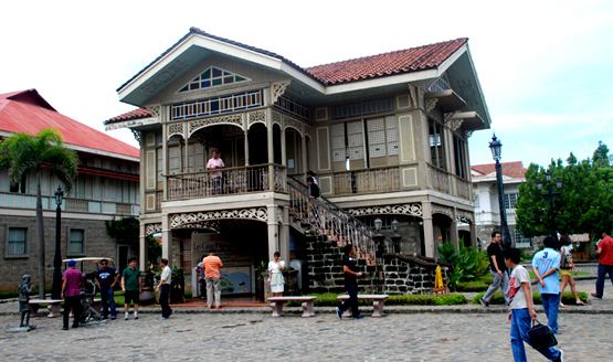
Colleges and Universities Bataan Peninsula State University Points of interest Las Casas Filipinas de Acuzar, Mount Natib, Roosevelt Protected Landscape | ||
Languages spoken | ||
Map of Bataan
Bataan ( Filipino: Lalawigan ng Bataan; Kapampangan: Lalawigan ning Bataan) is a province situated in the Central Luzon region of the Philippines. Its capital is the City of Balanga. Occupying the entire Bataan Peninsula on Luzon, Bataan is bordered by the provinces of Zambales and Pampanga to the north. The peninsula faces the South China Sea to the west and Subic Bay to the north-west, and encloses Manila Bay to the east.
Contents
- Map of Bataan
- Anvaya cove beach nature club morong bataan philippines 2
- History
- World War II
- Geography
- Administrative divisions
- Demographics
- Religion
- Churches
- Other places of interest
- Generation
- Distribution
- Sea ports terminals
- Airport
- Highways expressways national roads
- Emmy 2011 cat 78 tragedy of bataan food for thought prod
- References
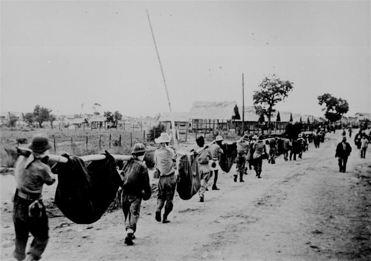
The Battle of Bataan is famous in history as one of the last stands of American and Filipino soldiers before they were overwhelmed by the Japanese forces in World War II. The Bataan Death March was named after the province, where the infamous march started.
Anvaya cove beach & nature club, morong, bataan, philippines (2)
History
In 1647, Dutch naval forces landed in country in an attempt to seize the islands from Spain. The Dutch massacred the people of Abucay in Bataan.
Historian Cornelio Bascara documents that the province of Bataan was established in January 11, 1757 by Governor-General Pedro Manuel Arandia out of territories belonging to Pampanga and the corregimiento of Mariveles which, at the time, included Maragondon, Cavite across the Manila Bay.
World War II
Bataan featured prominently during World War II. Prior to the 1941 Japanese invasion, the US Army stored nearly 1,000,000 US gallons (3,800 m3) of gasoline there.
Shortly after the Japanese Army invaded the country in December 1941, the combined US and Filipino forces were being gradually overrun and General Douglas MacArthur moved his troops to the Bataan Peninsula in an attempt to hold out until a relief force could be sent from the US. Japanese forces started a siege of the peninsula on January 7, 1942, and launched an all-out assault on April 3, a few months after the Battle of the Points.
The majority of the American and Filipino forces surrendered on April 9 and were forced to march more than a 100 kilometres (62 mi) from Bataan to Capas, Tarlac, which became known as the Bataan Death March.
Geography
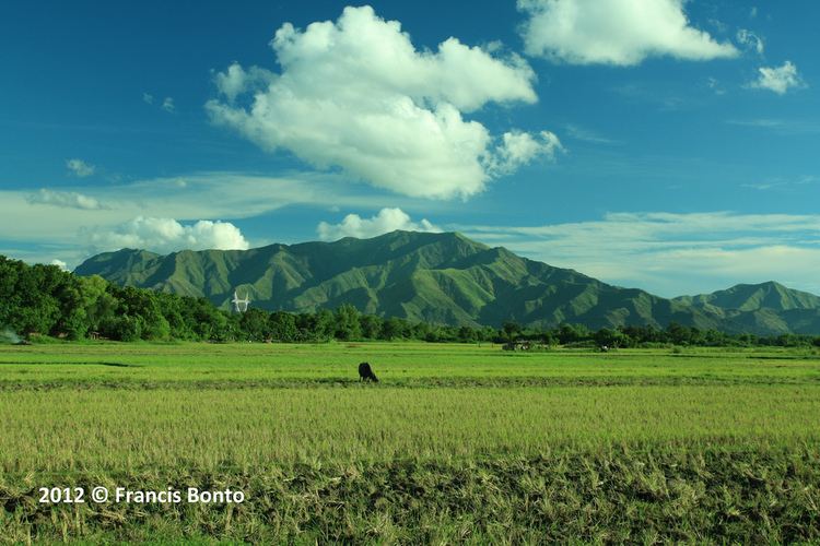
The province has an area of 1,372.98 square kilometres (530.11 sq mi), and covers the entire Bataan Peninsula, a rocky extension of the Zambales Mountains jutting out into the South China Sea, enclosing the Manila Bay. At the northern portion of the peninsula is Mount Natib (elevation 1,253 metres (4,111 ft)) and its surrounding mountains, separated from Mount Samat and the Mariveles Mountains in the south by a pass.
A narrow coastline plain characterizes the eastern portion of the province, while the western coast features many ridges, cliffs and headlands.
Administrative divisions
Bataan is politically subdivided into 11 municipalities and one component city.
Demographics
The population of Bataan in the 2015 census was 760,650 people, with a density of 550 inhabitants per square kilometre or 1,400 inhabitants per square mile.
Religion
Various religious groups are subscribed to by the people but Roman Catholicism is the predominant religion, comprising 85% of the Bataan population. Aglipayan as well as several Christian faiths are the minority.
Churches
Other places of interest
Generation
Bataan is a location of bulk power generation, whose most of the power produced are sent to the Luzon Grid. Most power plants in Bataan rely on fossil fuels, like oil and coal, but renewable energy sources, primarily solar power, forms part of the generation. The total output of existing power plants equals to 2068.1 MW, and new power plants to start operation will increase the output to 4224.1 MW.
Fossil fuel-fired plants form most of the bulk power generation from Bataan, with a total capacity of 2020 MW, and mostly concentrated in Limay and Mariveles. Existing power plants include the GN Power Mariveles Coal Power Plant, with 660 (2x330) MW, SMC Limay Greenfield Power Plant (4x150 MW), Petron Cogeneration Power Plant (4x35 MW), and Panasia Bataan Combined Cycle Power Plant (620 MW). Two plants under construction, the Dinginin Power Station (1,336 MW) and SMC Mariveles Coal Power Plant (4x150) will increase the capacity by 1936 MW.
Renewable energy, primarily solar power, forms a small portion of power generation in Bataan, with a total capacity of 48.1 MW, and are concentrated on the northern part of the province. Existing renewable energy power plants include the Bataan 2020 Cogen Power Plant (12.5 MW), YH Green Energy Solar Power Plant (12.6 MW), Citicore Solar Power Plant (18 MW), and Morong Solar Power Plant (5 MW). Three renewable energy power plants, namely the Solana Solar Alpha Inc. (20 MW), Bataan Solar Power Project (150 MW), and Santa Rita Wind Power Project (50 MW), are awarded to increase the capacity by 220 MW.
The Bataan Nuclear Power Plant in Morong, with 600 MW capacity, is supposed to be the first nuclear power plant in the Philippines and is built during the Marcos era. It was supposed to commence operation in 1986, but abandoned amidst critical opposition to the Marcos regime and concerns on nuclear power.
Distribution
Power distribution in the province are served by the Peninsula Electric Cooperative (PENELCO), but some large customers have their power supply sourced from the transmission grid, operated by National Grid Corporation of the Philippines (NGCP), whose network of 69,000 volt lines supply substations owned by PENELCO. On Freeport Area of Bataan (FAB) and barangays Malaya and Maligaya, they are served by the National Transmission Corporation (TransCo) - FAB branch through its distribution facilities within FAB.
Sea ports / terminals
Airport
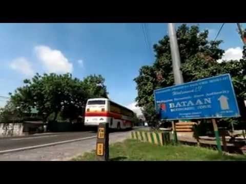
Highways / expressways / national roads
Bataan is served by a network of national highways and one expressway. Roman Superhighway, part of highway N301, and Jose Abad Santos Avenue, or highway N3 and Olongapo-Gapan Road, forms the backbone of the national highway network. Subic–Clark–Tarlac Expressway, a toll expressway, links the province with Pampanga and Tarlac. Bataan/Old National Road and Governor J.J. Linao National Road forms the secondary network, which connects the smaller municipalities with the main highway network.