
Type bay Islands Grande Island | ||
 | ||
Similar Ocean Adventure, Barrio Barretto, Harbor Point, Mount Pinatubo, Zoobic Safari | ||
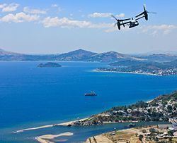
Baloy beach barrio baretto olongapo city subic bay north luzon philippines
Subic Bay is a bay on the west coast of the island of Luzon in the Philippines, about 100 kilometres (62 mi) northwest of Manila Bay. An extension of the South China Sea, its shores were formerly the site of a major United States Navy facility named U.S. Naval Base Subic Bay, which is now the location of an industrial and commercial area known as the Subic Bay Freeport Zone under the Subic Bay Metropolitan Authority.
Contents
- Baloy beach barrio baretto olongapo city subic bay north luzon philippines
- Map of Subic Bay Philippines
- Subic bay sbfz tourists destinations
- History
- Pamulaklakin Nature Park
- Shipwrecks of Subic Bay
- References
Map of Subic Bay, Philippines
Today, water as well as the towns and establishments surrounding the bay are collectively referred to as Subic Bay. This includes the former US naval base at SBMA, Hanjin shipyard, Olongapo city, the town of Barrio Baretto, the Municipality of Subic, and the erstwhile US defence housing areas of Binictican and Kalayan housing, up to Morong in Bataan Province.
The bay was long recognized for its deep and protected waters, but development was slow due to lack of level terrain around the bay.
Subic bay sbfz tourists destinations
History
In 1542, Spanish conquistador Juan de Salcedo sailed into Subic Bay but no port developed there because the main Spanish naval base would be established in the nearby Manila Bay. When the British captured this base in 1762, the Spanish were forced to find an alternate location and Subic Bay was found to be a strategic and superb port location. In 1884, King Alfonso XII of Spain decreed that Subic was to become "a naval port and the property appertaining thereto set aside for naval purposes."
In 1899 during the Philippine–American War, the Americans captured the Spanish base and controlled the bay until 1991. During this period, the naval facilities were greatly built up and expanded, including a new naval air station that was built in the early 1950s by slicing the top half from a mountain and moving the soil to reclaim a part of Subic Bay. In 1979, the area under American control was reduced from 24,000 hectares (59,000 acres) to 6,300 hectares (16,000 acres) when the Philippines claimed sovereign rule over the base.
Following the destruction of the 1991 Mount Pinatubo eruption, the Americans closed the base, and the area was transformed into the Subic Bay Freeport Zone.
In 2012, controversy arose when a contracted shipping firm was accused of dumping toxic waste into Subic Bay. MT Glenn Guardian, one of the vessels owned by a Malaysian firm, had collected some 189,500 litres (41,700 imp gal; 50,100 US gal) of domestic waste and about 760 litres (170 imp gal; 200 US gal) of bilge water from the USS Emory Land, an American Navy ship. Since the Malaysian firm was contracted by the US Navy, albeit under Philippine approval, this incident ignited anti-American sentiments in the Philippines from a single militant group.
Pamulaklakin Nature Park
The Pamulaklakin Nature Park is a reserve area of Binictican. Part of the 11 thousand hectares of forest is found at Subic Bay. The park was created by the Subic Bay Metropolitan Authority to supplement the income of the indigenous people. The term Pamulaklakin was derived from the native Ambala language, which means a herbal vine.
Shipwrecks of Subic Bay
The majority of the wrecks in Subic Bay are a result of either the Spanish–American War in 1898 or of World War II, where a number of Japanese vessels were sunk by American aircraft.