
Adm. region Oberbayern Vehicle registration TÖL, WOR Population 115,800 (2002) | State Bavaria Time zone CET (UTC+1) Website www.lra-toelz.de | |
 | ||
Points of interest Karwendel, Freizeitpark Märchenwald im Isartal, Brauneck, Sylvenstein Dam, Heimgarten Destinations | ||
Bad Tölz-Wolfratshausen is a district in Bavaria, Germany. It is bounded by (from the south and clockwise) Austria and the districts of Garmisch-Partenkirchen, Weilheim-Schongau, Starnberg, Munich and Miesbach.
Contents
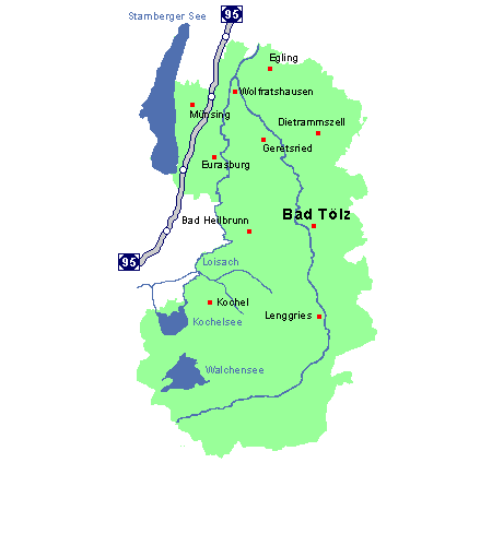
Map of Bad T%C3%B6lz-Wolfratshausen, Germany
History
The district was established in 1972 by merging the former districts of Bad Tölz and Wolfratshausen. Bad Tölz-Wolfratshausen has two castles, Castle Hohenburg and Seeburg (Münsing).
Geography
Bad Tölz-Wolfratshausen is one of the alpine districts on the German-Austrian borders. The valley of the Upper Isar River separates the Bavarian Alps from the Karwendel, a portion of the Alps mainly located in Austria. The highest peak of the district is the Schafreuter (2100 m).
The Isar River enters the district in the southwest and runs northwards passing the two main towns of the district, Bad Tölz and Wolfratshausen. In the high alpine south there are several mountain lakes: Walchensee (16 km²), Kochelsee (6 km²) and Sylvensteinsee (an artificial lake in the course of the Isar River). In the northwest the district borders on Lake Starnberg (Starnberger See).