
Admin. region Oberbayern Time zone CET/CEST (UTC+1/+2) Local time Wednesday 12:10 PM | Elevation 679 m (2,228 ft) Population 9,688 (31 Dec 2008) | |
 | ||
Weather 11°C, Wind NW at 8 km/h, 46% Humidity Points of interest Brauneck, Karwendel, Geierstein, Sylvenstein Dam, Seekarkreuz | ||
Lenggries is a municipality in Bavaria, Germany. Lenggries is the center of the Isarwinkel, the region along the Isar between Bad Tölz and Wallgau. The town has about 9,500 inhabitants. By area, it is the largest rural municipality ("Gemeinde") in what was formerly West Germany, and the 7th-largest overall. (All six currently larger Gemeinden are in Brandenburg.)
Contents
- Map of Lenggries Germany
- Etymology
- Geography
- History
- Economy
- Transport
- Culture and attractions
- People
- References
Map of Lenggries, Germany
Etymology
The name Lenggries is derived from Lenngengrieze (long Gries), a long rubble field with deposits of debris from the bed of the Isar.
Geography
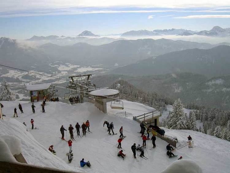
Lenggries sits on the Isar River before it transitions into the Alpine foothills. To the east are the Tegernsee Mountains, to the west lies the home mountain of Lenggries known as the Brauneck with an elevation of over 1,555 meters above sea level. The Brauneck is a well known ski area tied together by lifts. The town of Lenggries sits 700 meters above sea level.
History
Lenggries first appears in documentation in the year 1220. For many years, Lenggries was the only settlement on the "long Gries" ruled by the Barons of Hörwarth from the Hofmark castle, the Hohenburg. In 1705, the first resistance against the Austrians was organized in Lenggries. This later led to the killing of many peasants in a battle known as Sendling's Night of Murder. From 1808 to 1818, edicts from the Bavarian municipality formed Lenggries into a politically independent municipality. In 1924, Lenggries was connected to the railroad (known today as the Bayerische Oberlandbahn), and tourism first became important to Lenggries' economy. From 1935 until 1939, Gebirgsjäger (mountain infantry) were stationed in Lenggries.
Economy
The economy of Lenggries is mostly dependent on tourism, primarily focused on hiking and with emphasis on the forests of the area.
Transport
The town is the terminus (terminal) of the Munich — Lenggries railway (Green line) operated by Bayerische Oberlandbahn (BOB).