Harman Patil (Editor)

Wolfratshausen

Updated on
Edit
Like
Comment
Share on FacebookTweet on TwitterShare on LinkedInShare on Reddit
Country
  
Germany

Admin. region
  
Oberbayern

Time zone
  
CET/CEST (UTC+1/+2)

Population
  
17,749 (31 Dec 2008)

Local time
  
Wednesday 4:46 AM

State
  
Bavaria

Elevation
  
576 m (1,890 ft)

Area
  
9.13 km²

Postal code
  
82515

Wolfratshausen httpsmw2googlecommwpanoramiophotosmedium

District
  
Bad Tölz-Wolfratshausen

Weather
  
3°C, Wind S at 2 km/h, 100% Humidity

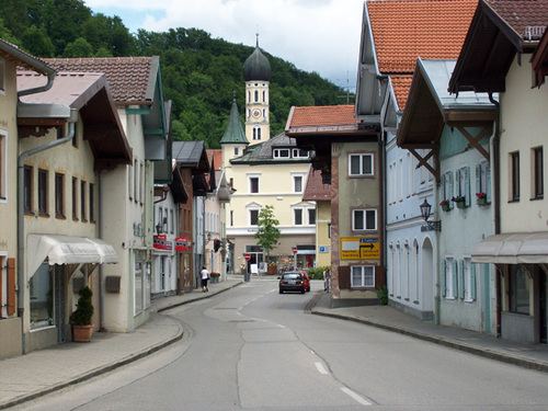
Wolfratshausen is a town of the district of Bad Tölz-Wolfratshausen, located in Bavaria, Germany. The town had a population of 18,122 as of 31 December 2014.

Contents

Map of Wolfratshausen, Germany

History

The first mention of "Wolveradeshusun" appears in documents from the year 1003. About 100 years later, Otto II, the Graf of Deißen-Andechs, built a castle on a hill overlooking the valley. The castle was destroyed on 7 April 1734 when lightning struck the tower storing black powder. Stones from the ruins were transported to Munich where they were used to build the Residenz.

From 1280 the town was designated a market town. In the 15th century, people were using the Loisach and Isar rivers for water transport, especially logging. Even today, you can ride a raft from Wolfratshausen into Munich.

During World War II, a forced-labor subcamp of Dachau concentration camp named Föhrenwald was located between Wolfratshausen and Geretsried. Following the war, the labor camp was used as a displaced persons camp by the Allies. In 1957, Föhrenwald was transformed into a suburb of Wolfratshausen and renamed Waldram, to honor the Lord of Münsing who was one of the founders of the Benediktbeuern Abbey.

In modern times, Wolfratshausen was formerly the seat of the district government, but this moved to Bad Tölz in 1972.

Geography

Wolfratshausen sits at the confluence of the Isar and Loisach Rivers, at 47°55′N 11°25′E approx. 30 km (19 mls.) southwest of Munich. A canal joins the two rivers to return water diverted for power generation at the Isar Amper Werke to the Isar. The town covers 9.13 square kilometres and is 577 meters above sea level.

Town Subdivision

The town of Wolfratshausen is split into the following subdivisions:

  • Altstadt
  • Weidach
  • Nantwein
  • Farchet
  • Waldram
  • Notable residents

    Former Bavarian Prime Minister Edmund Stoiber lives in Wolfratshausen. It is the birthplace of actors Saul Rubinek and Towje Kleiner.

    It is also the place where took place the assassination of Croatian businessman Stjepan Đureković, allegedly by UDBA agents.

    In about 1286 the martyrdom of the Roman-catholic saint Nantovinus occurred in the town's part of Nantwein, named after him.

    Personalities

  • Rudolf II, Count Palatine of the Rhine (1306-1353) Palatinate at the Rhine
  • Rupert I, Elector Palatine (1309-1390), Palgravegraf at the Rhine and Kurfürst from the Palatinate; founder of the University of Heidelberg which is named after him
  • Ernst Wiechert (1887-1950), writer and poet, acquired the Gagerthof in Wolfratshausen in 1936
  • Hans Stuck (1900-1978), car racing driver
  • Edmund Stoiber (born 1941), jurist and politician (CSU), Minister President of the Free State of Bavaria from 28 May 1993 to 30 September 2007
  • Saul Rubinek (born 1948), Canadian Hollywood actor, director and filmproducer
  • Johanna Hagn (born 1973), German judoka
  • Florian Wanner (born 1978), German judoka
  • Murat Bosporus (born 1979), German wrestling sportsman
  • Markus Janka (born 1980), German ice hockey goalie
  • Claudia Lichtenberg (born 1985), German professional cyclist
  • Buildings of Note

  • Parish Church "St.Andreas" (erected 1484)
  • The Humplbräu, a hotel and restaurant in the historic city center (first mentioned in a document in 1619)
  • Historic city center (since 2005 with traffic reduction by use of one-way streets)
  • The gallery Schwankl-Eck
  • The Loisachhalle, a community exhibition and multi-use hall.
  • Museums

  • Museum of Local History
  • Recreation and Travel Destinations

  • Amusement park "Märchenwald im Isartal" (opened 1968).
  • Log raft rides on the Isar and Loisach to Munich
  • Castle: Even if now only a Commemorative plaque and tuff remnants harken to the memory of this castle, its size can still be imagined. In 1734 the castle was destroyed by an explosion resulting from a lightning strike to the ammunition tower.
  • A walk through the hillside forest gives rise to picturesque views of the entire city and the peaks of the Karwendel and Wetterstein mountain ranges, from the Wendelstein in the east to the Zugspitze in the south.
  • Bike riding or rollerblading through the wildlife reserve Isarauen/Pupplinger Au.
  • The Japanese garden Yuko Nihon Teien, a gift from the Japanese sister city Iruma.
  • Bike ride to Lake Starnberg (about 12.5 miles)
  • The Via Bavarica Tyrolensis, a 140-mile bike path from Munich through the Alps to the Inn river Valley, goes through the Pupplinger Au.
  • Skiing, especially for children, at the slopes in Peretshofen and Beuerberg. The larger ski areas can be reached within 1 to 2 hours.
  • There are around 125 miles of cross-country ski runs in the surrounding area.
  • References

    Wolfratshausen Wikipedia