Country Canada | ||
 | ||
Restaurants PAESE Ristorante, Noah Kosher Sushi, Safari Bar & Grill | ||
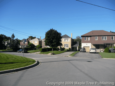
Toronto armour heights homes avenue road luxury house by harry riahi toronto luxury home
Armour Heights is a neighbourhood in Toronto, Ontario, Canada, in the district of North York. It is bounded by Wilson Avenue to the south, Bathurst Street to the west, and the west branch of the Don River to the north and east. Highway 401 cuts through the centre of the neighbourhood.
Contents
- Toronto armour heights homes avenue road luxury house by harry riahi toronto luxury home
- Map of Armour Heights Toronto ON Canada
- Armour heights concert 2014 2
- References
Map of Armour Heights, Toronto, ON, Canada
Armour Heights is not considered a neighbourhood by the City of Toronto. Instead, it and nearby Lansing are grouped into one neighbourhood called Lansing-Westgate. However, the areas are colloquially referred to as Lansing and Armour Heights.
The area is named after John Armour, a farmer who was granted a concession to the area sometime before 1837. He sold the eastern part of his land to the Hogg brothers in the middle of the nineteenth century, and it later became Hogg's Hollow. The rest of his property remained in the Armour family until just before the First World War when it was purchased by developer and speculator Colonel F.B. Robins. Robbins built a large estate for himself named Strathrobyn, but his development plans were put on hold by the war. He decided to loan out the lands to the military and an air training facility was established. It mostly trained American pilots and among other figures saw Amelia Earhart work there.
After the war the airfield became the base for Bishop-Barker Aeroplanes Limited, operated by war heroes Billy Bishop and William George Barker. It was at this site that Bishop had one of the most dangerous crashes of his career. The company folded in 1921 and the airfield was abandoned. Some development occurred during the 1920s, but the area was still too far from the centre of the city to attract many buyers.
The air force returned to the area in 1942 when it leased Strathrobyn as an officer's mess and training school. It remains in service today as the Canadian Forces College, one of the main officer training facilities of the Canadian Forces.
In the 1950s, some of the neighbourhood's streets were destroyed due to the construction of the 401. One of the major streets in Toronto, Avenue Road, terminates at the Armour Heights neighbourhood at Bombay Avenue. There is an Avenue Road/401 Parclo A4 interchange just south of Bombay Avenue.
The post-war years saw the steady development of the neighbourhood, and all the farmland was transformed into middle class suburban housing by the beginning of the 1970s. It has become an important Jewish area of Toronto. It is just to the east of Bathurst Manor the most Jewish neighbourhood in Toronto. Bathurst Street is lined with a number of Jewish stores and restaurants and synagogues such as Adath Israel. According to the 2001 census 12% of the population is Jewish An important landmark is Toronto's Holocaust Memorial, which is located just north of the community in Earl Bales Park.
