
Existed: 1926 – present Length 131.8 km | Constructed 1926 | |
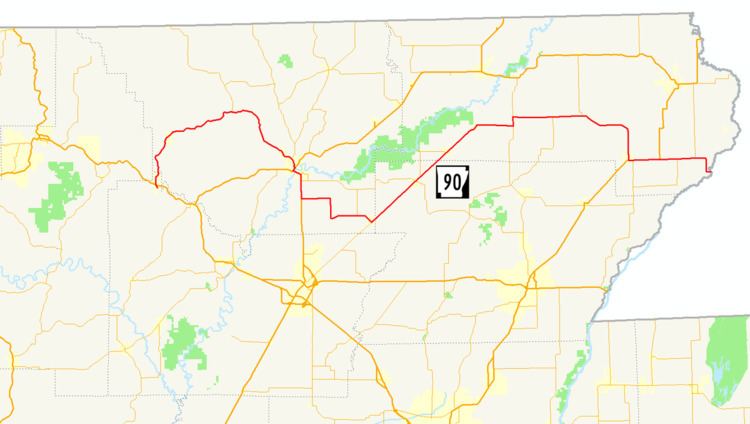 | ||
Arkansas Highway 90 (AR 90, Ark. 90, and Hwy. 90) is an east–west state highway in northeast Arkansas. The route of 81.93 miles (131.85 km) runs from Main Street in Ravenden to Route 84 at the Missouri state line. The route is an entirely undivided surface highway that passes through rich cotton country.
Contents
Map of AR-90, Arkansas, USA
Route description
AR 90 begins at Main Street in Ravenden and heads north to cross US 62/US 63/US 412. The route winds to Pocahontas where it meets AR 115 and US 62/US 67/AR 166. US 67/AR 90 run together south to Shannon. AR 90 then turns east to meet AR 231 and AR 34 in O'Kean. The route runs diagonally northeast until meeting AR 135 east of Knobel.
The route runs east to meet AR 141 near Boydsville and US 49/AR 1 in Rector. AR 90 continues west to terminate at Route 84 at the St. Francis River on the Missouri state line.
Major intersections
Mile markers reset at concurrencies.