
North end: Dale Street, McDougal Major cities Jonesboro | Length 98.3 km | |
 | ||
South end: Lawson Rd. south of Jonesboro Counties Craighead County, Arkansas, Greene County, Arkansas, Clay County, Arkansas | ||
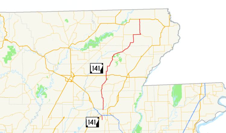
Arkansas Highway 141 is a state highway of 61.1 miles (98.3 km) that runs in Craighead, Greene and Clay Counties.
Contents
Map of AR-141, Arkansas, USA
Route description
AR 141 begins at Lawson Road south of Jonesboro near Craighead Forest Park. It runs north to meet US 49/US 63/AR 18, forming a concurrency with US 49 through downtown. Once AR 141 leaves US 49 it becomes North Church Street, running north to Philadelphia. AR 141 continues north to Lake Frierson State Park near Loredo. AR 141 runs with AR 168 after Loredo until Walcott and Crowley's Ridge State Park. Continuing north, AR 141 crosses US 412 before entering Beech Grove, where the route meets AR 34. The route then angles east to Hooker, meeting AR 135. AR 141 continues to wind northeast, meeting with AR 90 angling due north. The route crosses US 62 south of McDougal and terminates at Dale Street in McDougal.