
Length 104.3 km | ||
 | ||
South end: US 62/US 63/US 412/AR 166, Imboden
US 67/AR 90, Pocahontas North end: Route 21, Missouri state line Counties Sharp County, Arkansas, Lawrence County, Arkansas, Randolph County, Arkansas | ||
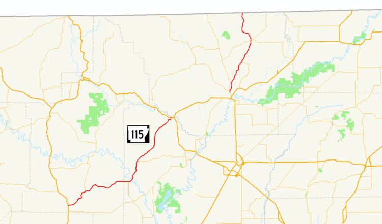
Arkansas Highway 115 is a state highway of 64.8 miles (104.3 km) that runs in Sharp, Lawrence, and Randolph Counties.
Contents
Map of AR-115, Arkansas, USA
Route description
AR 115 begins at US 167/AR 58 in Cave City running with AR 58 north. The route continues northeast to meet AR 117 in Smithville. AR 115 arrows north to Imboden where it meets US 62/US 63/US 412/AR 166. It runs with these routes until Pocahontas, where the route begins to angle north toward Missouri. AR 115 briefly concurs with US 67 and AR 90 in Pocahontas. The route meets AR 328 in Maynard before the Missouri state line, where it continues as Missouri Route 21.
References
Arkansas Highway 115 Wikipedia(Text) CC BY-SA